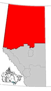
Division No. 18 is a census division in Alberta, Canada. It is located in the southeast corner of northern Alberta and its largest urban community is the Town of Grande Cache. The boundaries of the division are coextensive with the outer boundaries of the Municipal District of Greenview No. 16.

Girouxville is a village in northern Alberta, Canada, located 58 kilometres (36 mi) south of the town of Peace River.

Alcomdale is a hamlet in central Alberta, Canada within Sturgeon County. It is located on Highway 44, approximately 34 kilometres (21 mi) northwest of Edmonton's city limits. There is a community hall and public playground within the hamlet, no other services.

Villeneuve is a hamlet in central Alberta, Canada within Sturgeon County. It is located on Highway 44, approximately 10 kilometres (6.2 mi) northwest of Edmonton's city limits. It is home to the Michel First Nations band government.

Carbondale is a hamlet in central Alberta, Canada within Sturgeon County. It is located 2 kilometres (1.2 mi) west of Highway 28, approximately 11 kilometres (6.8 mi) north of Edmonton's city limits.

Cardiff is a hamlet in central Alberta, Canada within Sturgeon County. It is located 3 kilometres (1.9 mi) east of Highway 2, approximately 15 kilometres (9.3 mi) north of Edmonton's city limits. The Town of Morinville is 1.6 kilometres (0.99 mi) to the west of Cardiff.

Eaglesham is a hamlet in northern Alberta, Canada within Birch Hills County, located 6 kilometres (3.7 mi) north of Highway 49, approximately 89 kilometres (55 mi) northeast of Grande Prairie.

Enilda is a hamlet in northern Alberta within Big Lakes County, located 10 kilometres (6.2 mi) west of Highway 49, approximately97 kilometres (60 mi) northeast of Grande Prairie.

Faust is a hamlet in northern Alberta within Big Lakes County, located 1 kilometre (0.62 mi) north of Highway 2, approximately 241 kilometres (150 mi) northwest of Edmonton.

Guy is a hamlet in northern Alberta, Canada within the Municipal District of Smoky River No. 130. It is located on Highway 49, approximately 113 kilometres (70 mi) northeast of Grande Prairie. It is the home of Honey Bunny honey products.

Jean Cote, or Jean Côté, is a hamlet in northern Alberta, Canada within the Municipal District of Smoky River No. 130. It is located approximately 11 kilometres (6.8 mi) west of Highway 2 and 123 kilometres (76 mi) northeast of Grande Prairie.

Lamoureux is a hamlet in central Alberta, Canada within Sturgeon County. It is located 6 kilometres (3.7 mi) northeast of Edmonton's city limits on the northern shore of the North Saskatchewan River, opposite the City of Fort Saskatchewan.

Ridgevalley is a hamlet in northern Alberta, Canada within the Municipal District of Greenview No. 16. It is located 2.5 kilometres (1.6 mi) southwest of Highway 43, approximately 57 kilometres (35 mi) east of Grande Prairie.

Rivière Qui Barre is a hamlet in central Alberta, Canada within Sturgeon County. It is located 1 kilometre (0.62 mi) west of Highway 44, approximately 22 kilometres (14 mi) northwest of Edmonton's city limits. It was founded in 1885 by French-speaking settlers, adding a post office in 1895. The name is the French translation of Keepootakawa, the Cree name of the nearby river.

Sturgeon Heights is a settlement in northern Alberta within the Municipal District of Greenview No. 16, located on Highway 43, 71 kilometres (44 mi) southeast of Grande Prairie.

Tangent is a hamlet in northern Alberta, Canada within Birch Hills County, located 6 kilometres (3.7 mi) north of Highway 49, approximately 98 kilometres (61 mi) northeast of Grande Prairie.

Watino is a hamlet in northern Alberta, Canada within Birch Hills County. It is located on Highway 49, approximately 96 kilometres (60 mi) northeast of Grande Prairie, and has an elevation of 385 meters (1,263 ft).

Marten Beach is a hamlet in northern Alberta, Canada within the Municipal District of Lesser Slave River No. 124. It is located on the northeast shore of Lesser Slave Lake, 2 kilometres (1.2 mi) west of Highway 88. It is approximately 36 kilometres (22 mi) north of the Town of Slave Lake and 238 kilometres (148 mi) northwest of the City of Edmonton.

Lake Newell Resort is a hamlet in southern Alberta, Canada within the County of Newell that was established in 2007.

Sturgeon Lake 154 is an Indian reserve in northern Alberta, Canada. It is located on Highway 43, 3.5 km (2.2 mi) west of the Town of Valleyview and approximately 85 km (53 mi) east of the City of Grande Prairie. It and the adjacent Sturgeon Lake 154B Indian Reserve are surrounded by the Municipal District of Greenview No. 16. It is under the administration of the Sturgeon Lake Cree Nation.


