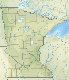
Hay Creek is a small trout stream in southeastern Minnesota. It has its headwaters west of Goodhue and empties into the Mississippi River just to the north of Red Wing. It runs 25.1 miles (40.4 km). Hay Creek was named for the hay meadows near its banks. A railroad once ran along Hay Creek from the claybanks near Goodhue to the pottery and stoneware factories in Red Wing, which also made use of the water from the creek. The railroad was torn up in 1937, but traces such as trestle pilings remain.

The Baptism River is an 8.8-mile-long (14.2 km) river of the U.S. state of Minnesota. The river source is the confluence of the East Branch Baptism River and the West Branch Baptism River just south of the community of Finland.

The Beaver River is a 23.4-mile-long (37.7 km) river in Lake County, Minnesota. It flows into Lake Superior.

The Caribou River is a 15.0-mile-long (24.1 km) river in northern Minnesota, the United States. It rises in a swamp about .6 miles (1 km) south of Morris Lake and two miles (3.2 km) east of Echo Lake, near the Lake/Cook County line, at an altitude about 1620 feet above sea level. It descends some 1,020 feet in elevation as it flows south to its mouth at Lake Superior, also near the eastern border of Lake County.
Shotley Brook is a stream in Beltrami County, Minnesota, in the United States.
Walker Brook is a stream in Clearwater County, Minnesota, United States.
Rush Creek is a stream in Fillmore and Winona counties, in the U.S. state of Minnesota. It is a tributary of the Root River, which it joins in Rushford, Minnesota.

Camp Creek is a stream in Fillmore County, in the U.S. state of Minnesota. It is a tributary of the South Branch Root River. Camp Creek was named from the fact pioneer settlers camped upon its banks.

Badger Creek is a stream in Houston County, in the U.S. state of Minnesota. It is a tributary of the South Fork Root River, which it meets east of Houston, Minnesota. Badger Creek was named for the badgers once common in the area.
Seelye Brook is a stream in the U.S. state of Minnesota.
Bass Brook is a stream in Itasca County, in the U.S. state of Minnesota.
Chelsey Brook is a stream in the U.S. state of Minnesota.
Chase Brook is a stream in Mille Lacs County, in the U.S. state of Minnesota.
Black Brook is a stream in Mille Lacs County, in the U.S. state of Minnesota. It is a tributary of the Rum River.
Whitney Brook is a stream in Mille Lacs County, in the U.S. state of Minnesota.
Vondell Brook is a stream in Mille Lacs County, in the U.S. state of Minnesota.
Tibbetts Brook is a stream in Mille Lacs County, in the U.S. state of Minnesota.
Battle Brook is a stream in the U.S. state of Minnesota.

Trout Brook is a stream in Ramsey County, in the U.S. state of Minnesota. It source is at McCarrons Lake.
Tibbits Brook is a stream in Sherburne County, in the U.S. state of Minnesota.


