Related Research Articles

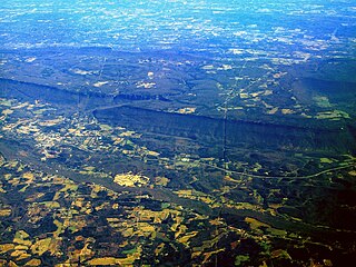
A cuesta is a hill or ridge with a gentle slope on one side, and a steep slope on the other. In geology the term is more specifically applied to a ridge where a harder sedimentary rock overlies a softer layer, the whole being tilted somewhat from the horizontal. This results in a long and gentle backslope called a dip slope that conforms with the dip of resistant strata, called caprock. Where erosion has exposed the frontslope of this, a steep slope or escarpment occurs. The resulting terrain may be called scarpland.

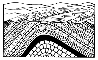
In structural geology, an anticline is a type of fold that is an arch-like shape and has its oldest beds at its core, whereas a syncline is the inverse of an anticline. A typical anticline is convex up in which the hinge or crest is the location where the curvature is greatest, and the limbs are the sides of the fold that dip away from the hinge. Anticlines can be recognized and differentiated from antiforms by a sequence of rock layers that become progressively older toward the center of the fold. Therefore, if age relationships between various rock strata are unknown, the term antiform should be used.

Bredon Hill is a hill in Worcestershire, England, south-west of Evesham in the Vale of Evesham. The summit of the hill is in the parish of Kemerton, and it extends over parts of eight other parishes. The hill is geologically part of the Cotswolds and lies within the Cotswolds Area of Outstanding Natural Beauty. However, it now stands isolated in the Vale of Evesham due to natural causes.
The geology of Shropshire is very diverse with a large number of periods being represented at outcrop. The bedrock consists principally of sedimentary rocks of Palaeozoic and Mesozoic age, surrounding restricted areas of Precambrian metasedimentary and metavolcanic rocks. The county hosts in its Quaternary deposits and landforms, a significant record of recent glaciation. The exploitation of the Coal Measures and other Carboniferous age strata in the Ironbridge area made it one of the birthplaces of the Industrial Revolution. There is also a large amount of mineral wealth in the county, including lead and baryte. Quarrying is still active, with limestone for cement manufacture and concrete aggregate, sandstone, greywacke and dolerite for road aggregate, and sand and gravel for aggregate and drainage filters. Groundwater is an equally important economic resource.
Seatearth is a British coal mining term, which is used in the geological literature. As noted by Jackson, a seatearth is the layer of sedimentary rock underlying a coal seam. Seatearths have also been called seat earth, "seat rock", or "seat stone" in the geologic literature. Depending on its physical characteristics, a number of different names, such as underclay, fireclay, flint clay, and ganister can be applied to a specific seatearth.
The geology of Cheshire in England consists mainly of Triassic sandstones and mudstones. To the north west of Cheshire, these rocks are heavily faulted and the underlying Carboniferous Coal Measures are thrown up. Around the areas of Poynton and Macclesfield, the coal is close to the surface and was easily mined. Below the Coal Measures is the Millstone Grit, which appears towards the Derbyshire border on the flanks of the Peak District dome.

The geology of Wales is complex and varied; its study has been of considerable historical significance in the development of geology as a science. All geological periods from the Cryogenian to the Jurassic are represented at outcrop, whilst younger sedimentary rocks occur beneath the seas immediately off the Welsh coast. The effects of two mountain-building episodes have left their mark in the faulting and folding of much of the Palaeozoic rock sequence. Superficial deposits and landforms created during the present Quaternary period by water and ice are also plentiful and contribute to a remarkably diverse landscape of mountains, hills and coastal plains.

In geology and geomorphology, a hogback or hog's back is a long, narrow ridge or a series of hills with a narrow crest and steep slopes of nearly equal inclination on both flanks. Typically, the term is restricted to a ridge created by the differential erosion of outcropping, steeply dipping, homoclinal, and typically sedimentary strata. One side of a hogback consists of the surface of a steeply dipping rock stratum called a dip slope. The other side is an erosion face that cuts through the dipping strata that comprises the hogback. The name "hogback" comes from the Hog's Back of the North Downs in Surrey, England, which refers to the landform's resemblance in outline to the back of a hog. The term is also sometimes applied to drumlins and, in Maine, to both eskers and ridges known as "horsebacks".

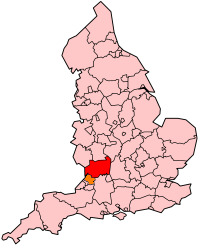
Gloucestershire is one of the most geologically and scenically diverse counties in England, with rocks from the Precambrian through to the Jurassic represented. These varying rock-types are responsible for the three major areas of the county, each with its own distinctive scenery and land-use - the Forest of Dean in the west, bordering Wales, the Cotswolds in the east, and in between, the Severn Vale.

The Pennant Measures is the traditional name for a sequence of sedimentary rocks of the South Wales Coalfield. They were also referred to as the Upper Coal Measures and assigned to the Westphalian 'C' and Westphalian 'D' stages of the Carboniferous Period. The Pennant Measures were divided into the Lower Pennant Measures and the Upper Pennant Measures, differing from the underlying Middle and Lower Coal Measures in being principally of sandstone units – known collectively as the Pennant Sandstone – with mudstone being the subsidiary rock type. Numerous coal seams occur within the Pennant Measures though they are less common than in the underlying Coal Measures.
The geology of Monmouthshire in southeast Wales largely consists of a thick series of sedimentary rocks of different types originating in the Silurian, Devonian, Carboniferous, Triassic and Jurassic periods.

The Tunbridge Wells Sand Formation is a geological unit which forms part of the Wealden Group and the uppermost and youngest part of the unofficial Hastings Beds. These geological units make up the core of the geology of the Weald in the English counties of West Sussex, East Sussex and Kent.

The Wadhurst Clay Formation is a geological unit which forms part of the Wealden Group and the middle part of the now unofficial Hastings Beds. These geological units make up the core of the geology of the High Weald in the English counties of West Sussex, East Sussex and Kent.

The Dox Formation, also known as the Dox Sandstone, is a Mesoproterozoic rock formation that outcrops in the eastern Grand Canyon, Coconino County, Arizona. The strata of the Dox Formation, except for some more resistant sandstone beds, are relatively susceptible to erosion and weathering. The lower member of the Dox Formation consists of silty-sandstone and sandstone, and some interbedded argillaceous beds, that form stair-stepped, cliff-slope topography. The bulk of the Dox Formation typically forms rounded and sloping hill topography that occupies an unusually broad section of the canyon.
The geology of Lancashire in northwest England consists in the main of Carboniferous age rocks but with Triassic sandstones and mudstones at or near the surface of the lowlands bordering the Irish Sea though these are largely obscured by Quaternary deposits.

The Dent Group is a group of Upper Ordovician sedimentary and volcanic rocks in north-west England. It is the lowermost part of the Windermere Supergroup, which was deposited in the foreland basin formed during the collision between Laurentia and Avalonia. It lies unconformably on the Borrowdale Volcanic Group. This unit was previously known as the Coniston Limestone Group or Coniston Limestone Formation and should not be confused with the significantly younger Coniston Group.
The geology of West Sussex in southeast England comprises a succession of sedimentary rocks of Cretaceous age overlain in the south by sediments of Palaeogene age. The sequence of strata from both periods consists of a variety of sandstones, mudstones, siltstones and limestones. These sediments were deposited within the Hampshire and Weald basins. Erosion subsequent to large scale but gentle folding associated with the Alpine Orogeny has resulted in the present outcrop pattern across the county, dominated by the north facing chalk scarp of the South Downs. The bedrock is overlain by a suite of Quaternary deposits of varied origin. Parts of both the bedrock and these superficial deposits have been worked for a variety of minerals for use in construction, industry and agriculture.
This article describes the geology of the Brecon Beacons National Park in mid/south Wales. The area gained national park status in 1957 with the designated area of 1,344 km2 (519 sq mi) including mountain massifs to both the east and west of the Brecon Beacons proper. The geology of the national park consists of a thick succession of sedimentary rocks laid down from the late Ordovician through the Silurian and Devonian to the late Carboniferous period. The rock sequence most closely associated with the park is the Old Red Sandstone from which most of its mountains are formed. The older parts of the succession, in the northwest, were folded and faulted during the Caledonian orogeny. Further faulting and folding, particularly in the south of the park is associated with the Variscan orogeny.
The geology of the Yorkshire Dales National Park in northern England largely consists of a sequence of sedimentary rocks of Ordovician to Permian age. The core area of the Yorkshire Dales is formed from a layer-cake of limestones, sandstones and mudstones laid down during the Carboniferous period. It is noted for its karst landscape which includes extensive areas of limestone pavement and large numbers of caves including Britain's longest cave network.
The geology of the South Downs National Park in South East England comprises a gently folded succession of sedimentary rocks from the Cretaceous and early Palaeogene periods overlain in places by a range of superficial deposits from the last 2.6 million years. Whereas the South Downs are formed from the Late Cretaceous age chalk, the South Downs National Park extends into the Weald to the north of the range and thereby includes older rock strata dating from the Early Cretaceous including sandstones and mudstones. The youngest solid rocks are found on the southern fringes of the National Park in the eastern extension of the Hampshire Basin and include sand, silt and clay deposited during the Palaeocene and Eocene epochs.
References
- ↑ England and Wales sheet 217, Moreton-in-Marsh Solid and Drift Geology. Keyworth, Nottinghamshire: British Geological Survey. ISBN 0751832863.
- ↑ "Cambering, gulls and valley bulging". Understanding our Earth. British Geological Survey. Retrieved 31 May 2021.
- ↑ Ballantyne, Colin K.; Harris, Charles (1994). The Periglaciation of Great Britain (First ed.). Cambridge: Cambridge University Press. pp. 137–140.