
Camberwell Junction is a major intersection in Camberwell, a suburb of Melbourne, Australia. Burke, Riversdale and Camberwell Roads meet here on six different legs. Trams that pass through the junction run on the routes 70, 72 and 75. [1]
Camberwell Junction is a major intersection in Camberwell, a suburb of Melbourne, Australia. Burke, Riversdale and Camberwell Roads meet here on six different legs. Trams that pass through the junction run on the routes 70, 72 and 75. [1]
The Junction is approximately 500 metres south of Camberwell railway station on the Belgrave, Lilydale and Alamein lines. [2]
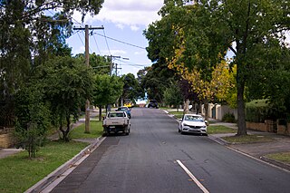
The Junction is adjacent to Camberwell shopping centre located mainly on Burke Road. The nearby Camberwell Fresh Food Market features speciality delicatessens and fruit and vegetables. The Rivoli cinemas in Riversdale Road comprise an Art Deco design and show mainstream and arthouse films. [3]
The intersection was the site of the Camberwell Hotel from which the wider suburb gets its name. Built in 1853, it became a popular rest stop for people on their journey to Gippsland during the Victorian gold rush of the 1850s and 1860s. [4]
The Junction became the focal point for retail and other activity in Camberwell. Shops, churches and services were built at or near the intersection as the population rapidly expanded throughout the late 19th century. [5]
In 1975 Ivan Gaal created a short film featuring Camberwell Junction, which has been uploaded to YouTube by ACMI [6]
The speed limit along Burke Road through the Junction was reduced from 60km/h to 40km/h to improve safety in 2017. [7]
The City of Boroondara is a local government area in Victoria, Australia. It is located in the eastern suburbs of Melbourne. It was formed in June 1994 from the amalgamation of the Cities of Kew, Camberwell and Hawthorn.

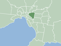
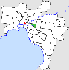
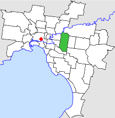
Camberwell is a suburb of Melbourne, Victoria, Australia, 10 km east of Melbourne's Central Business District, located within the City of Boroondara local government area. Camberwell recorded a population of 21,965 at the 2021 census.

Surrey Hills is a suburb of Melbourne, Victoria, Australia, 11 km east of Melbourne's Central Business District, located within the Cities of Boroondara and Whitehorse local government areas. Surrey Hills recorded a population of 13,655 at the 2021 census.

Burwood is an inner eastern suburb of Melbourne, Victoria, Australia, 14 kilometres east of Melbourne's Central Business District, located within the Cities of Monash and Whitehorse local government areas. Burwood recorded a population of 15,147 at the 2021 census.

Balwyn is a suburb of Melbourne, Victoria, Australia, 10 km east of Melbourne's Central Business District, located within the City of Boroondara local government area. Balwyn recorded a population of 13,495 at the 2021 census.

Balwyn North, also known as North Balwyn, is a suburb of Melbourne, Victoria, Australia, 10 km east of Melbourne's Central Business District, located within the Cities of Boroondara and Whitehorse local government areas. Balwyn North recorded a population of 21,302 at the 2021 census. It contains the localities of Greythorn and Bellevue.

Canterbury is an eastern suburb of Melbourne, Victoria, Australia, 10 km from Melbourne's Central Business District, located within the City of Boroondara local government area. Canterbury recorded a population of 7,800 at the 2021 census.

Hawthorn is an inner suburb of Melbourne, Victoria, Australia, 6 kilometres (3.7 mi) east of Melbourne's central business district, located within the City of Boroondara local government area. Hawthorn recorded a population of 22,322 at the 2021 census.
Kew East is a suburb of Melbourne, Victoria, Australia, 8 km east from Melbourne's Central Business District, located within the City of Boroondara local government area. Kew East recorded a population of 6,620 at the 2021 census.

Camberwell railway station is a commuter railway station and the junction point for the Alamein, Belgrave and Lilydale lines, serving the eastern Melbourne suburb of Camberwell in Victoria, Australia. Camberwell is a ground-level premium station, featuring three platforms, an Island platform with two faces and one side platform connected by a ramp accessible overground concourse. The station opened on 3 April 1882.

Willison railway station is a commuter railway station on the Alamein line, serving the eastern Melbourne suburb of Camberwell in Victoria, Australia. Willison is a ground-level unstaffed station, featuring two side platforms. It opened on 8 June 1908, with the current station provided in 1954 and platforms in 1972.

Hartwell railway station is a commuter railway station on the Alamein line, serving the eastern Melbourne suburb of Camberwell in Victoria, Australia. Hartwell is a ground-level unstaffed station, featuring an island platform with two faces. It opened on 7 May 1906, with the current station provided in 1938.

Melbourne tram route 75 is operated by Yarra Trams on the Melbourne tram network from Vermont South to Central Pier. The 22.8 kilometre route is operated out of Camberwell depot with A and B class trams. It is the longest route on the network.

Melbourne tram route 70 is operated by Yarra Trams on the Melbourne tram network from Waterfront City to Wattle Park. The 16.5 kilometre route is operated out of Camberwell depot with A and B class trams.

Burke Road is a major north–south thoroughfare in Melbourne, Australia. It runs from Ivanhoe East to Caulfield East and through the major shopping district at Camberwell.

The City of Kew was a local government area about 4 kilometres (2.5 mi) east of Melbourne, the state capital of Victoria, Australia, on the southeast bank of the Yarra River. The city covered an area of 14.56 square kilometres (5.62 sq mi), and existed from 1860 until 1994.
The City of Hawthorn was a local government area about 4 kilometres (2.5 mi) east of Melbourne, the state capital of Victoria, Australia, on the southeast bank of the Yarra River. The city covered an area of 9.71 square kilometres (3.75 sq mi), and existed from 1860 until 1994.
The City of Camberwell was a local government area about 10 kilometres (6 mi) east of Melbourne, the state capital of Victoria, Australia. The city covered an area of 36.01 square kilometres (13.90 sq mi), and existed from 1914 until 1994.

Camberwell tram depot is located on Council Street, Hawthorn East, a suburb of Melbourne, Victoria, Australia. Opened in December 1929, it is operated by Yarra Trams. It is one of eight tram depots on the Melbourne tram network.
The Melbourne tram network began in 1884 with the construction of the Fairfield Horse Tramway. However, the purpose of the line was to increase land prices in the area, and it soon closed during the depression in 1890. The first genuine attempt to construct a tramway network was the construction of the Richmond cable tram line by the Melbourne Tramway & Omnibus Company in 1885. Over the next few years, 16 more cable tram lines were constructed, as well as numerous other horse tramways. The depression of the early 1890s slowed further expansion of the cable network. The first electric tram line was the Box Hill and Doncaster tramway which opened in 1889. This was a pioneering line in what was then the countryside and thus didn't receive much patronage. It closed in 1896. The next attempt at an electric tramway was Victorian Railways' St Kilda to Brighton line, which opened in 1906. Later that year, the North Melbourne Electric Tramway & Lighting Company opened lines to Essendon and Maribyrnong. Many local councils formed their own tramway trusts and built tramways within their own constituency. The most successful of these was the Prahran & Malvern Tramways Trust.
37°49′53″S145°3′24″E / 37.83139°S 145.05667°E
| | This article about a place in Melbourne is a stub. You can help Wikipedia by expanding it. |
| | This Australian road or road transport-related article is a stub. You can help Wikipedia by expanding it. |