Hunters Creek Village is a city in Harris County, Texas, United States, part of the Greater Houston metropolitan area. The population was 4,385 at the 2020 census. It is part of a collection of upscale residential communities in west Houston known as the Memorial Villages.

Piney Point Village is a city in Harris County, Texas, United States. The population was 3,128 at the 2020 census. Piney Point Village is the wealthiest place in Texas, as ranked by per capita income. It is part of a collection of upscale residential communities in west Houston known as the Memorial Villages.
River Oaks is a residential community located in the center of Houston, Texas, United States. Located within the 610 Loop and between Downtown and Uptown, the community spans 1,100 acres (450 ha). Established in the 1920s by brothers Will Hogg and Michael Hogg, the community became a well-publicized national model for community planning. Real estate values in the community range from $1 million to over $20 million. River Oaks was also named the most expensive neighborhood in Houston in 2013. The community is home to River Oaks Country Club, which includes a golf course designed by architect Donald Ross and redesigned in 2015 by Tom Fazio.
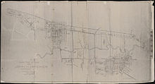
The city of Houston in the U.S. state of Texas was founded in 1837 after Augustus and John Allen had acquired land to establish a new town at the junction of Buffalo and White Oak bayous in 1836. Houston served as the temporary capital of the Republic of Texas. Meanwhile, the town developed as a regional transportation and commercial hub. Houston was part of an independent nation until 1846 when the United States formally annexed Texas. Railroad development began in the late 1850s but ceased during the American Civil War. Houston served the Confederacy as a regional military logistics center. The population increased during the war and blockade runners used the town as a center for their operations.

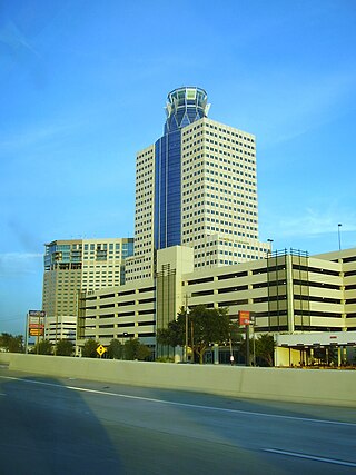
Downtown is the largest central business district in the city of Houston and the largest in the state of Texas, located near the geographic center of the metropolitan area at the confluence of Interstate 10, Interstate 45, and Interstate 69. The 1.84-square-mile (4.8 km2) district, enclosed by the aforementioned highways, contains the original townsite of Houston at the confluence of Buffalo Bayou and White Oak Bayou, a point known as Allen's Landing. Downtown has been the city's preeminent commercial district since its founding in 1836.

Sam Houston Math, Science, and Technology Center (SHMSTC), formerly known as Sam Houston High School is a high school located in the Hawthorne Place and Timber Garden subdivisions, in Houston, Texas, United States. Sam Houston Math, Science, and Technology Center handles grades nine through twelve and is part of the Houston Independent School District. Before 1955, it was located in Downtown Houston.

Spring Branch Independent School District is a school district headquartered in Hedwig Village, Texas, United States in Greater Houston. The district serves portions of western Houston, including most of Spring Branch. It also serves several small municipalities known as the Memorial Villages in its jurisdiction, such as Hedwig Village and Spring Valley Village. A majority of the district lies within Houston city limits.
Harrisburg is a community now located within the city of Houston, Texas.
The Memorial area of Houston, Texas is located west of Downtown, northwest of Uptown, and south of Spring Branch. The Memorial Super Neighborhood, as defined by the City of Houston, is bounded by Buffalo Bayou to the south, Barker Reservoir to the west, Westview to the north, and the Memorial Villages, a contiguous group of independent municipalities, to the east.

Buffalo Bayou is a slow-moving body of water which flows through Houston in Harris County, Texas. Formed 18,000 years ago, it has its source in the prairie surrounding Katy, Fort Bend County, and flows approximately 53 miles (85 km) east through the Houston Ship Channel into Galveston Bay and the Gulf of Mexico. In addition to drainage water impounded and released by the Addicks and Barker reservoirs, the bayou is fed by natural springs, surface runoff, and several significant tributary bayous, including White Oak Bayou, Greens Bayou, and Brays Bayou. Additionally, Buffalo Bayou is considered a tidal river downstream of a point 440 yards (400 m) west of the Shepherd Drive bridge in west-central Houston.

Second Ward is a historical political district ward in the East End community in Houston, Texas. It was one of the four original wards of the city in the nineteenth century. The community known as the Second Ward today is roughly bounded by Buffalo Bayou to the north, Lockwood Avenue to the east, and railroad tracks to the south and west, although the City of Houston's "Super Neighborhood" program includes a section east of Lockwood.
Meyerland is a community in southwest Houston, Texas, outside of the 610 Loop and inside Beltway 8. The neighborhood is named after the Meyer family, who bought and owned 6,000 acres (24 km2) of land in southwest Houston.

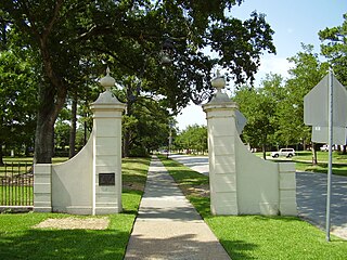
Memorial Park, a municipal park in Houston, Texas, is one of the largest urban parks in the United States. Opened 100 years ago in 1924, the park covers approximately 1,466 acres (5.9 km2) mostly inside the 610 Loop, across from the neighborhood of Memorial. Memorial Drive runs through the park, heading east to downtown Houston and west to the 610 Loop. A small portion of land west of the 610 Loop bordered by Woodway Drive and Buffalo Bayou is also part of the park. I-10/U.S. 90 borders the park to the north. The park was originally designed by landscape architects Hare & Hare of Kansas City, Missouri. In 2016, the operation of the park was transitioned from the Houston Parks and Recreation Department to the Memorial Park Conservancy, a private non-profit organization with a mission to "restore, preserve and enhance Memorial Park."

Rice Military is a neighborhood in Houston, Texas, United States. The Beer Can House is located in Rice Military.
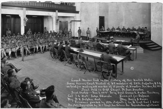
The Houston race riot of 1917, also known as the Camp Logan Mutiny, was a mutiny and riot by 156 soldiers from the all-black 24th Infantry Regiment of the United States Army, taking place on August 23, 1917, in Houston, Texas. The incident occurred within a climate of overt hostility from members of the all-white Houston Police Department (HPD) against members of the local black community and black soldiers stationed at Camp Logan. Following an incident where police officers arrested and assaulted black soldiers, many of their comrades mutinied and marched to Houston. There they opened fire and killed eleven civilians and five policemen. Five soldiers were also killed in exchanges of gunfire with the police.

Greater Greenspoint, also referred to as the North Houston District, is a 7-square-mile (18 km2) business district and a suburban neighborhood in northern Harris County, Texas, United States, located mostly within the city limits of Houston. Centered around the junction of Interstate 45 and Texas State Highway Beltway 8 near George Bush Intercontinental Airport, the area is a classic example of a planned edge city. The initial 2,000-acre (8.1 km2) retail and office development centered around Greenspoint Mall was a project of the Friendswood Development Company during the 1970s and early 1980s.

Allen's Landing is the officially recognized birthplace of the city of Houston, Texas, United States, the largest city in Texas and the fourth largest in the United States. Located in Downtown Houston between the Main Street and Fannin Street viaducts, the landing encompasses the southern bank of Buffalo Bayou, the city's principal river, at its confluence with White Oak Bayou, a major tributary. Allen's Landing is located south of the University of Houston–Downtown Commerce Street Building.
Crestwood/Glen Cove is a community in Houston, Texas. It consists of the Crestwood and Glen Cove subdivisions. The Crestwood/Glen Cove Civic Club serves the Crestwood/Glen Cove community.

Idylwood is a historic neighborhood in the southeastern part of the I-610 loop in Houston, Texas. Idylwood, as of 2021, is the most expensive neighborhood in the East End. As of that year its houses were priced between $295,000 and $679,900. It currently has approximately 340 homes. Bill England, a redeveloper in the East End area, stated in 2004 that Idylwood appealed to buyers who are priced out of houses located in the cities of Bellaire and West University Place.
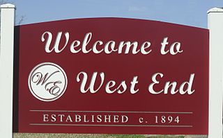
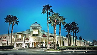
West End is a neighborhood in Houston, Texas, United States located along the Washington Avenue Corridor.