Division No. 1, Subdivision A is an unorganized subdivision on the Avalon Peninsula in Newfoundland and Labrador, Canada. It is in Division No. 1, and lies between Trinity Bay and Placentia Bay.

Heart's Content is an incorporated town in Trinity Bay on the Bay de Verde Peninsula of Newfoundland and Labrador, Canada.
Aspen Cove is a small fishing community in the province of Newfoundland and Labrador, Canada. Formerly called Aspey or Apsey Cove, Aspen Cove was named for the presence of aspen trees in the area. It first appears in the 1857 Census as Apsey Cove with a population of thirteen, all dependent on the salmon fishery. By the 1870s more families moved to Aspen Cove for the cod and lobster fisheries. In the 1921 census the population had reached 104 and the economy had changed from salmon, fur, and agriculture to cod, lobster, and lumbering.
Hillview-Adeytown is a former local service district and former designated place on the east coast of Newfoundland in Newfoundland and Labrador, Canada that existed from 1999 until 2008. It consisted of the village of Hillview on the Southwest Arm of Trinity Bay and the village of Adeytown on the Northwest Arm of Trinity Bay, just south of Clarenville.
Upper Burgeo is an abandoned settlement in the La Poile District. It was located 3 – 4 km west of Burgeo on Cornelius Island. Burgeo, which still exists today, was then called Lower Burgeo.
Deadman's Bay is a local service district and designated place in the Canadian province of Newfoundland and Labrador. It is on the Straight Shore of Bonavista Bay near the community of Lumsden. The community is located near fishing grounds, contributing to its diversified and successful fishery despite its exposed, sandy coastline and harsh fall storms.

Frederickton is a designated place in the Canadian province of Newfoundland and Labrador.

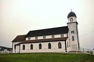
Salvage is a town located on the Eastport Peninsula of the Canadian province of Newfoundland and Labrador. The town had a population of 108 in the Canada 2021 Census.
Ship Harbour is a community in Newfoundland and Labrador, Canada located on the eastern shore of Placentia Bay.
Codroy is a community in the Codroy Valley of Newfoundland and Labrador, Canada.

Resettlement in Newfoundland and Labrador terms refers to an organized approach to centralize the population into growth areas. It is used in the current context when referring to a voluntary relocation initiated from isolated communities themselves.
Kerley's Harbour was a small outport village on Trinity Bay, Newfoundland and Labrador, Canada. Kerley's Harbour was formerly called Careless Harbour. The first recorded settlement of Kerley's Harbour was in the 1845 Newfoundland census, with a population of 40. However, the community existed long before this time as William Maher married Flora Jeans on October 15, 1821, in Careless Harbour as it is recorded in the Roman Catholic records. The population reached a peak of 90 residents in 1935. The main settlers of the community were Millers, Ivanys, Kings and Clarkes.

South East Bight (SEB) or Southeast Bight is a local service district and designated place in the Canadian province of Newfoundland and Labrador. It is on the western shore of Placentia Bay on the Burin Peninsula. The community is not connected by road and is only accessible by ferry from Petite Forte. Many people from the community travel to Monkstown in the winter by snowmobile, but is very uncommon to try to get there in the summer, because of marsh, bogs, ponds and hills. To get to South East Bight one must travel towards Marystown on the Burin Peninsula, turn off the highway at Boat Harbour, travel to Petite Forte and then take a half-hour ferry ride to South East Bight.
Lobster Harbour may refer to either a settlement located in Notre Dame Bay or to one in White Bay, Newfoundland and Labrador.
William's Harbour is a former local service district and designated place in the Canadian province of Newfoundland and Labrador. The community was entirely resettled in 2017. The settlement was part of the NunatuKavut territory.

La Poile is a local service district and designated place in the Canadian province of Newfoundland and Labrador. It is on La Poile Bay. The community is inaccessible by road and is served by a ferry via a port in Rose Blanche.
Brake's Cove is an abandoned community in Newfoundland and Labrador.
Conne was a community in Newfoundland and Labrador, Canada located on the Northern shore of Fortune Bay. It was first reported to be settled in 1836, in the first Census of Newfoundland with sixteen inhabitants. It was a severely isolated settlement, which had no church or school and very little land for growing crops, and it based its existence on the inshore fishery of cod, lobster, salmon and herring.
Pays Cove is an abandoned town in Newfoundland and Labrador, Canada that had a peak population of 11 in 1935.
New Harbour is an abandoned town located within Fortune Bay in Newfoundland and Labrador, Canada that had a peak population of 24 in 1945. It is not to be confused with New Harbour, Trinity Bay and New Harbour on the south-west coast of Newfoundland.
