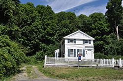
Candlewood Corner | |
---|---|
Coordinates: 41°28′07.7″N73°28′22.5″W / 41.468806°N 73.472917°W | |
Country | United States |
State | Connecticut |
County | Fairfield |
Town | New Fairfield |
ZIP Code | 06812 (New Fairfield) |
Area code(s) | 203/475 |
State Route |
Candlewood Corner is a small enclave of restaurants and businesses on Route 39 in the town of New Fairfield, Fairfield County, Connecticut, United States. It is in the southeast part of the town and serves as the gateway to New Fairfield's Candlewood Lake communities. [1] The Town Tribune, a local newspaper serving New Fairfield and Sherman is located here. [2]
Prior to the construction of Candlewood Lake, this section was known as "Millers Corner" and then later "Hatch’s Corner," before ultimately taking on the name "Candlewood Corner". [3] It is home to the historic Cosier-Murphy House, which is listed on the National Register of Historic Places. [4]
Brookfield is a town in Fairfield County, Connecticut, United States, situated within the southern foothills of the Berkshire Mountains. The population was 17,528 at the 2020 census. The town is located 55 miles (89 km) northeast of New York City, making it part of the New York metropolitan area. The town is part of the Western Connecticut Planning Region. In July 2013, Money magazine ranked Brookfield the 26th-best place to live in the United States, and the best place to live in Connecticut.
Fairfield County is a county in the southwestern corner of the U.S. state of Connecticut. It is the most populous county in the state and was also its fastest-growing from 2010 to 2020. As of the 2020 census, the county's population was 957,419, representing 26.6% of Connecticut's overall population. The closest to the center of the New York metropolitan area, the county contains four of the state's top 7 largest cities—Bridgeport (1st), Stamford (2nd), Norwalk (6th), and Danbury (7th)—whose combined population of 433,368 is nearly half the county's total population.
New Fairfield is a town in Fairfield County, Connecticut, United States. The population was 13,579 at the 2020 census. New Fairfield is one of five towns that surround Candlewood Lake, the largest lake in Connecticut. The town is located 55 miles (89 km) northeast of New York City, making it part of the New York metropolitan area. The town is part of the Western Connecticut Planning Region.
Sherman is the northernmost and least populous town of Fairfield County, Connecticut, United States. The population was 3,527 at the 2020 census. The town is part of the Western Connecticut Planning Region. The town was formed in 1802 from the northern part of New Fairfield. It is named for Roger Sherman, the only person who signed all four founding documents of the United States of America. He also had a cobblers shop in the north end of town which has been reconstructed behind the Northrup House in the center of town.
Fairfield is a town in Herkimer County, New York, United States. The population was 1,627 at the 2010 census. The town is named after Fairfield, Connecticut.
Camp Floyd State Park Museum is a state park in the Cedar Valley in Fairfield, Utah, United States. The park includes a small part of the former Camp Floyd site, the Stagecoach Inn, and the Fairfield District School.
Candlewood Lake is a manmade lake located in Fairfield and Litchfield counties of Western Connecticut, in the northeastern United States. At 8.4 square miles (22 km2), it is the largest lake in Connecticut and the largest lake within a 60 mi (97 km) radius of New York City. The lake is bordered by the city of Danbury, and the towns of Brookfield, New Fairfield, New Milford, and Sherman. Some of the most expensive real estate in the Greater Danbury area is located along the shores of the lake.
Blue Mounds State Park is a state park of Minnesota, USA, in Rock County near the town of Luverne. It protects an American bison herd which grazes on one of the state's largest prairie remnants.
The History of Brookfield, Connecticut extends back roughly three centuries.
Liberty Corner is an unincorporated community located in Bernards Township, in Somerset County, New Jersey. Liberty Corner is about 3.75 miles (6 km) south of Bernardsville. Liberty Corner has a post office with ZIP code 07938. The Liberty Corner Historic District was listed on the state and national registers of historic places in 1991.
This is a list of the National Register of Historic Places listings in Salt Lake City, Utah.
The Cosier-Murphy House is a historic house at 67 Connecticut Route 39 in the Candlewood Corner section of New Fairfield, Connecticut. Built about 1840, it is one of the town's best-preserved 19th-century houses, and a good local example Greek Revival architecture. The house, along with a small agricultural outbuilding, was listed on the National Register of Historic Places in 1991.
St. Albans Town Hall is the center of government of the town of St. Albans, Vermont. It is located at 579 Lake Road in the village of St. Albans Bay. It is a Richardsonian Romanesque building, constructed in 1898, two years after the city of St. Albans, the former town center, was politically separated. The building was listed on the National Register of Historic Places in 1996.
Candlewood Orchards is a private residential community and census-designated place (CDP) in the town of Brookfield, Fairfield County, Connecticut, United States. It is in the northwest part of the town, on the east shore of Candlewood Lake. It is bordered to the north by Candlewood Shores and to the west and south by the town of New Fairfield.
Candlewood Shores is a private residential community and census-designated place (CDP) in the town of Brookfield, Fairfield County, Connecticut, United States. It is in the northwest part of the town, on the east shore of Candlewood Lake. It is bordered to the south by Candlewood Orchrads, to the north by Candlewood Lake Club, and to the west by the town of New Fairfield.
Candlewood Lake Club is a private residential community and census-designated place (CDP) in the town of Brookfield, Fairfield County, and in the town of New Milford, Litchfield County, in the U.S. state of Connecticut. It is in the northwest corner of Brookfield and the southwest corner of New Milford, on the east shore of Candlewood Lake. It is bordered to the south by Candlewood Shores, to the north by Chimney Point, and to the west by the town of New Fairfield.
Candlewood Isle is a census-designated place (CDP) on an island of the same name in Candlewood Lake, in the town of New Fairfield, Fairfield County, Connecticut, United States. It is in the southeast part of the town, with Candlewood Knolls and Kellogg Point on the mainland to the west and Candlewood Lake Club, Candlewood Shores and Candlewood Orchards across the lake to the east.
Candlewood Knolls is a census-designated place (CDP) in the town of New Fairfield, Fairfield County, Connecticut, United States. It is in the southeast part of the town, on the western shore of Candlewood Lake.
Knollcrest is a census-designated place (CDP) in the town of New Fairfield, Fairfield County, Connecticut, United States. It is in the northeast part of the town, on a peninsula on the western side of Candlewood Lake. It is bordered to the northeast, across Squantz Cove, by Bogus Hill.
Sail Harbor is a census-designated place (CDP) in the towns of New Fairfield and Sherman, Fairfield County, Connecticut, United States. It is in the northeast corner of New Fairfield and the southeast corner of Sherman, on Great Neck and Shelter Harbor, landforms on the west side of Candlewood Lake. It is bordered to the west by Inglenook.