Cane, United States Virgin Islands | |
|---|---|
Village | |
| Country | |
| Island | Saint Croix |
| Time zone | UTC-4 (AST) |
Cane is a settlement on the island of Saint Croix in the United States Virgin Islands.
Cane, United States Virgin Islands | |
|---|---|
Village | |
| Country | |
| Island | Saint Croix |
| Time zone | UTC-4 (AST) |
Cane is a settlement on the island of Saint Croix in the United States Virgin Islands.

Lost Creek is an affluent upper-middle-class neighborhood and census-designated place (CDP) of approximately 4,500 people in Travis County, Texas, United States. The census tract is bordered by Capital of Texas Highway to the east, Barton Creek to the south, Barton Creek Boulevard to the west, and Bee Caves Road to the north. The Lost Creek CDP encompasses several small neighborhoods—Parkstone, Woods of Westlake, Camelot, and Knollwood—as well as the largest and most populous Lost Creek neighborhood.

Saint Croix is an island in the Caribbean Sea, and a county and constituent district of the United States Virgin Islands (USVI), an unincorporated territory of the United States.

Saint John is one of the Virgin Islands in the Caribbean Sea and a constituent district of the United States Virgin Islands (USVI), an unincorporated territory of the United States.
Kingshill is a settlement on the island of Saint Croix in the United States Virgin Islands. Kingshill is home to the University of the Virgin Islands campus in St. Croix. The St. Croix campus opened in 1964.

Cruz Bay, U.S. Virgin Islands is the main town on the island of Saint John in the United States Virgin Islands. According to the 2000 census, Cruz Bay had a population of 2,743.
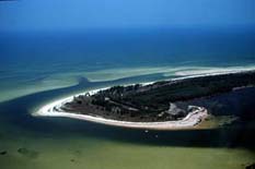
Anclote Key is an island off the Gulf Coast of the U.S. state of Florida, the largest island in the Anclote Keys, located at 28°11′16″N82°50′44″W near Tarpon Springs. Its name originates from the Spanish term for "anchor." The island is accessible only by boat and is split between Anclote Key Preserve State Park and Anclote National Wildlife Reserve. The island contains mangrove wetlands, coastal pine flatwoods, and beaches. A large number of shorebirds nest and breed on Anclote Key and the surrounding islands. Sand Key is located nearby. Most of the island is located within Pasco County, while its southernmost section is in Pinellas County. The island is home to the Anclote Keys Light.

Boyana Glacier in Levski Ridge, Tangra Mountains on Livingston Island, South Shetland Islands in Antarctica is situated southeast of Macy Glacier and west-southwest of Srebarna Glacier. It is bounded by Vazov Rock on the west, St. Naum Peak, Starosel Gate, Silistra Knoll and Kotel Gap on the north, and Christoff Cliff on the east. The glacier extends 3 km in east-west direction and 1.6 km in north-south direction, and flows southeastward into the Bransfield Strait between Vazov Point and Aytos Point.

The Queen Elizabeth II Bridge, sometimes called the Beef Island Bridge, is a bridge, 70 meters (230 ft) long, that links Beef Island with Tortola in the British Virgin Islands. The original bridge was opened in 1966, and was replaced by a new bridge in 2003.

Whatley is a census-designated place in Clarke County, Alabama, United States. As of the 2010 census, its population was 225. It is named in honor of Franklin Benjamin Whatley. It has one site on the National Register of Historic Places, the Whatley Historic District.

Mount Healthy windmill is a ruined windmill on the north side of Tortola in the British Virgin Islands. It was formerly used during the plantation era of the Territory to crush sugar cane. After the collapse of the sugar economy in the early nineteenth century the windmill fell into disuse and became a ruin. It crushed cane for the sugar mill and rum distillery in nearby Brewer's Bay. There are other ruins like the Boiling House, remnants of the Animal Mill Round, distillery, hospital, storage, shed, and housing. The 18th century windmill belonged to the area's wealthiest planter. Slaves harvested and processed sugar cane into sugar at this extensive sugarcane plantation.
Macculloch Glacier is a glacier located in the northeastern coast of the Baffin Mountains on Baffin Island, Nunavut, Canada.

The Dutch Virgin Islands is the collective name for the enclaves that the Dutch West India Company had in the Virgin Islands. The area was ruled by a director, whose seat was not permanent. The main reason for starting a colony here was that it lay strategically between the Dutch colonies in the south and New Netherland. The Dutch West India Company was mainly affected by the competition from Denmark, England and Spain. In 1680 the remaining islands became a British colony.
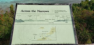
Leinster Bay is a bay and former sugar cane plantation on the island of Saint John in the United States Virgin Islands. It is uninhabited and part of Virgin Islands National Park. Visitors can park at Annaberg and hike the Leinster Bay trail to access the bay, which is a popular snorkeling spot. Waterlemon Cay is a small cay in Leinster Bay. The ruins of the plantation's estate house can be reached by continuing past the bay and up the Johnny Horn Trail.
Mary Point is an uninhabited peninsula on the island of Saint John in the United States Virgin Islands. There are no roads or trails and steep cliffs prevent access from the water. Although Mary Point once housed a small sugar cane plantation, the area is now overgrown with thick forest. The foundation and crumbling walls of Mary Point Estate can be seen from the Francis Bay trail. It is part of Virgin Islands National Park. Mary Creek, the shallow bay on the east side, is a popular spot for fly fishing and kitesurfing.
Cane Valley is a settlement on the island of Saint Croix in the United States Virgin Islands.
Green Kay is a settlement on the island of Saint Croix in the United States Virgin Islands. It is located 3.3 miles (5.3 km) east of Christiansted.
Upper Bethlehem is a settlement on the island of Saint Croix in the United States Virgin Islands.

Glassy Mountain is a mountain in the Chattahoochee National Forest in Rabun County, Georgia, with its USGS GNIS summit at 34°50′44″N83°30′02″W, which is 3,415 feet (1,041 m) AMSL. It is bypassed on its northern flank by a major two-lane highway that carries U.S. Route 76 and Georgia State Route 2 east and west.

Leesville is an unincorporated community in Lawrence County, Indiana, United States.
Paradise was an unincorporated community in Alachua County, Florida, United States. It has been annexed into the city of Gainesville, and is located approximately where Alachua County Road 232 crosses U.S. Route 441.
Coordinates: 17°42′18″N64°50′44″W / 17.70500°N 64.84556°W
| | This Saint Croix, United States Virgin Islands location article is a stub. You can help Wikipedia by expanding it. |