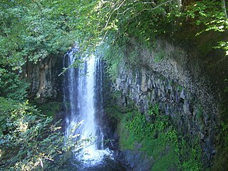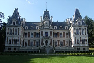
Bort-les-Orgues is a commune in the Corrèze department in central France.
The arrondissement of Ussel is an arrondissement of France in the Corrèze department in the Nouvelle Aquitaine region. Since the January 2017 reorganization of the arrondissements of Corrèze, it has 80 communes.

TER Auvergne was the regional rail network serving Auvergne région, France. In 2017 it was merged into the new TER Auvergne-Rhône-Alpes.
The canton of Forcalquier is an administrative division in southeastern France. At the French canton reorganisation which came into effect in March 2015, the canton was expanded from 10 to 15 communes:

The Rhue is a 56.6-kilometre (35.2 mi) long river in the Puy-de-Dôme, Cantal and Corrèze départements, south central France. Its source is at Besse-et-Saint-Anastaise, near Super Besse, in the parc naturel régional des volcans d'Auvergne, 4.5 kilometres (2.8 mi) southeast of the puy de Sancy. It flows generally southwest. It is a left tributary of the Dordogne into which it flows at Bort-les-Orgues.

The Diège is a 54.4 km (33.8 mi) long river in the Corrèze département, south central France. Its source is at Saint-Setiers, on the plateau de Millevaches, in the parc naturel régional de Millevaches en Limousin. It flows generally southeast. It is a right tributary of the Dordogne into which it flows between Roche-le-Peyroux and Saint-Julien-près-Bort, 68 km (42 mi) southwest of Clermont-Ferrand.
The Corrèze General Council is the general council of Corrèze (France). It was chaired by François Hollande from 2008–2012, although he departed from this position when he took office as the President of France on May 15, 2012. It includes 37 members.
The canton of Argentat is an administrative division situated in the Corrèze département and in the Nouvelle Aquitaine region of France. Since the French canton reorganisation which came into effect in March 2015, the communes of the canton of Argentat are:
The canton of Saint-Étienne-5 is a French administrative division located in the department of Loire and the Auvergne-Rhône-Alpes region. It has the following communes:
The canton of Saint-Étienne-4 is a French administrative division located in the department of Loire and the Auvergne-Rhône-Alpes region. It has the following communes:
The canton of Saint-Étienne-6 is an administrative division of the Loire department, in eastern France. It was created at the French canton reorganisation which came into effect in March 2015. Its seat is in Saint-Étienne.
The canton of Sainte-Fortunade is an administrative division of the Corrèze department, south-central France. It was created at the French canton reorganisation which came into effect in March 2015. Its seat is in Sainte-Fortunade.
The canton of Égletons is an administrative division of the Corrèze department, south-central France. Its borders were modified at the French canton reorganisation which came into effect in March 2015. Its seat is in Égletons.
The canton of Naves is an administrative division of the Corrèze department, south-central France. It was created at the French canton reorganisation which came into effect in March 2015. Its seat is in Naves.
The canton of Plateau de Millevaches is an administrative division of the Corrèze department, south-central France. It was created at the French canton reorganisation which came into effect in March 2015. Its seat is in Meymac.
The canton of Uzerche is an administrative division of the Corrèze department, south-central France. Its borders were modified at the French canton reorganisation which came into effect in March 2015. Its seat is in Uzerche.
The canton of L'Yssandonnais is an administrative division of the Corrèze department, south-central France. It was created at the French canton reorganisation which came into effect in March 2015. Its seat is in Objat.
The canton of Plateau du Haut-Velay granitique is an administrative division of the Haute-Loire department, south-central France. It was created at the French canton reorganisation which came into effect in March 2015. Its seat is in Craponne-sur-Arzon.
Haute-Corrèze Communauté is a communauté de communes, an intercommunal structure, in the Corrèze and Creuse departments, in the Nouvelle-Aquitaine region, central France. It was created in January 2017 by the merger of the former communautés de communes Ussel - Meymac - Haute-Corrèze, Pays d'Eygurande, Gorges de la Haute-Dordogne, Val et Plateaux Bortois, Sources de la Creuse and part of Bugeat - Sornac - Millevaches au Cœur. Its population was 35,140 in 2014. Its seat is in Ussel.


