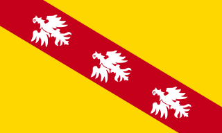
The canton of Le Saulnois is an administrative division of the Moselle department, northeastern France. Its borders were modified at the French canton reorganisation which came into effect in March 2015. Its seat is in Château-Salins. [1]
The cantons of France are territorial subdivisions of the French Republic's arrondissements and departments.
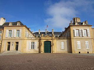
Moselle is the most populous department in Lorraine, in the east of France, and is named after the river Moselle, a tributary of the Rhine, which flows through the western part of the department. Inhabitants of the department are known as Mosellans.
In the administrative divisions of France, the department is one of the three levels of government below the national level, between the administrative regions and the commune. Ninety-six departments are in metropolitan France, and five are overseas departments, which are also classified as regions. Departments are further subdivided into 334 arrondissements, themselves divided into cantons; the last two have no autonomy, and are used for the organisation of police, fire departments, and sometimes, elections.
It consists of the following communes: [1]
Morville may refer to several places in Europe :
The arrondissement of Château-Salins is a former arrondissement of France in the Moselle department in the Lorraine region. In January 2016 it was merged into the new arrondissement of Sarrebourg-Château-Salins. It had 128 communes.
The arrondissement of Forbach is a former arrondissement of France in the Moselle department in the Lorraine region. In 2015 it was merged into the new arrondissement of Forbach-Boulay-Moselle. It had seven cantons and 73 communes.
The arrondissement of Metz-Campagne is a former arrondissement of France in the Moselle department in the Lorraine region. In 2015 it was merged into the new arrondissement of Metz. It had nine cantons and 142 communes.
The Seille is a river in north-eastern France. It is a right tributary of the Moselle. It is also known as the Seille lorraine or the Grande Seille, to distinguish it from another Seille, a small tributary of the Saône.
The canton of Montereau-Fault-Yonne is a French administrative division, located in the arrondissement of Provins, in the Seine-et-Marne département.
Vic-sur-Seille is a commune in the Moselle department in Grand Est in north-eastern France.
The Canton of Poligny is a canton within the department of Jura in the French region of Bourgogne-Franche-Comté.
The Communauté de communes du Saulnois is a federation of municipalities of the rural Saulnois region, located in the department of Moselle in Eastern France. It consists of 128 communes. Its seat is in Château-Salins.
Lorraine Regional Natural Park is a protected area of pastoral countryside in the Grand Est region of northeastern France. The park covers a total area of 205,000 hectares. The parkland spreads between the cities of Metz and Nancy and spans three departments.
The Canton of Faulquemont is a French administrative division, located in the Moselle département.
The arrondissement of Forbach-Boulay-Moselle is an arrondissement of France in the Moselle department in the Grand Est region. It was created at the 2015 arrondissements reform by the merger of the former arrondissements of Forbach and Boulay-Moselle. It has 169 communes.
The arrondissement of Metz is an arrondissement of France in the Moselle department in the Grand Est region. It was created at the 2015 arrondissements reform by the merger of the former arrondissements of Metz-Campagne and Metz-Ville. It has 140 communes.
The canton of Delme is a former French administrative division located in the department of the Moselle and the Lorraine region. It was disbanded following the French canton reorganisation which came into effect in March 2015. Its communes became part of the new canton of Le Saulnois.
The arrondissement of Sarrebourg-Château-Salins is an arrondissement of France in the Moselle department in the Grand Est region. It was created at the 2015 arrondissements reform, coming into effect in January 2016, by the merger of the former arrondissements of Sarrebourg and Château-Salins. It has 230 communes.
The canton of Les Coteaux de Moselle is an administrative division of the Moselle department, northeastern France. It was created at the French canton reorganisation which came into effect in March 2015. Its seat is in Moulins-lès-Metz.
The canton of Le Pays Messin is an administrative division of the Moselle department, northeastern France. It was created at the French canton reorganisation which came into effect in March 2015. Its seat is in Courcelles-Chaussy.
The canton of Entre Seille et Meurthe is an administrative division of the Meurthe-et-Moselle department, northeastern France. It was created at the French canton reorganisation which came into effect in March 2015. Its seat is in Dieulouard.
The canton of Grand Couronné is an administrative division of the Meurthe-et-Moselle department, northeastern France. It was created at the French canton reorganisation which came into effect in March 2015. Its seat is in Laneuveville-devant-Nancy.
The canton of Lunéville-2 is an administrative division of the Meurthe-et-Moselle department, northeastern France. It was created at the French canton reorganisation which came into effect in March 2015. Its seat is in Lunéville.
This Moselle geographical article is a stub. You can help Wikipedia by expanding it. |
Coordinates: 48°49′N6°31′E / 48.82°N 6.51°E
A geographic coordinate system is a coordinate system that enables every location on Earth to be specified by a set of numbers, letters or symbols. The coordinates are often chosen such that one of the numbers represents a vertical position and two or three of the numbers represent a horizontal position; alternatively, a geographic position may be expressed in a combined three-dimensional Cartesian vector. A common choice of coordinates is latitude, longitude and elevation. To specify a location on a plane requires a map projection.