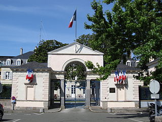
Laval is a town in western France, about 300 km (190 mi) west-southwest of Paris, and the capital of the Mayenne department. Laval was before the French Revolution part of the province of Maine, now split between two departments, Mayenne and Sarthe. Its inhabitants are called Lavallois. The commune of Laval proper, without the metropolitan area, is the 13th most populous in northwestern France and the 119th in France.
Communauté d'agglomération de Laval is the communauté d'agglomération, an intercommunal structure, centred on the city of Laval. It is located in the Mayenne department, in the Pays de la Loire region, western France. It was created in 2001. Its population was 99,851 in 2014, of which 52,935 in Laval proper.

The arrondissement of Laval is an arrondissement of France in the Mayenne department in the Pays de la Loire region. Since the March 2016 reorganization of the arrondissements of Mayenne, it has 34 communes.
The following is a list of the 17 cantons of the Mayenne department, in France, following the French canton reorganisation which came into effect in March 2015:

Gare de Laval is a railway station serving the town Laval, Mayenne department, western France. It is situated on the Paris–Brest railway.
The canton of Meslay-du-Maine is an administrative division of the Mayenne department, northwestern France. Its borders were modified at the French canton reorganisation which came into effect in March 2015. Its seat is in Meslay-du-Maine.
The canton of Évron is an administrative division of the Mayenne department, northwestern France. Its borders were modified at the French canton reorganisation which came into effect in March 2015. Its seat is in Évron.
The canton of Loiron is an administrative division of the Mayenne department, northwestern France. Its borders were not modified at the French canton reorganisation which came into effect in March 2015. Its seat is in Loiron-Ruillé.
The canton of Villaines-la-Juhel is an administrative division of the Mayenne department, northwestern France. Its borders were modified at the French canton reorganisation which came into effect in March 2015. Its seat is in Villaines-la-Juhel.
The canton of Azé is an administrative division of the Mayenne department, northwestern France. It was created at the French canton reorganisation which came into effect in March 2015. Its seat is in Azé.
The canton of Bonchamp-lès-Laval is an administrative division of the Mayenne department, northwestern France. It was created at the French canton reorganisation which came into effect in March 2015. Its seat is in Bonchamp-lès-Laval.
The canton of Château-Gontier is an administrative division of the Mayenne department, northwestern France. It was created at the French canton reorganisation which came into effect in March 2015. Its seat is in Château-Gontier.
The canton of Cossé-le-Vivien is an administrative division of the Mayenne department, northwestern France. Its borders were modified at the French canton reorganisation which came into effect in March 2015. Its seat is in Cossé-le-Vivien.
The canton of Ernée is an administrative division of the Mayenne department, northwestern France. Its borders were modified at the French canton reorganisation which came into effect in March 2015. Its seat is in Ernée.
The canton of Gorron is an administrative division of the Mayenne department, northwestern France. Its borders were modified at the French canton reorganisation which came into effect in March 2015. Its seat is in Gorron.
The canton of L'Huisserie is an administrative division of the Mayenne department, northwestern France. It was created at the French canton reorganisation which came into effect in March 2015. Its seat is in L'Huisserie.
The canton of Lassay-les-Châteaux is an administrative division of the Mayenne department, northwestern France. Its borders were modified at the French canton reorganisation which came into effect in March 2015. Its seat is in Lassay-les-Châteaux.
The canton of Mayenne is an administrative division of the Mayenne department, northwestern France. It was created at the French canton reorganisation which came into effect in March 2015. Its seat is in Mayenne.
The canton of Saint-Berthevin is an administrative division of the Mayenne department, northwestern France. Its borders were modified at the French canton reorganisation which came into effect in March 2015. Its seat is in Saint-Berthevin.