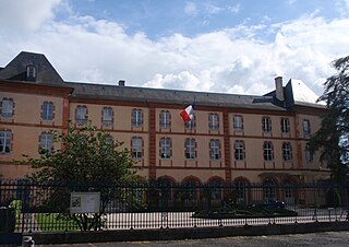
Tarbes is a commune in the Hautes-Pyrénées department in the Occitanie region of southwestern France. It is the capital of Bigorre. It has been a commune since 1790. It was known as Turba or Tarba in Roman times. Tarbes is part of the historical region of Gascony.
The arrondissement of Tarbes is an arrondissement of France in the Hautes-Pyrénées department in the Occitanie region. Since the January 2017 reorganization of the arrondissements of Hautes-Pyrénées, it has 212 communes.
The following is a list of the 17 cantons of the Hautes-Pyrénées department, in France, following the French canton reorganisation which came into effect in March 2015:
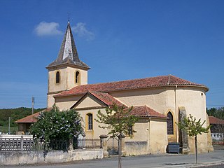
Fontrailles is a commune in the Hautes-Pyrénées department in south-western France. The city belongs to the canton Fontrailles Trie-sur-Baise and the district of Tarbes. The people are called Fontrailles Fontrailles and numbered 147 at the 1999 census. The area is 9.1 square kilometers.

Michel Pélieu (born 26 June 1946) is a French politician.
The canton of Neste, Aure et Louron is an administrative division of the Hautes-Pyrénées department, southwestern France. It was created at the French canton reorganisation which came into effect in March 2015. Its seat is in Capvern.
The canton of La Vallée de l'Arros et des Baïses is an administrative division of the Hautes-Pyrénées department, southwestern France. It was created at the French canton reorganisation which came into effect in March 2015. Its seat is in Tournay.
The canton of La Vallée des Gaves is an administrative division of the Hautes-Pyrénées department, southwestern France. It was created at the French canton reorganisation which came into effect in March 2015. Its seat is in Argelès-Gazost.
The canton of Aureilhan is an administrative division of the Hautes-Pyrénées department, southwestern France. Its borders were modified at the French canton reorganisation which came into effect in March 2015. Its seat is in Aureilhan.
The canton of Bordères-sur-l'Échez is an administrative division of the Hautes-Pyrénées department, southwestern France. Its borders were modified at the French canton reorganisation which came into effect in March 2015. Its seat is in Bordères-sur-l'Échez.
The canton of Les Coteaux is an administrative division of the Hautes-Pyrénées department, southwestern France. It was created at the French canton reorganisation which came into effect in March 2015. Its seat is in Trie-sur-Baïse.
The canton of La Haute-Bigorre is an administrative division of the Hautes-Pyrénées department, southwestern France. It was created at the French canton reorganisation which came into effect in March 2015. Its seat is in Bagnères-de-Bigorre.
The canton of Lourdes-1 is an administrative division of the Hautes-Pyrénées department, southwestern France. It was created at the French canton reorganisation which came into effect in March 2015. Its seat is in Lourdes.
The canton of Lourdes-2 is an administrative division of the Hautes-Pyrénées department, southwestern France. It was created at the French canton reorganisation which came into effect in March 2015. Its seat is in Lourdes.
The canton of Moyen Adour is an administrative division of the Hautes-Pyrénées department, southwestern France. It was created at the French canton reorganisation which came into effect in March 2015. Its seat is in Barbazan-Debat.
The canton of Ossun is an administrative division of the Hautes-Pyrénées department, southwestern France. Its borders were not modified at the French canton reorganisation which came into effect in March 2015. Its seat is in Ossun.
The canton of Val d'Adour-Rustan-Madiranais is an administrative division of the Hautes-Pyrénées department, southwestern France. It was created at the French canton reorganisation which came into effect in March 2015. Its seat is in Maubourguet.
The canton of La Vallée de la Barousse is an administrative division of the Hautes-Pyrénées department, southwestern France. It was created at the French canton reorganisation which came into effect in March 2015. Its seat is in Lannemezan.
The canton of Vic-en-Bigorre is an administrative division of the Hautes-Pyrénées department, southwestern France. Its borders were modified at the French canton reorganisation which came into effect in March 2015. Its seat is in Vic-en-Bigorre.