
Western Sahara is a territory in Northern Africa, bordered by the North Atlantic Ocean, Morocco proper, Algeria, and Mauritania. Geographic coordinates: 24°30′N13°00′W

Mauritania, a country in the Western Region of the continent of Africa, is generally flat, its 1,030,700 square kilometres forming vast, arid plains broken by occasional ridges and clifflike outcroppings. Mauritania is the world’s largest country lying entirely below an altitude of 1,000 metres (3,300 ft). It borders the North Atlantic Ocean, between Senegal and Western Sahara, Mali and Algeria. It is considered part of both the Sahel and the Maghreb. A series of scarps face southwest, longitudinally bisecting these plains in the center of the country. The scarps also separate a series of sandstone plateaus, the highest of which is the Adrar Plateau, reaching an elevation of 500 metres or 1,640 feet. Spring-fed oases lie at the foot of some of the scarps. Isolated peaks, often rich in minerals, rise above the plateaus; the smaller peaks are called Guelbs and the larger ones Kedias. The concentric Guelb er Richat is a prominent feature of the north-central region. Kediet ej Jill, near the city of Zouîrât, has an elevation of 915 metres or 3,002 feet and is the highest peak.
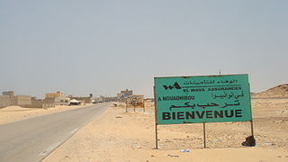
Nouadhibou is the second largest city in Mauritania and serves as a major commercial center. The city has about 173,000 inhabitants. It is situated on a 65-kilometre peninsula or headland called Ras Nouadhibou, Cap Blanc, or Cabo Blanco, of which the western side has the city of La Güera. Nouadhibou is consequently located merely a couple of kilometers from the border between Mauritania and Western Sahara. Its current mayor is Elghassem Ould Bellali, who was installed on 15 October 2018.
Cap Blanc or Cape Blanc, meaning "White Cape", may refer to:

Dakhlet Nouadhibou region is an administrative division of Mauritania. Its regional capital is Nouadhibou, which is located at its northwestern end and is home to nearly 95% of the region's population. The rest of the shoreline is sparsely populated with villages, but the east of the region is mostly uninhabited.

The Bay of Arguin is a bay on the Atlantic shore of Mauritania and the former mouth of the Tamanrasset River, now a Paleo-river.
The Banc d'Arguin National Park of Bay of Arguin lies in Western Africa on the west coast of Mauritania between Nouakchott and Nouadhibou and is the former mouth of the Tamanrasset River. The World Heritage Site is a major site for migratory birds and breeding birds, including flamingos, pelicans and terns. Much of the breeding is on sand banks including the islands of Tidra, Niroumi, Nair, Kijji and Arguim. The surrounding waters are some of the richest fishing waters in western Africa and serve as nesting grounds for the entire western region.

Ras Nouadhibou is a 60-kilometre (37 mi) peninsula or headland divided by the border between Mauritania and Western Sahara on the African coast of the Atlantic Ocean. It is internationally known as Cabo Blanco in Spanish or Cap Blanc in French.

Ras Muari, often referred to as Cape Monze, is a beach located off the shore of the Arabian Sea in Karachi. It stretches from the village of Mubarak to Yousuf Goth (Pacha) in West Karachi, Sindh, Pakistan.
Tanoudert is a coastal town in Mauritania. It is located in the Dakhlet Nouadhibou region and forms a part of the Banc d'Arguin National Park. It is situated to a homonymous bay lying to the west and further west is Cape Tagarit (Cap-Tagair).

Cansado is a coastal town in north-western Mauritania on the Ras Nouadhibou peninsula. It is located in the Nouadhibou Department in the Dakhlet Nouadhibou region.
La Batterie, also known in Arabic as Al Batariyya, is a village in north-western Mauritania on the Ras Nouadhibou peninsular. It is located in the Nouadhibou Department in the Dakhlet Nouadhibou region south of Nouadhibou close to Cansado.
Dakhlet Nouadhibou is a bay on the Atlantic shore of Mauritania. The Dakhlet Nouadhibou Region, one of the primary administrative divisions of Mauritania, is named after it.
The 2010–11 Mauritanian Premier League was the 31st season of the Mauritanian Premier League, the top-level football championship of Mauritania. It began on 24 December 2010 and concluded on 18 June 2011. CF Cansado are the defending champions.
The Ras Makunduchi Lighthouse is located at the south eastern tip of Kusini District Unguja South Region of Tanzania. The lighthouse is located near the historic town of Makunduchi. It is a 27m squared concrete tower painted red and white. The tower has 165 steps to the top and has two non resident operators. Since the lighthouse is on Zanzibar, it is managed by the Zanzibar Ports Corporation instead of the Tanzania Ports Authority.

The Makatumbe Range Rear Lighthouse is located on the island of Outer Makatumbe close to the coast of Dar es salaam, Tanzania. The lighthouse assists ships waiting in the strait that are about to enter the Kivukoni channel.

Les Mamelles Lighthouse is a strategically important lighthouse situated near Cap Vert, the westernmost point of Africa, on the outskirts of Dakar the capital of Senegal. Completed in 1864, it has been described as "one of the world's great lighthouses, guiding ships around the western tip of Africa".

The Mauritania–Western Sahara border is 1,564 kilometres (972 mi) in length and runs from the tripoint with Algeria in the north-east to the Atlantic Ocean in the south-west.

