
Cape Morris Jesup is a headland in Peary Land, Greenland.
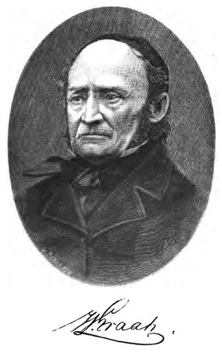
Wilhelm August Graah (1793–1863) was a Danish naval officer and Arctic explorer. Graah had mapped areas of West Greenland when he, in 1828–30, was sent by King Frederick VI of Denmark on an expedition to the unmapped eastern coast with the purpose to search for the lost Eastern Norse Settlement.
Cape Thorvaldsen is a headland in southwest Greenland in the Kujalleq municipality.
Iluileq is an uninhabited island in the Kujalleq municipality in southern Greenland.

King Frederick VI Coast is a major geographic division of Greenland. It comprises the coastal area of Southeastern Greenland in Sermersooq and Kujalleq municipalities fronting the Irminger Sea of the North Atlantic Ocean. It is bordered by King Christian IX Land on the north and the Greenland Ice Sheet to the west.
Paatusoq, mentioned as 'Patursok' by Wilhelm August Graah, is a fjord in the King Frederick VI Coast, Kujalleq municipality, southeastern Greenland. Its name means "The one with the big mouth" in the Greenlandic language.
Kangerluluk, meaning 'the awful fjord', is a fjord in the King Frederick VI Coast, Kujalleq municipality, southern Greenland.
Avaqqat Kangerluat, also known as Avarqqat Kangerluat, Avaqqat Kangerlua and Puiagtoq Fjord, is a fjord in the King Frederick VI Coast, Kujalleq municipality, southern Greenland.

Odinland, also Odinsland in the Defense Mapping Agency Greenland Navigation charts, is a peninsula in the King Frederick VI Coast, southeastern Greenland. It is a part of the Sermersooq municipality.

Cape Bridgman is a headland in the Wandel Sea, Arctic Ocean, northeast Greenland.
Cape Walløe, also known as Kangeq and Kangerssiuasik, is a headland in the North Atlantic Ocean, southeast Greenland, Kujalleq municipality.

Cape Steen Bille or Kap Bille, also known as Kangeq, is a headland in the North Atlantic Ocean, southeast Greenland, Kujalleq municipality.
Kangerluk, also known as Kangerluluarak, is a fjord in the King Frederick VI Coast, Kujalleq municipality, southern Greenland.

Cape Washington is a headland in North Greenland. Administratively it belongs to the Northeast Greenland National Park.
Cape Cannon is a headland in the Lincoln Sea, Arctic Ocean, North Greenland. Administratively it is part of the Northeast Greenland National Park.
Cape Møsting is a headland in the North Atlantic Ocean, southeast Greenland, Kujalleq municipality.

Cape Moltke is a headland in the North Atlantic Ocean, southeast Greenland, Kujalleq municipality.
Cape Brown is a headland in the Greenland Sea, east Greenland, Sermersooq municipality.
Cape Simpson is a headland in the Greenland Sea, Northeast Greenland. Administratively it is part of the Northeast Greenland National Park.
Graah Fjord, also known as Devold Fjord and Langenæs Fjord, is a fjord in King Frederick VI Coast, eastern Greenland.


