Iluileq

Last updated
Iluileq
Iluileq
Location of Iluileq
Greenland edcp location map.svg
Red pog.svg
Iluileq
Location in Greenland
Geography
Location North Atlantic Ocean
Southern Greenland
Coordinates 60°52′N42°48′W / 60.867°N 42.800°W / 60.867; -42.800
Highest elevation829 m (2720 ft)
Highest pointNûgâlik
Administration
Greenland
Municipality Kujalleq
Demographics
Population0

Iluileq (named 'Ilivilik' in old maps) is an uninhabited island in the Kujalleq municipality in southern Greenland.

Contents

History

Wilhelm August Graah (1793–1863) met groups of Southeast-Greenland Inuit on the island during his 1828–30 expedition. He was impressed by some of the women, finding them more beautiful and cleaner compared with the West Greenlandic women he had known. [1]

In June 1870 Iluileq was the place where the crew of the Hansa, the supply ship of the Second German North Polar Expedition was finally able to land after their ship became separated from the Germania , drifted with the ice pack and sank. [2] The crew drifted on the sea ice southward and after nearly eleven months finally reached Iluileq by boat. They found no Inuit on the island. From there they followed the shore southwards until they reached the Moravian Herrnhut mission at Friedrichsthal (modern Narsaq Kujalleq) near Cape Farewell, from where they got back to Germany on a Danish ship. [3]

Geography

Iluileq is a coastal island that lies off King Frederick VI Coast in southeastern Greenland. It is located at the head of Iluileq Fjord (Danell Fjord), on the northern side of it. A small narrow fjord branch or sound separates Iluileq from the mainland on its NW side and Kangerluk Fjord opens its mouth just north of the eastern end of the sound. [4] The island's length is 19 kilometres (12 miles) and its maximum width 5.8 kilometres (4 miles).

Iluileq has rugged cliffs, its highest point reaching 829 metres (2,720 feet). Off the eastern end of the island's coast lies Cape Discord (Kangeq) and off its southern shore lies the small cluster of islets named Ivingmiut. [5]

Map of Greenland section showing Iluileq Island. Lindenow-Greenland-onc d 16-map-section.jpg
Map of Greenland section showing Iluileq Island.

See also

Related Research Articles

<span class="mw-page-title-main">Nanortalik</span> Place in Greenland, Kingdom of Denmark

Nanortalik, formerly Nennortalik, is a town in Nanortalik Island, Kujalleq municipality, southern Greenland. With 1,185 inhabitants as of 2020, it is the eleventh-largest town in the country. The name Nanortalik means "Place of Polar Bears" or "Place Where the Polar Bears Go". It is the southernmost town in Greenland with a population of over 1,000.

<span class="mw-page-title-main">Clavering Island</span> Island on the east coast of Greenland

Clavering Island is a large island in eastern Greenland off Gael Hamke Bay, to the south of Wollaston Foreland.

<span class="mw-page-title-main">German North Polar Expedition</span>

The German North Polar Expeditions were a short series of mid-19th century German expeditions to the Arctic. The aim was to explore the North Pole region and to brand the newly united, Prussian-led German Empire as a great power. In 1866, German geographer August Petermann wrote a pamphlet strongly advocating German participation in the international quest for the North Pole, which stimulated a German expedition.

<span class="mw-page-title-main">Wollaston Foreland</span>

Wollaston Foreland is a peninsula in King Christian X Land, East Greenland. Administratively it belongs to the NE Greenland National Park area.

Sabine Island is an island to the northeast of Wollaston Foreland, previously known as Inner Pendulum Island. It is in the Northeast Greenland National Park area.

<span class="mw-page-title-main">Germania Land</span> Peninsula in Greenland

Germania Land or Germanialand is a peninsula in northeastern Greenland. Despite the high latitude it is largely unglaciated.

<span class="mw-page-title-main">Carl Koldewey</span> German arctic explorer (1837–1908)

Carl Christian Koldewey was a German Arctic explorer. He led both German North Polar Expeditions.

<span class="mw-page-title-main">Wilhelm August Graah</span> Danish naval officer and Arctic explorer

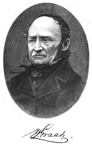
Wilhelm August Graah (1793–1863) was a Danish naval officer and Arctic explorer. Graah had mapped areas of West Greenland when he, in 1828–30, was sent by King Frederick VI of Denmark on an expedition to the unmapped eastern coast with the purpose to search for the lost Eastern Norse Settlement.

<span class="mw-page-title-main">Tunumiit</span> Group of Greenlandic Inuit

Tunumiit or Iivit are Greenlandic Inuit from Tunu or Kangia, the eastern part of Greenland. The Tunumiit live now mainly in Tasiilaq and Ittoqqortoormiit and are a part of the Arctic people known collectively as the Inuit. The singular for Tunumiit is Tunumiu.

<span class="mw-page-title-main">Bernstorff Fjord</span>

Bernstorff Fjord is a fjord in King Frederick VI Coast, eastern Greenland.

<span class="mw-page-title-main">Umivik Bay</span>

Umivik Bay, also known as Umiivik and Umerik, is a bay in King Frederick VI Coast, southeastern Greenland. It is part of the Sermersooq municipality.

<span class="mw-page-title-main">King Frederick VI Coast</span> Region in Greenland

King Frederick VI Coast is a major geographic division of Greenland. It comprises the coastal area of Southeastern Greenland in Sermersooq and Kujalleq municipalities fronting the Irminger Sea of the North Atlantic Ocean. It is bordered by King Christian IX Land on the north and the Greenland Ice Sheet to the west.

Avaqqat Kangerluat, also known as Avarqqat Kangerluat, Avaqqat Kangerlua and Puiagtoq Fjord, is a fjord in the King Frederick VI Coast, Kujalleq municipality, southern Greenland.

<span class="mw-page-title-main">Odinland</span> Peninsula in southeastern Greenland

Odinland, also Odinsland in the Defense Mapping Agency Greenland Navigation charts, is a peninsula in the King Frederick VI Coast, southeastern Greenland. It is a part of the Sermersooq municipality.

Cape Walløe, also known as Kangeq and Kangerssiuasik, is a headland in the North Atlantic Ocean, southeast Greenland, Kujalleq municipality.

Kangerluk, also known as Kangerluluarak, is a fjord in the King Frederick VI Coast, Kujalleq municipality, southern Greenland.

Cape Møsting is a headland in the North Atlantic Ocean, southeast Greenland, Kujalleq municipality.

<span class="mw-page-title-main">Cape Moltke</span>

Cape Moltke is a headland in the North Atlantic Ocean, southeast Greenland, Kujalleq municipality.

Graah Fjord, also known as Devold Fjord and Langenæs Fjord, is a fjord in King Frederick VI Coast, eastern Greenland.

References

  1. Graah, W. A. (2014). Narrative of an Expedition to the East Coast of Greenland. weitsuechtig. ISBN   3943850528. p. 70
  2. Carl Koldewey, The German Arctic Expedition of 1869-1870: Narrative of the Wreck of the Hansa in the Ice. p. 162
  3. Venzke, Jörg-Friedhelm (1990) The 1869–70 German North Polar Expedition. The Arctic 43(1): 83–85.
  4. GoogleEarth
  5. Iluileq Map