
The Falkland Islands are located in the South Atlantic Ocean between 51°S and 53°S on a projection of the Patagonian Shelf, part of the South American continental shelf. In ancient geological time this shelf was part of Gondwana, and around 400 million years ago split from what is now Africa and drifted westwards from it. Today the islands are subjected to the Roaring Forties, winds that shape both their geography and climate.

The Jason Islands are an archipelago in the Falkland Islands, lying to the far north-west of West Falkland. Three of the islands, Steeple Jason, Grand Jason and Clarke's Islet, are private nature reserves owned by the Wildlife Conservation Society of New York City. Other islands in the group are National Nature Reserves owned by the Falkland Islands Government.

James Ross Island is a large island off the southeast side and near the northeastern extremity of the Antarctic Peninsula, from which it is separated by Prince Gustav Channel. Rising to 1,630 metres (5,350 ft), it is irregularly shaped and extends 64 km in a north–south direction. It was charted in October 1903 by the Swedish Antarctic Expedition under Otto Nordenskiöld, who named it for Sir James Clark Ross, the leader of a British expedition to this area in 1842 that discovered and roughly charted a number of points along the eastern side of the island. The style, "James" Ross Island is used to avoid confusion with the more widely known Ross Island in McMurdo Sound.

Port San Carlos is located on the northern bank of the inlet known as Port San Carlos, off San Carlos Water on the Western coast of East Falkland, in the Falkland Islands. It is sometimes nicknamed "KC" after former owner Keith Cameron.

Salvador Settlement, also called Salvador, Salvador Settlement Corral, is a small harbour and settlement on East Falkland, in the Falkland Islands, It is on the north east coast, on the south shore of Port Salvador. It is one of a handful of Spanish place names on the islands, still in use.

Port Egmont was the first British settlement in the Falkland Islands, on Saunders Island off West Falkland, and is named after John Perceval, 2nd Earl of Egmont, who was First Lord of the Admiralty at the time of its founding.
Volunteer Point is a headland on the east coast of East Falkland, in the Falkland Islands, north-northeast of Stanley, and east of Johnson's Harbour and Berkeley Sound. It lies at the end of a narrow peninsula, which protects Volunteer Lagoon. It received its name in 1815, when the sealing ship Volunteer left a boat's crew there to collect seal skins while it went in search of opportunities elsewhere. Four years later, on 13 February 1820, the French research vessel L'Uranie struck a submerged rock just off the point but stayed afloat long enough to be beached in Berkeley Sound. All on board survived, including the Captain's wife, Rose de Freycinet, who recorded the incident in her diary.

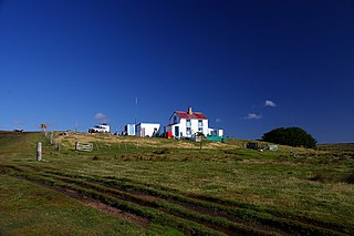
Johnson's Harbour is a settlement on the north east coast of East Falkland in the Falkland Islands. It is on the shore of Berkeley Sound at the head of Chabot Creek on a bay also named Johnson's Harbour. It has a small store but the FIGAS only lands there for emergencies. Surrounding hills include North Lookout, Diamond Mountain and Hawk Hill.
Green Patch is a settlement on East Falkland, in the Falkland Islands, It is on the north east coast, on the south shore of Berkeley Sound, a few miles south east from Port Louis, on Port Louis Harbour. It looks out onto Long Island and Hog Island.
Cape Pembroke is the easternmost point of the Falkland Islands, and is on East Falkland. There is an automated lighthouse here.

Foul Bay is an inlet on East Falkland island in the Falkland Islands. It is in the north west of the island, between Concordia Bay and San Carlos Water, and the northern end of Falkland Sound. It is also near Cape Dolphin.
Concordia Bay is on the north shore of East Falkland in the Falkland Islands. It is between Foul Bay and Salvador Water. It is also near Cape Dolphin, and the northern end of the Falkland Sound.
Cape Bougainville is the second-most northerly point on East Falkland, Falkland Islands, after Cape Dolphin, and is the second-most northerly point of the two main islands, East and West Falkland. Many of the smaller islands, such as the Jason Islands, are further north.

Mare Harbour, known colloquially as East Cove Port, is a small settlement on East Falkland, on Choiseul Sound. It is mostly used as a port facility and depot for RAF Mount Pleasant, as well as a deepwater port used by the Royal Navy ships patrolling the South Atlantic and Antarctica, which means that the main harbour of the islands, Stanley Harbour tends to deal with commercial transport.
The climate of the Falkland Islands is cool and temperate, regulated by the large oceans which surround it. The Falkland Islands are a British Overseas Territory located over 480 kilometres (298 mi) from South America, to the north of the Antarctic convergence, where cooler waters from the south mix with warmer waters from the north.

The borders of the oceans are the limits of Earth's oceanic waters. The definition and number of oceans can vary depending on the adopted criteria. The principal divisions of the five oceans are the Pacific Ocean, Atlantic Ocean, Indian Ocean, Southern (Antarctic) Ocean, and Arctic Ocean. Smaller regions of the oceans are called seas, gulfs, bays, straits, and other terms. Geologically, an ocean is an area of oceanic crust covered by water.
Flatcap Point is the most northerly of two relatively low flat-topped rock cliffs on the east side of the northern arm of Rohss Bay, James Ross Island. It was mapped from surveys by the Falkland Islands Dependencies Survey (1960–61); the descriptive name was given by the UK Antarctic Place-Names Committee.

Le Boreal is a cruise ship owned and operated by the French cruise line company Compagnie du Ponant.

Bertha's Beach Important Bird Area comprises 3,300 hectares of coastal wetlands at the entrance to Choiseul Sound, on the east coast of East Falkland, in the Falkland Islands. It lies about 8 kilometres (5.0 mi) south-east of Mount Pleasant Airport and 40 km south-west of Stanley. It has been identified by BirdLife International as an Important Bird Area (IBA) because of its significancer for a variety of migratory waders and other waterbirds. Overlapping it is the 4000 ha Bertha's Beach Ramsar site, recognising it as a wetland of international importance.
