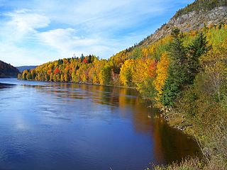
The Gulf of Saint Lawrence is the outlet of the North American Great Lakes via the Saint Lawrence River into the Atlantic Ocean. The gulf is a semienclosed sea, covering an area of about 226,000 square kilometres (87,000 sq mi) and containing about 34,500 cubic kilometres (8,300 cu mi) of water, which results in an average depth of 152 metres (499 ft).

Belle Isle is an uninhabited island just off the coast of Labrador and north of Newfoundland at the Atlantic entrance to the Strait of Belle Isle which takes its name. Named by French explorer Jacques Cartier, the island lies on the shortest shipping lane between the Great Lakes and Europe, and also on the main north–south shipping route to Hudson Bay and the Northwest Territories. The northern terminus of the International Appalachian Trail is located on Belle Isle.
St. Lunaire Bay is a natural bay off the island of Newfoundland in the province of Newfoundland and Labrador, Canada.

Cape Norman is a settlement in Newfoundland and Labrador. It is the northernmost village on the island of Newfoundland. It is situated slightly inland of Cape Norman Bay.
Rencontre Bay is natural bay on the island of Newfoundland in the province of Newfoundland and Labrador, Canada. It is near Devil Bay.
La Hune Bay is natural bay on the island of Newfoundland in the province of Newfoundland and Labrador, Canada. It is by Cape La Hune.
West Bay is a natural bay on the island of Newfoundland in the province of Newfoundland and Labrador, Canada.
St. Barbe Bay is a natural bay off the island of Newfoundland in the province of Newfoundland and Labrador, Canada.
Sacred Bay is a natural bay off the island of Newfoundland in the province of Newfoundland and Labrador, Canada.
Médée Bay is a natural bay off the island of Newfoundland in the province of Newfoundland and Labrador, Canada. It faces the modern village and archeological site of L'Anse aux Meadows.
Grand Galets Bay is a natural bay off the island of Newfoundland in the province of Newfoundland and Labrador, Canada.
St. Mein Bay is a natural bay off the island of Newfoundland in the province of Newfoundland and Labrador, Canada. It is located on the eastern side of the tip of the Great Northern Peninsula, and the village of St. Anthony is nearby.
Marguerite Bay is a natural bay off the island of Newfoundland in the province of Newfoundland and Labrador, Canada.
Forteau Bay is a natural bay on the coast of Labrador in the province of Newfoundland and Labrador, Canada.
Barren Bay is a natural bay on the coast of Labrador in the province of Newfoundland and Labrador, Canada. It is nearby to West Island, Drunken Cove Point and Salmon Bight Point. Barren Bay is also close to Frenchman Cove, Fenchman Cove and Hauling Cove.
Caplin Bay is a natural bay on the coast of Labrador in the province of Newfoundland and Labrador, Canada.
St. Michaels Bay is a natural bay on the coast of Labrador in the province of Newfoundland and Labrador, Canada.
Scrammy Bay is a natural bay on the coast of Labrador in the province of Newfoundland and Labrador, Canada.
Black Bear Bay is a natural bay on the coast of Labrador in the province of Newfoundland and Labrador, Canada.


