The gray whale, also known as the grey whale, gray back whale, Pacific gray whale, Korean gray whale, or California gray whale, is a baleen whale that migrates between feeding and breeding grounds yearly. It reaches a length of 14.9 meters (49 ft), a weight of up to 41 tonnes (90,000 lb) and lives between 55 and 70 years, although one female was estimated to be 75–80 years of age. The common name of the whale comes from the gray patches and white mottling on its dark skin. Gray whales were once called devil fish because of their fighting behavior when hunted. The gray whale is the sole living species in the genus Eschrichtius. It is the sole living genus in the family Eschrichtiidae, however some recent studies classify it as a member of the family Balaenopteridae. This mammal is descended from filter-feeding whales that appeared during the Neogene.
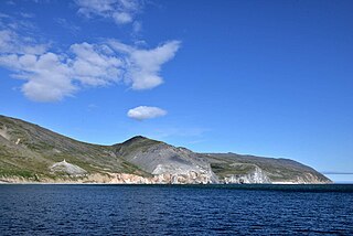
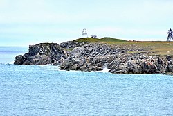
Cape Dezhnyov or Cape Dezhnev ;, formerly known as East Cape or Cape Vostochny, is a cape that forms the easternmost mainland point of Asia. It is located on the Chukchi Peninsula in the very sparsely populated Chukotka Autonomous Okrug of Russia. This cape is located between the Chukchi Sea and the Bering Strait, 82 kilometres (51 mi) across from Cape Prince of Wales in Alaska; the Bering Strait is delimited by the two capes. The Diomede Islands and Fairway Rock are located in the midst of the strait.

The East Siberian Sea is a marginal sea in the Arctic Ocean. It is located between the Arctic Cape to the north, the coast of Siberia to the south, the New Siberian Islands to the west and Cape Billings, close to Chukotka, and Wrangel Island to the east. This sea borders on the Laptev Sea to the west and the Chukchi Sea to the east.

The Chukchi Sea, sometimes referred to as the Chuuk Sea, Chukotsk Sea or the Sea of Chukotsk, is a marginal sea of the Arctic Ocean. It is bounded on the west by the Long Strait, off Wrangel Island, and in the east by Point Barrow, Alaska, beyond which lies the Beaufort Sea. The Bering Strait forms its southernmost limit and connects it to the Bering Sea and the Pacific Ocean. The principal port on the Chukchi Sea is Uelen in Russia. The International Date Line crosses the Chukchi Sea from northwest to southeast. It is displaced eastwards to avoid Wrangel Island as well as the Chukotka Autonomous Okrug on the Russian mainland.
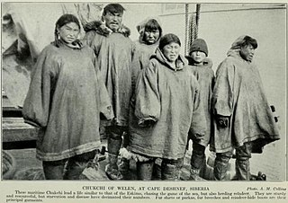
Uelen is a rural locality in Chukotsky District, just south of the Arctic Circle in Chukotka Autonomous Okrug in the Russian Far East. As of the 2010 Census, its population was 720. Located near Cape Dezhnev where the Bering Sea meets the Chukchi Sea, it is the easternmost settlement in Russia and the whole of Asia. It is located in the Western Hemisphere, but the International Date Line curves around it, so it remains in a Russian time zone (UTC+12:00). Uelen is also the closest Asian settlement to North America. It is on the northeast corner of the Uelen Lagoon, a roughly 15 by 3 kilometres east-west lagoon separated from the ocean by a sandspit. Municipally, Uelen is subordinated to Chukotsky Municipal District and is incorporated as Uelen Rural Settlement.

Cape Krusenstern is a cape on the northwestern coast of the U.S. state of Alaska, located near the village of Kivalina at 67°07′41″N163°44′43″W.

The Gulf of Anadyr, or Anadyr Bay, is a large bay on the Bering Sea in far northeast Siberia. It has a total surface area of 200,000 km2 (77,000 sq mi)
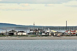
Vankarem is a village (selo) in Iultinsky District of Chukotka Autonomous Okrug, in the Far Eastern Federal District of Russia, situated on Cape Vankarem on the coast of the Chukchi Sea. Population: 184 (2010 Census); Municipally, Vankarem is subordinated to Iultinsky Municipal District and incorporated as Vankarem Rural Settlement.

Kolyuchin Bay is a large bay in the Chukchi Sea on the northern shore of the Chukotka Peninsula, Russia.

The Amguema is a river in Chukotka Autonomous Okrug, Russia. It is 498 kilometres (309 mi) long, and has a drainage basin of 28,100 square kilometres (10,800 sq mi).

Vladimir Ivanovich Voronin was a Soviet Navy captain, born in Sumsky Posad, in the present Republic of Karelia, Russia. In 1932 he commanded the expedition of the Soviet icebreaker A. Sibiryakov which made the first successful crossing of the Northern Sea Route in a single navigation without wintering. This voyage was organized by the All-Union Arctic Institute.
The Icy Cape is a headland on the Chukchi Sea side of the North Slope Borough, Alaska, United States. It was discovered and named by James Cook on August 17, 1778, on account of the ice along the coast.

Karkarpko Island is a small island in the Chukchi Sea. It is close to the coast, being only 3 km (1.9 mi) away to the east from the landtip north of Cape Vankarem in the Chukotka Peninsula.

The Neskynpil'gyn Lagoon is a shallow coastal lake in the Chukchi Sea at the northern shore of the Chukotka Peninsula, Russia. 30 kilometres (19 mi) to the east is Kolyuchinskaya Bay and 25 kilometres (16 mi) west, Cape Serdtse-Kamen.

Cape Serdtse-Kamen is a headland on the northeastern coast of Chukotka, Russian Federation. It is about 140 km west of Cape Dezhnev, 120 km east of Kolyuchinskaya Bay and about 30 km to the east of the Neskynpil'gyn Lagoon. Nearby is the village of Enurmino.
Providence Bay is a fjord in the southern coast of the Chukchi Peninsula of northeastern Siberia. It was a popular rendezvous, wintering spot, and provisioning spot for whalers and traders in the nineteenth and early twentieth centuries. Emma Harbor is a large sheltered bay in the eastern shore of Providence Bay. Provideniya and Ureliki settlements and Provideniya Bay Airport stand on the Komsomolskaya Bay. Plover Bay in English sources sometimes refers specifically to the anchorage behind Napkum Spit within Providence Bay but was commonly used as a synonym for Providence Bay; Russian 19th century sources used the term for an anchorage within Providence Bay.
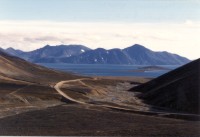
Providensky District is an administrative and municipal district (raion), one of the six in Chukotka Autonomous Okrug, Russia. It is located in the northeast of the autonomous okrug, in the southern half of the Chukchi Peninsula with a northwest extension reaching almost to the Kolyuchinskaya Bay on the Arctic. It borders with Chukotsky District in the north, the Bering Sea in the east and south, and with Iultinsky District in the west. The area of the district is 26,800 square kilometers (10,300 sq mi). Its administrative center is the urban locality of Provideniya. Population: 3,923 (2010 Census); 4,660 (2002 Census); 9,778 (1989 Census). The population of Provideniya accounts for 50.2% of the district's total population.

Cape Schmidt, formerly known as Cape North, is a headland in the Chukchi Sea, part of Iultinsky District of the Chukotka Autonomous Okrug, Russian Federation.

The Naukan, also known as the Naukanski, are a Siberian Yupik people and an Indigenous people of Siberia. They live in the Chukotka Autonomous Region of eastern Russia.
