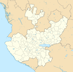
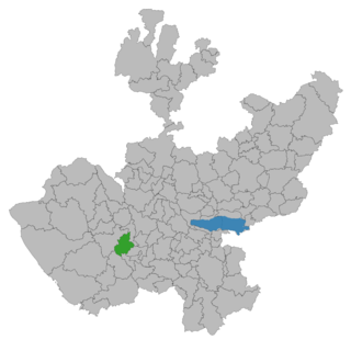
Jalisco is a state in Western Mexico that is divided into 125 municipalities. According to the 2020 Mexican census, it is the third most populated state with 8,348,151 inhabitants and the seventh largest by land area spanning 78,595.9 square kilometres (30,346.0 sq mi). The largest municipality by population is Zapopan, with 1,476,491 residents, while the smallest is Santa María del Oro with 1,815 residents. The largest municipality by land area is Mezquitic which spans 3,363.60 km2 (1,298.69 sq mi), and the smallest is Techaluta with 79.20 km2 (30.58 sq mi). The newest is San Ignacio Cerro Gordo, established in 2007 out of Arandas.

Lagos de Moreno is a city and municipality in the State of Jalisco, Mexico. Lagos is located in the region of Los Altos de Jalisco, within the macroregion of the Bajío, one of the most highly developed areas in Latin America. Lagos de Moreno is occasionally known as the "Athens of Jalisco", owing to the numerous writers and poets who were born there.

Sayula is a town and municipality in the Mexican state of Jalisco, approximately 100 kilometers south of Guadalajara. It is surrounded by smaller towns, such as Usmajac, San Andres, El Reparo, and Amacueca.

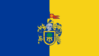
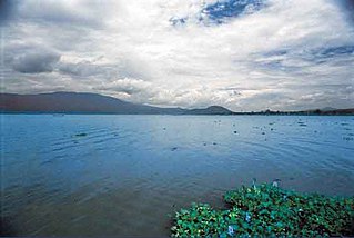
Chapala is a town and municipality in the central Mexican state of Jalisco, located on the north shore of Lake Chapala, Mexico's largest freshwater lake. According to the 2015 census, its population is 50,738 for the municipality. The municipality includes about 11,000 in the town of Ajijic.
Cocula is a city and municipality in the Mexican state of Jalisco. It is located 35 mi (56 km) southwest of Guadalajara, on Mexico Highway 80. It sits at an elevation of 4,460 feet (1,360 m). According to the 2020 census, the population of the municipality was 29,267 with 16,550 inhabitants living in the city. Other important towns in the municipality are Cofradía de la Luz, La Sauceda, and Santa Teresa.
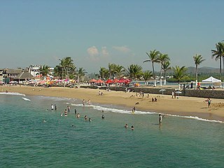
Barra de Navidad is a small town located on the western coastline of the Mexican state of Jalisco. It belongs to the municipality of Cihuatlán. The town population was 4,266 according to the 2020 census.

Arandas is a municipality of the Altos Sur region of the state of Jalisco in Mexico. Arandas is also the name of the municipality's main township and the center of the municipal government. The city centre is located approximately 86 miles (138 km) east of Guadalajara, the state capital. Arandas is accessible to residents of Guadalajara by the Mexican Federal Highway 80D and Jalisco State Highway 314.

Autlán de Navarro is a city and its surrounding municipality of the same name in the Costa Sur region of the southwestern part of the state of Jalisco in Mexico. At the Mexican census of 2005, the municipality had a population of 53,269. In 2010, the population had increased up to approximately 108,427, including all its delegations. The municipality has a surface area of 705.1 km². It is located 192 kilometers away from the Guadalajara metropolitan area and 165 kilometers from Manzanillo, Colima. This department capital is the most populated and largest city of the Costa Sur region. It is a leader district in the region since, Autlán is an important commercial exchange center. In September 12, 2014 the Autlán municipality was vouched for by the Congress of the Union.
La Manzanilla is a town located in La Huerta Municipality, Jalisco, Mexico. The village is located in the southeastern corner of the Bay of Tenacatita, on the Costalegre of southwestern mainland Mexico in the state of Jalisco. "Manzanilla" is Spanish for chamomille. The population was 1,592 according to the 2020 census.
Bolaños is the municipal seat of Bolaños Municipality, Jalisco, Mexico. The population was 1,086 according to the 2020 census.

Zapotlanejo is a town and municipality in the Mexican state of Jalisco.

Mesa del Cobre is a town in the municipality of San Martín de Hidalgo in the Mexican state of Jalisco, approximately 2 hours southwest of Guadalajara. The population was 44 according to the 2020 census.
Jalisco, officially the Free and Sovereign State of Jalisco, is one of the 31 states which, along with Mexico City, comprise the 32 Federal Entities of Mexico. It is located in western Mexico and is bordered by six states, Nayarit, Zacatecas, Aguascalientes, Guanajuato, Michoacán, and Colima. Jalisco is divided into 125 municipalities, and its capital and largest city is Guadalajara.

Acatic is a town and municipality, in Jalisco in central-western Mexico. The municipality covers an area of 339.2 km². The town produces mainly Spanish style shingles, brick, adobe floor tile, chia, corn, and tequila. Pueblo Viejo Tequila is bottled near by. The town is the entry "gate" to Los Altos of Jalisco.
Tlajomulco de Zúñiga is the municipal seat and third most populous city in the municipality of the same name, located in the state of Jalisco in central-western Mexico. It forms part of the Guadalajara metropolitan area, lying to the southeast of it. The municipality covers an area of 636.93 km2. As of 2010 it had a population of 416,626, with a total urban population of 378,965.
Unión de Tula is a town and municipality, in the Sierra de Amula region of the state of Jalisco in central-western Mexico. The municipality covers an area of 443 km2 (171 sq mi).

Lázaro Cárdenas, also known as Cárdenas, is a town in the municipality of San Martín de Hidalgo in the Mexican state of Jalisco. The population was 276 according to the 2020 census.
El Cobre is a rural town in the municipality of San Martín de Hidalgo in the Mexican state of Jalisco. The town is in between the towns of Lagunillas and Mesa del Cobre, in Sierra de Quila, Jalisco's second-largest forest reserve. The population was 51 according to the 2020 census.

Betania is a town in Ayotlán Municipality, in Jalisco in central-western Mexico. The population was 2,690 according to the 2020 census. The 2005 census had previously recorded a population of 2,849 inhabitants.
El Refugio is a town in the Tizapan El Alto municipality of Jalisco, Mexico. The population was 369 according to the 2020 census. The population was recorded as 372 in the 2010 census.