Related Research Articles

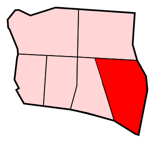
NOTE: This district's boundaries were changed in 2016. This map is not presently accurate.

The Meherrin River is a 92-mile (148 km) long river in the U.S. states of Virginia and North Carolina. It begins in central Virginia, about 50 miles (80 km) northwest of Emporia, and flows roughly east-southeast into North Carolina, where it joins the larger Chowan River.
Ballydargan is a townland eight kilometres south of Downpatrick, County Down, Northern Ireland. Ballydargan is in the parish of Bright.

Wiąg is a village in the administrative district of Gmina Świecie, within Świecie County, Kuyavian-Pomeranian Voivodeship, in north-central Poland. It lies approximately 6 kilometres (4 mi) east of Świecie, 45 km (28 mi) north of Toruń, and 50 km (31 mi) north-east of Bydgoszcz.

Bukowiec is a village in Świecie County, Kuyavian-Pomeranian Voivodeship, in north-central Poland. It is the seat of the gmina called Gmina Bukowiec. It lies approximately 14 kilometres (9 mi) west of Świecie and 39 km (24 mi) north-east of Bydgoszcz.
Cape Junction is an unincorporated community in Northampton County, Virginia, United States.

The Church of St Mary Magdalene, Sutton-in-Ashfield is a parish church in the Church of England in Sutton-in-Ashfield, Nottinghamshire.

Brzeźnica is a village in the administrative district of Gmina Jastrowie, within Złotów County, Greater Poland Voivodeship, in west-central Poland. It lies approximately 9 kilometres (6 mi) west of Jastrowie, 25 km (16 mi) west of Złotów, and 116 km (72 mi) north of the regional capital Poznań.

Babilon is a settlement in the administrative district of Gmina Chojnice, within Chojnice County, Pomeranian Voivodeship, in northern Poland. It lies approximately 13 kilometres (8 mi) north-west of Chojnice and 102 km (63 mi) south-west of the regional capital Gdańsk.
Lesiak is a settlement in the administrative district of Gmina Rybno, within Działdowo County, Warmian-Masurian Voivodeship, in northern Poland.

Rościn is a village in the administrative district of Gmina Drawno, within Choszczno County, West Pomeranian Voivodeship, in north-western Poland. It lies approximately 7 kilometres (4 mi) north of Drawno, 28 km (17 mi) north-east of Choszczno, and 81 km (50 mi) east of the regional capital Szczecin.

Pniewo is a village in the administrative district of Gmina Płoty, within Gryfice County, West Pomeranian Voivodeship, in north-western Poland. It lies approximately 16 kilometres (10 mi) north-east of Płoty, 16 km (10 mi) east of Gryfice, and 78 km (48 mi) north-east of the regional capital Szczecin.

Guararé District is a district (distrito) of Los Santos Province in Panama. The population according to the 2000 census was 9,485. The district covers a total area of 216 km². The capital lies at the city of Guararé.

Pocrí District is a district (distrito) of Los Santos Province in Panama. The population according to the 2000 census was 3,397. The district covers a total area of 280 km². The capital lies at the city of Pocrí, Los Santos.

Colborne is a Canadian parish in Restigouche County, New Brunswick.

Ensign is a hamlet in southern Alberta, Canada within Vulcan County. It is located approximately 11 kilometres (6.8 mi) south of Highway 23 and 78 kilometres (48 mi) southeast of Calgary.
Kayan is an unincorporated community in Northumberland County, in the U.S. state of Virginia.

Penntown is an unincorporated community in Adams Township, Ripley County, in the U.S. state of Indiana.

Almagro is a ward (barrio) of Madrid belonging to the district of Chamberí.
Prettyman is an unincorporated community in Cass County, in the U.S. state of Missouri.
References
Coordinates: 53°16′12″N007°25′54″W / 53.27000°N 7.43167°W
| This article related to the geography of County Offaly, Ireland is a stub. You can help Wikipedia by expanding it. |