Cadbury Castle is an Iron Age Hillfort close to Bickleigh, Devon, England. It was later encamped by the Parliamentarian forces during the English Civil War under Thomas Fairfax when he laid siege to Bickleigh Castle.

Castle Close is a circular earthwork located near Stoodleigh in Mid Devon, England at OS grid reference SS937181. It is described on maps as a settlement. Situated some 208 metres above sea level, overlooking the River Exe, it is most likely to be an Iron Age Hill fort or enclosure.

Prestonbury Castle is an Iron Age Hill fort on the north east edge of Dartmoor in Devon, England. Situated on a massive hilltop some 240 metres above sea level overlooking the Teign Valley, it is located near two other hill forts both of which lie about 2 km (1 mi) away.

There are two hills named Castle Hill within the immediate environs of Great Torrington in Devon, England. The first is within the town and is the site of the Norman & mediaeval castles, but was probably an Iron Age hill fort before this.50.9509°N 4.1436°W

Denbury Hill is the name of an Iron Age hill fort near the village of Denbury in Devon, England.

Hawkesdown Hill is an Iron Age Hill fort close to Axmouth in Devon situated on a prominent hillside above the Axe Estuary. It is approximately 130 metres (430 ft) above sea level.
Membury Castle is an Iron Age hill fort situated above the village of Membury in Devon. The fort occupies a commanding hilltop position some 204 metres above sea level with views across both the Yarty and Axe valleys.

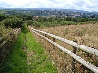
Musbury Castle is an Iron Age Hill fort situated above the Village of Musbury in Devon. The fort occupies a commanding hill top approx 175 Metres above Sea Level overlooking the Axe valleyat Ordnance Survey grid reference SY282941.
Wooston Castle is an Iron Age Hill fort situated on the edge of a hill overlooking the Teign Valley in Devon some 200 metres above sea level, only 3 km south and east of Prestonbury Castle and 5 km east of Cranbrook Castle.

Cranbrook Castle is an Iron Age Hill fort occupying a commanding hilltop just to the south of and overlooking the Teign valley in Devon. It is 337 metres above sea level and 2 km south and slightly west of Prestonbury castle, 3 km west of Wooston Castle.

Castle Dyke is an Iron Age hill fort situated between Chudleigh and Dawlish in Devon, England. The fort is situated on a Hilltop at approx 140 metres above sea level.
Milber Down is an Iron Age hill fort on the hill above the suburb of Milber, Newton Abbot in Devon, England. The fort is situated on the north-western slope of Milber Down at about 110 metres above sea level, and is bisected by the minor ridge road that leads to Barton, Torquay. One Iron Age artefact discovered there was a figurine of a stag.
Holne Chase Castle is an Iron Age hill fort situated close to Buckland-in-the-Moor in Devon, England. The fort is situated on a promontory on the Northern slopes of Holne Chase in Chase Wood at approx 150 Metres above Sea Level overlooking the River Dart.

Brent Hill is the site of an Iron Age hill fort situated close to South Brent in Devon, England. The fort occupies the top of Brent Hill at approx 311 Metres above Sea Level.
Yellowberries Copse is an Iron Age enclosure, or possibly hill fort situated South of South Brent in Devon, England. The fort is situated on the North West slope of Cutwell Hill at approx 155 Metres above Sea Level.
Stanborough is the site of an Iron Age hill fort near the village of Halwell, south of Totnes, Devon, England. The fort is situated on a promontory on the western edge of a hill at about 200 metres (660 ft) above sea level. The site was first listed as a historical heritage in 1923.

Halwell Camp is an Iron Age hill fort situated close to the village of Halwell in Devon, England. The fort is situated on a pass between two hilltops to the east of the village at approx 185 metres above sea level.
Noss is the name given to an Iron Age hill fort situated close to Dartmouth in Devon, England. The fort is situated on the South Western slope of a promontory on the Eastern side of a hill west of the Village of Hillhead some 65-80 Metres above Sea Level overlooking Noss Point in the Dart Estuary.
Holbury is an Iron Age hill fort situated close to Holbeton in Devon, England. The fort is situated on a hilltop east of the Village approximately 95 metres above sea level overlooking the Erme Estuary.
Yarrowbury is an Iron Age hill fort situated close to Bigbury in Devon, England. The fort is situated on Hilltop to the north east of the village at approximately 80 metres above sea level, overlooking the Avon Estuary.