Related Research Articles

Amazonas is a state of Brazil, located in the North Region in the northwestern corner of the country. It is the largest Brazilian state by area and the 9th largest country subdivision in the world, and the largest in South America, being greater than the areas of Uruguay, Paraguay, and Chile combined. Mostly located in the Southern Hemisphere, it is the third largest country subdivision in the Southern Hemisphere after the Australian states of Western Australia and Queensland. Entirely in the Western Hemisphere, it is the fourth largest in the Western Hemisphere after Greenland, Nunavut and Alaska. It would be the sixteenth largest country in land area, slightly larger than Mongolia. Neighbouring states are Roraima, Pará, Mato Grosso, Rondônia, and Acre. It also borders the nations of Peru, Colombia and Venezuela. This includes the Departments of Amazonas, Vaupés and Guainía in Colombia, as well as the Amazonas state in Venezuela, and the Loreto Region in Peru.

Manaus is the capital and largest city of the Brazilian state of Amazonas. It is the seventh-largest city in Brazil, with an estimated 2020 population of 2,219,580 distributed over a land area of about 11,401 km2 (4,402 sq mi). Located at the east center of the state, the city is the center of the Manaus metropolitan area and the largest metropolitan area in the North Region of Brazil by urban landmass. It is situated near the confluence of the Negro and Solimões rivers. It is the only city in the Amazon Rainforest with a population over 1 million people.

Amazonas is a department of Southern Colombia in the south of the country. It is the largest department in area while also having the 3rd smallest population. Its capital is Leticia and its name comes from the Amazon River, which drains the department.

Amazonas State is one of the 23 states into which Venezuela is divided. It covers nearly a fifth of the area of Venezuela, but has less than 1% of Venezuela's population.

Classification of Indigenous peoples of the Americas is based upon cultural regions, geography, and linguistics. Anthropologists have named various cultural regions, with fluid boundaries, that are generally agreed upon with some variation. These cultural regions are broadly based upon the locations of Indigenous peoples of the Americas from early European and African contact beginning in the late 15th century. When Indigenous peoples have been forcibly removed by nation-states, they retain their original geographic classification. Some groups span multiple cultural regions.
Ilha Tupinambarana is a former fluvial island bordered by rivers of the Amazon system in eastern Amazonas, Brazil. It has been split into four completely separate parts by natural channels, just like those isolating it from the mainland. The original island stretched from the municipalities of Parintins, in the northeast, to Nova Olinda do Norte, in the southwest. The combined area of the islands is to 11,850 km², making Ilha Tupinambarana the second largest fluvial group of islands in the world after Bananal Island. It is also the 92nd largest island in the world and the 3rd largest island in Brazil.

Solimões is the name often given to upper stretches of the Amazon River in Brazil from its confluence with the Rio Negro upstream to the border of Peru.

The Battle of Riachuelo was a large and decisive naval battle of the Paraguayan War between Paraguay and the Empire of Brazil. By late 1864, Paraguay had scored a series of victories in the war, but on 11 June 1865, its naval defeat by the Brazilians on the Paraná River began to turn the tide in favor of the allies.

Belgrano C is a sector within the barrio of Belgrano of Buenos Aires, Argentina, and is not officially recognised as one of the 48 barrios of Buenos Aires.
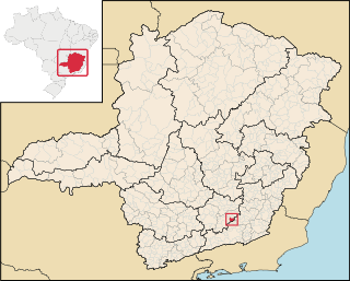
Santa Bárbara do Tugúrio is a Brazilian municipality located in the state of Minas Gerais. The city belongs to the mesoregion of Campo das Vertentes and to the microregion of Barbacena. In 2020, the estimated population was 4,407.
Piratucu River is a river of Amazonas state in north-western Brazil.
Marimari River is tributary of the Abacaxis River in Amazonas state in north-western Brazil. It merges into the Abacaxis River shortly before the latter merges into the Paraná Urariá.
The Paraconi River is a river in the state of Amazonas in north-western Brazil. It is located east of the Madeira River and these two are connected via the Paraná Urariá. Through the Paraná Urariá it is also connected to several other smaller rivers and ultimately Paraná do Ramos, which is a side channel of the Amazon River itself.

Vaupés River is a tributary of the Rio Negro in South America. It rises in the Guaviare Department of Colombia, flowing east through Guaviare and Vaupés Departments. It forms part of the international border between the Vaupés department of Colombia and the Amazonas state of Brazil. On the border it merges with the Papurí River and becomes known as the Uaupés. In 1847 an explorer saw a rapid which hurled its waves 12 or 15 metres in the air, "as if great subaqueous explosions were taking place." The river continues on east through the Alto Rio Negro Indigenous Territory until it flows into the Rio Negro at São Joaquim, Amazonas. Vaupés is a blackwater river.
Tunas Creek formerly known as Arroyo Escondido, is a stream tributary to the Pecos River, in Pecos County, Texas. Its source is at 30°52′53″N102°34′59″W on the southwestern side of Big Mesa.

Cocal de Telha is a municipality in the state of Piauí in the Northeast region of Brazil.
Bee Run is a stream in northern St. Francois County in the U.S. state of Missouri. It is a tributary of the Big River.
The Pira-tapuya, or variations like Pira-Tapuia, Piratapuyo, etc., or Tapuya for short, are an indigenous people of the Amazon regions. They live along the Vaupés River in Colombia and in the state of Amazonas, Brazil.
References
Coordinates: 1°44′04″S58°33′32″W / 1.73444°S 58.55889°W