Related Research Articles
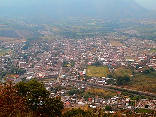
The city of Puruándiro is in the north of the Mexican state of Michoacán. It is located at 20°5′17″N101°30′56″W. The population is 70,571.

Santa Ana Maya Municipality is one of the municipalities of Michoacán, bordering on the state of Guanajuato and Lake Cuitzeo.

Isla de Janitzio is the main island of Lake Pátzcuaro in the state of Michoacán, Mexico.
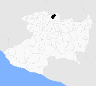
Tingambato is a municipality in the north-central part of the Mexican state of Michoacán. Its municipal seat is the city of the same name. Of the region Tierra Caliente, The municipality has an area of 188.77 square kilometres and is bordered by the north by the municipalities of Nahuatzén and Erongarícuaro, to the east by Pátzcuaro and Salvador Escalante, to the south by Ziracuaretiro, and to the west by Uruapan. The municipality had a population of 17,630 inhabitants according to the 2015 census. Its municipal seat is the city of the same name.

Tuxpan is a small village in between Zitácuaro and Ciudad Hidalgo in the Mexican state of Michoacán. It is located 118 km (73 mi) from Morelia.

Erongarícuaro, which means "Place of waiting" in the Purepecha language, is a town in the Mexican state of Michoacán. It is located about an hour and a half drive to Morelia or Uruapan and just 20 minutes from the famous colonial town of Pátzcuaro. The estimated population is about 5,000 people.
Huanímaro is a Mexican city located in Southwest region of the state of Guanajuato. The municipality has an area of 130.57 square kilometres and is bordered to the north and west by Abasolo, to the south by the state of Michoacán, and to the east by Valle de Santiago. The municipality had a population of 19,693 inhabitants according to the 2005 census.
Copándaro is a municipality located in the Mexican state of Michoacán. The municipality has an area of 173.52 square kilometres and is bordered to the north by Huandacareo and Cuitzeo, to the east and south by Tarímbaro, and to the west by Chucándiro. The municipality had a population of 8,131 inhabitants according to the 2005 census. Its municipal seat is the city of Copándaro de Galeana.
Nuevo Urecho is a municipality located in the center of the Mexican state of Michoacán. The municipality has an area of 330.66 square kilometres and is bordered to the north by the municipality of Taretan, to the east by Ario, to the south by La Huacana, and to the west by Gabriel Zamora. The municipality had a population of 7,722 inhabitants according to the 2005 census. Its municipal seat is the city of the same name.
Taretan is a municipality located in the central part of the Mexican state of Michoacán. The municipality has an area of 185.23 square kilometres and is bordered to the north by the municipality of Ziracuaretiro, to the east by Salvador Escalante and Ario, to the south by Gabriel Zamora and Nuevo Urecho, and to the west by Uruapan The municipality had a population of 12,294 inhabitants according to the 2005 census. Its municipal seat is the city of the same name.
Álvaro Obregón is located in the center zone of the Mexican state of Michoacán. This town limits with the state of Guanajuato to the north, with Querendaro and Indaparapeo to the east, with Charo to the south, with Tarimbaro to the west and with Cuitzeo to the northwest. It is also home to Morelia's International Airport.

Coeneo de la Libertad is a town and municipal seat of the Coeneo municipality, located in the north central area of the Mexican state of Michoacán. The name Coeneo means "place of birds".
San Antonio Tariácuri is a small town located in the northern part of the Mexican state of Michoacan de Ocampo. Named after both St. Anthony of Padua from the Roman Catholic Church and the Purepechan Emperor Tariácuri who unified the Purépecha Empire.
The city of Pastor Ortiz is in the north of the Mexican state of Michoacán. It is the municipal seat for the municipality of Jose Sixto Verduzco. It is located at 20.3023°N 101.597°W. The population is 5,000.
The town of San José Huipana is in the north of the Mexican state of Michoacán. It is located at 20°3′18″N101°18′46″W. The population is 3,300.

Angamacutiro is a municipality in the Mexican state of Michoacán. It is located in the far north portion of the state and its municipal seat is the city of Angamacutiro de la Unión. In the native indigenous languages of Uapeani, Pauacume y Tariácuri, Angamacutiro means "lugar al borde de la barranca ."

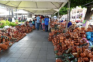
Michoacán handcrafts and folk art is a Mexican regional tradition centered in the state of Michoacán, in central/western Mexico. Its origins traced back to the Purépecha Empire, and later to the efforts to organize and promote trades and crafts by Vasco de Quiroga in what is now the north and northeast of the state. The state has a wide variety of over thirty crafts, with the most important being the working of wood, ceramics, and textiles. A number are more particular to the state, such as the creation of religious images from corn stalk paste, and a type of mosaic made from dyed wheat straw on a waxed board. Though there is support for artisans in the way of contests, fairs, and collective trademarks for certain wares, Michoacán handcrafts lack access to markets, especially those catering to tourists.

The Palm Sunday Handcraft Market, held in Uruapan, is the largest event in the Mexican state of Michoacán dedicated to the sale of the state’s traditional handcrafts and is reputed to be the largest of its kind in Latin America. The event draws over 1,300 artisans who offer over a million pieces for sale, which represent all of the state’s major handcraft traditions. It also includes other events such as a handcraft competition, exhibition of indigenous dress, food and other traditions, concerts, dance and more. The event is centered on the very large main plaza of the city of Uruapan, but extends over to adjoining streets and to other plazas in the city.
The town of Villa Madero is a municipal seat in the municipality of Madero in the State of Michoacán, Mexico. It was established in 1868 with the name of Cruz de Caminos. According to tradition the first inhabitant of the place was a man named Armas, he is now considered the town's founder. The land where the town currently sits belonged to La Hacienda De La Concepcion. The village is the point of intersection of the paths that lead to Acuitzio, Etucuaro, Curuchancio and Tacambaro, this is why it became known as Cruz De Caminos.
Huiramba is a town in the state of Michoacán, Mexico, which is the main settlement of Huiramba Municipality. In 2011 it had 3,307 inhabitants.
References
- ↑ Williams, Gisela (20 July 2008). "Move over Oaxaca, Arty Michoacán is Calling". The New York Times.
- ↑ "Capula's Catrina dolls". Lakepatzcuaro.org. Retrieved 2014-07-16.