This article needs additional citations for verification .(January 2022) |
Caquena | |
|---|---|
Village | |
| Country | |
| Region | Arica and Parinacota Region |
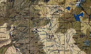
Caquena is a village in the Arica and Parinacota Region, Chile.
This article needs additional citations for verification .(January 2022) |
Caquena | |
|---|---|
Village | |
| Country | |
| Region | Arica and Parinacota Region |
Caquena is a village in the Arica and Parinacota Region, Chile.
According to the Köppen climate classification, Caquena has a cold tundra climate (ET) with wet summers and dry winters. The diurnal range is high year-round.
| Climate data for Caquena | |||||||||||||
|---|---|---|---|---|---|---|---|---|---|---|---|---|---|
| Month | Jan | Feb | Mar | Apr | May | Jun | Jul | Aug | Sep | Oct | Nov | Dec | Year |
| Average high °C (°F) | 12.4 (54.3) | 11.6 (52.9) | 12.9 (55.2) | 12.7 (54.9) | 11.2 (52.2) | 10.6 (51.1) | 10.4 (50.7) | 11.6 (52.9) | 12.5 (54.5) | 14.0 (57.2) | 14.7 (58.5) | 13.8 (56.8) | 12.4 (54.3) |
| Daily mean °C (°F) | 4.6 (40.3) | 4.2 (39.6) | 4.8 (40.6) | 4.1 (39.4) | 1.4 (34.5) | −0.1 (31.8) | −0.6 (30.9) | 0.6 (33.1) | 1.9 (35.4) | 3.0 (37.4) | 4.0 (39.2) | 4.2 (39.6) | 2.7 (36.8) |
| Average low °C (°F) | −3.2 (26.2) | −3.1 (26.4) | −3.2 (26.2) | −4.5 (23.9) | −8.4 (16.9) | −10.9 (12.4) | −11.6 (11.1) | −10.4 (13.3) | −8.7 (16.3) | −8.0 (17.6) | −6.7 (19.9) | −5.3 (22.5) | −7.0 (19.4) |
| Average precipitation mm (inches) | 123 (4.8) | 108 (4.3) | 75 (3.0) | 13 (0.5) | 1 (0.0) | 3 (0.1) | 8 (0.3) | 8 (0.3) | 1 (0.0) | 5 (0.2) | 10 (0.4) | 59 (2.3) | 414 (16.2) |
| Source: Atlas Agroclimatico de Chile [1] | |||||||||||||

Tacna is a city in southern Peru and the regional capital of the Tacna Region. A very commercially active city, it is located only 35 km (22 mi) north of the border with Arica y Parinacota Region from Chile, inland from the Pacific Ocean and in the valley of the Caplina River. It is Peru's tenth most populous city.

Tacna is the southernmost department and region in Peru. The Chilean Army occupied the present-day Tacna Department during the War of the Pacific from 1885 to 1929 when it was reincorporated into Peruvian soil.

Arica Province is one of two provinces of Chile's northernmost region, Arica y Parinacota. The province is bordered on the north by the Tacna Province of Peru, on the south by the Tamarugal Province in the Tarapacá Region, on the east the Parinacota Province and on the west by the Pacific Ocean. Its capital is the port city of Arica.

Parinacota Province is one of two provinces of the Chilean region of Arica y Parinacota. Its capital is Putre. It is named after the Parinacota Volcano.

Arica is a commune and a port city with a population of 222,619 in the Arica Province of northern Chile's Arica y Parinacota Region. It is Chile's northernmost city, being located only 18 km (11 mi) south of the border with Peru. The city is the capital of both the Arica Province and the Arica and Parinacota Region. Arica has a mild, temperate climate with some of the lowest annual rainfall rates anywhere in the world. Arica is located at the bend of South America's western coast known as the Arica Bend or Arica Elbow. At the location of the city are two lush valleys that dissect the Atacama Desert converge: Azapa and Lluta. These valleys provide fruit for export.

Putre is a Chilean town and commune, capital of the Parinacota Province in the Arica-Parinacota Region. It is located 130 km (81 mi) east of Arica, at an altitude of 3,500 m (11,483 ft). The town is backdropped by Taapaca volcanic complex.

Payachata or Paya Chata is a north–south trending complex of potentially active volcanos on the border of Bolivia and Chile, directly north of Chungará Lake. The complex contains two peaks, Pomerape to the north and Parinacota to the south. On the Bolivian side the volcanoes are located in the Oruro Department, Sajama Province, Curahuara de Carangas Municipality, and on the Chilean side they lie in the Arica y Parinacota Region, Parinacota Province.

The Tarapacá Region is one of Chile's 16 first-order administrative divisions. It comprises two provinces, Iquique and Tamarugal. It borders the Chilean Arica and Parinacota Region to the north, Bolivia's Oruro Department and Potosí Department on the east, Chile's Antofagasta Region to the south and the Pacific Ocean to the west. The port city of Iquique is the region's capital.
Azapa Valley is a fertile and narrow oasis in Arica y Parinacota Region, Chile. It is framed between two sere hills and divided by the San Jose River that runs during the summer season. It is located three kilometres (1.9 mi) from the city of Arica. This jewel of the north has a unique climate that permits the farming of a great variety of fruits and vegetables throughout the year. This is in addition to the unique Azapa olives, renowned for their violet color and bitter flavor that also gives birth to a hearty oil.

The Arica y Parinacota Region is one of Chile's 16 first order administrative divisions. It comprises two provinces, Arica and Parinacota. It borders Peru's Department of Tacna to the north, Bolivia's La Paz and Oruro departments to the east and Chile's Tarapacá Region to the south. Arica y Parinacota is the 5th smallest, the 3rd least populous and the 6th least densely populated of the regions of Chile. Arica is the region's capital and largest city.
Lauca is a Biosphere Reserve, located in northern Chile, in Arica y Parinacota Region. The reserve comprises three protected areas: Lauca National Park, Las Vicuñas National Reserve and Salar de Surire Natural Monument. This zone was declared a Biosphere Reserve by UNESCO in 1981.
General Lagos is Chile's northernmost commune in Parinacota Province, Arica and Parinacota Region. Its capital is Visviri.
Codpa is a village located 114 kilometres (71 mi) to the south of Arica, in the Chilean commune of Camarones in the region of Arica and Parinacota, Chile.

The Cosapilla River is a river of Chile and Bolivia and is part of the boundary. It is also called Caquena and, in Bolivia, Cosapa. From its source in the Parinacota Province, the river flows north, is part of the Chile-Bolivia boundary and then flows in the Bolivian Department of Oruro.
Villa Frontera, also identified as Chacalluta, is a village within the Arica Province of the Arica and Parinacota Region, Chile.
The Canal Lauca is an artificial channel to divert the waters of the Lauca River westward through a canal and tunnel into the Azapa Valley for purposes of irrigation in the valley and hydroelectric-power generation. Its construction began 1948 and water diversion began 14 years later from a dam located about 16 miles southwest of Lago Cotacotani Lake.

Kunturiri is a volcano in the Andes on the border of Bolivia and Chile which rises up to 5,762 metres (18,904 ft). On the Chilean side it is located in the Arica and Parinacota Region and on the Bolivian side in the Oruro Department, Sajama Province, Curahuara de Carangas Municipality, Sajama Canton as well as in the La Paz Department, Pacajes Province, Calacoto Municipality, Ulloma Canton.
The Caldera Lauca is a caldera in the Arica y Parinacota Region of Chile. It is located in the Cordillera Occidental, in the valley of the Lauca River. The elliptic caldera has an east-west extension of 23 kilometres (14 mi) and 50 kilometres (31 mi) in north-south direction, buried beneath the late Miocene Vilañuñumani-Tejene volcanic complex in the north and ending at Chucal in the south. The 21 mya Oxaya Ignimbrite originates in the caldera. The eastern border of the caldera is buried beneath younger ignimbrites and deposits but is located east of the Guallatiri volcano. An Oligocene fault marks the western edge of the caldera.
Coordinates: 18°03′S69°12′W / 18.050°S 69.200°W
| | This Arica y Parinacota Region location article is a stub. You can help Wikipedia by expanding it. |