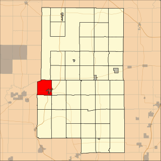
Aitkin Township is a township in Aitkin County, Minnesota, United States. The population was 856 as of the 2010 census.

Farm Island Township is a township in Aitkin County, Minnesota, United States. The population was 1,099 as of the 2010 census.

Ham Lake is a city in Anoka County, Minnesota, United States. It is a suburb in the Minneapolis–Saint Paul metropolitan area. The population was 15,296 at the 2010 census.

Mud Lake is an unorganized territory located in Marshall County, Minnesota, United States. In both the 2000 and 2010 U.S. censuses, the unorganized territory recorded a population of 0.

The Iowa Great Lakes, often referred to as Okoboji., is a group of natural lakes in northwestern Iowa in the United States. The three principal lakes of the group are Big Spirit Lake, West Okoboji Lake, and East Okoboji Lake. They are the largest natural lakes in the state of Iowa. The largest, Spirit Lake, is 5,684 acres (2,300 ha).The lake area extends to the north into Jackson County, Minnesota. The headwaters of Little Sioux River flow past the west side of the lake area.
Bde Maka Ska is the largest lake in Minneapolis, Minnesota, United States, and part of the city's Chain of Lakes. Surrounded by city park land and circled by bike and walking trails, it is popular for many outdoor activities. The lake has an area of 401 acres (1.62 km2) and a maximum depth of 87 feet (27 m).

Minnesota Glacier is a broad glacier, about 40 nautical miles long and 5 nautical miles wide, flowing east through the Ellsworth Mountains in Antarctica, separating the Sentinel Range and the Heritage Range. It is nourished by ice from the plateau west of the mountains and by Nimitz Glacier and Splettstoesser Glacier, and merges into the larger Rutford Ice Stream at the eastern margin of the Ellsworth Mountains.

Eagle Mountain is the highest natural point in Minnesota, United States, at 2,301 feet (701 m). It is in northern Cook County, in the Boundary Waters Canoe Area Wilderness and Superior National Forest in the Misquah Hills, northwest of Grand Marais. It is a Minnesota State Historic Site.
Bachelor Lake is a lake in Brown County, Minnesota in the northeastern part of Stark township. Covering 79.80 acres, it is an officially protected water of the State of Minnesota. The lake is within the Cottonwood River Major Watershed. The lake’s elevation is 1,004 feet (306 m), and it is zoned as a shoreland area which is regulated as a shoreland management water.
Saginaw is an unincorporated area in Saint Louis County, Minnesota, United States. Although unincorporated, Saginaw has a post office with the ZIP code 55779.
Fairbanks is an unincorporated community in Fairbanks Township, Saint Louis County, Minnesota, United States; located within the Superior National Forest.
Central Lakes is an unincorporated community in Saint Louis County, Minnesota, United States.
Ash Lake is an unincorporated community in Saint Louis County, Minnesota, United States; located within the Kabetogama State Forest.

Carey Glacier is a glacier on the east side of Miller and Fruzhin Peaks and west of Ruset and Malkoch Peaks in Petvar Heights at the southeast end of the Sentinel Range, Ellsworth Mountains, flowing southeast to Minnesota Glacier. It was mapped by the United States Geological Survey from surveys and from U.S. Navy air photos, 1957–59, and named by the Advisory Committee on Antarctic Names for Lieutenant David W. Carey, pilot with U.S. Navy Squadron VX-6, who was killed in the crash of a P2V Neptune airplane at McMurdo Sound in October 1956.
School Lake is a lake in Brown County, Minnesota, in the United States. It is a 102-acre protected lake.
Island Lake is an unincorporated community in Beltrami County, in the U.S. state of Minnesota.
Schley is an unincorporated community in Cass County, Minnesota, United States, within the Bowstring State Forest and the Chippewa National Forest. It is between Cass Lake and Bena along U.S. Highway 2 near Forest Road 2958.
Sleepy Eye Lake is a lake in Brown County, in the U.S. state of Minnesota. The lake is a 263-acre protected body of water.
Wall Lake is an unincorporated community in Otter Tail County, in the U.S. state of Minnesota.
