Related Research Articles

Westboro is an area in the west end of Ottawa, Ontario, Canada. Located along the Ottawa River, Island Park Drive defines Westboro's eastern border, while the Ottawa River defines its northern border. Under this definition, the population of the area is 22,725.

Old Ottawa South is an older urban neighbourhood in Capital Ward in Ottawa, Ontario, Canada. Old Ottawa South is a relatively small and compact neighbourhood, located between the Rideau Canal and the Rideau River. The eastern boundary is Avenue Road. Bronson Avenue forms the western border of the residential neighbourhood. Carleton University is on the other (western) side of Bronson but the campus can be considered to be geographically within Old Ottawa South as the campus is also nestled between the river and the canal.

Ottawa West—Nepean is a federal electoral district in Ontario, Canada, that has been represented in the House of Commons of Canada since 1997.

Ottawa Centre is an urban federal electoral district in Ontario, Canada, that has been represented in the House of Commons of Canada since 1968. While the riding's boundaries have changed over the years to account for population changes, the riding has always comprised the central areas of Ottawa, the nation's capital.

Orléans is a federal electoral district in Ottawa, Ontario, Canada, that has been represented in the House of Commons of Canada since 1988.

Carleton is a federal electoral district in Ontario, Canada, represented in the House of Commons of Canada from 1867 to 1968 and since 2015. It was represented in the Legislative Assembly of Upper Canada from 1821 to 1840 and in the Legislative Assembly of the Province of Canada from 1841 until 1866. It has been represented by Pierre Poilievre the current Leader of the Opposition since it's creation in 2015.

Rideau View is a sub-neighbourhood of Carleton Heights in River Ward, in the west-end of Ottawa, Ontario, Canada, located near the Rideau River. It is bordered by Meadowlands Drive to the south, Claymor Avenue to the west and Dynes Road to the north. Debra Avenue is the main road that runs through the neighbourhood and there is some residential housing on Eiffel Avenue. Some of parts of the neighbourhoods are east of Prince of Wales Drive and runs parallel along the Rideau River. The area is also located close to the former city of Nepean. A major feature of the neighbourhood is a low-income housing project designed and built by the Ottawa Housing corporation. There are four high-rise condominiums on Prince of Wales at the corner of Dynes and Meadowlands.

Ottawa Centre is an urban provincial electoral district in Ontario, Canada that has been represented in the Legislative Assembly of Ontario since 1968. While the riding's boundaries have changed over the years to account for population changes, the riding has always comprised the central areas of Ottawa, the nation's capital.

Ottawa—Vanier is a provincial electoral district in Ottawa, Ontario, Canada, that has been represented in the Legislative Assembly of Ontario since 1908. It is located in the east end of Ottawa.

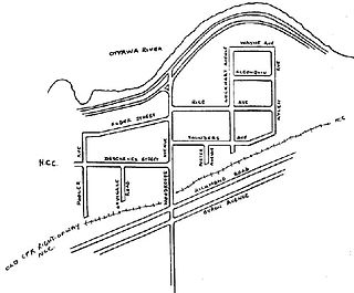
Woodroffe North is a neighbourhood in Bay Ward in the west end of Ottawa, Ontario, Canada. It is bounded on the south by Richmond Road on the west by Pooler Avenue, on the north by the Ottawa River and on the east by the northern prolongation of Sherbourne Avenue. Woodroffe North has also been referred to as a community within the neighbourhood of Westboro which claims its western border to be Woodroffe Avenue. The Woodroffe North Community includes residents that live on streets West of Woodroffe Avenue. Originally the homes used to be cottages similar to those in Britannia. Most of the cottages were demolished and changed into houses. Lockhart Avenue is split up at Richmond Road and continues at Byron and ends at Saville Row in front of Carlingwood.
Prince of Wales on the Rideau is an affluent neighbourhood in Carleton Heights, River Ward, and Wellsmere Court in the west-end of Ottawa, Ontario, Canada. It consists of 210 homes on a peninsula between the Rideau River and Prince of Wales Drive, on the west shore of Mooney's Bay.
Highland Park is a sub-neighbourhood of Westboro, in the Kitchissippi Ward in Ottawa, Ontario, Canada. It is located between Carling Avenue and Richmond Road, Churchill Avenue and Denbury Ave. It is a mixed-income neighbourhood, with some large luxury homes closer to Richmond Road, middle-income homes built in the last two centuries, and a large number of lower-income low-rise apartment buildings closer to Carling Avenue. The population of the neighbourhood according to the Canada 2011 Census was 4,070.
Qualicum-Graham Park or Qualicum is a suburban neighbourhood in College Ward in the City of Ottawa, Ontario, Canada. It is located in the former City of Nepean in the west end of the city. Many of the residences in the area are executive homes situated on large lots (100x100) being built in the 1960s. Qualicum Street boasts large custom houses built by Bill Teron. The neighbourhood is bounded to the north by the Queensway, to the west by Richmond Road, to the south by Baseline Road, and to the east by Morrison Drive at the former Ottawa-Nepean border towards Redwood. Named after Qualicum Beach in British Columbia.
Katimavik-Hazeldean is a neighbourhood in Kanata South Ward in the west end of Ottawa, Ontario, Canada. It is located in the former City of Kanata which amalgamated into Ottawa in 2001. It is located in south-central Kanata, bounded by Eagleson Road to the east, Hazeldean Road to the south, the Carp River to the west, and Highway 417 to the north.
Courtland Park is a sub-neighbourhood of Carleton Heights in River Ward in the west end of Ottawa, Ontario, Canada. It is bounded on the north by Baseline Road, on the east by the Rideau River, on the south by Dynes Road and on the west by Fisher Avenue. Prince of Wales Drive runs thorough the neighbourhood.
Woodpark is a small neighbourhood in Bay Ward, in the west end of Ottawa, Ontario, Canada. It is bounded in the north by Richmond Road, to the East by Woodroffe Avenue north, in the South by Carling Avenue and in the west by the Kichi Zibi Mikan. The total population of the neighbourhood according to the Canada 2016 Census was 2,191.

Carleton Heights is a neighbourhood in River Ward in Ottawa, Ontario, Canada. According to the Carleton Heights and Area Community Association, the neighbourhood is bounded on the north by the Central Experimental Farm, on the east by the Rideau River, on the south by the junction of Prince of Wales Drive and Fisher Avenue and on the west by Fisher Avenue. The neighbourhood is sometimes referred to as Hog's Back after the nearby falls. The total population of the neighbourhood is 7,586 according to the Canada 2016 Census.
City View is a neighbourhood in College Ward in the west end of the city of Ottawa, Ontario, Canada. It is located within the former city of Nepean.
Rideauview Terrace is a sub-neighbourhood of Carleton Heights in River Ward in the west-end of Ottawa, Ontario, Canada. It is located just west of the Rideau Canal. It is bordered by Prince of Wales Drive to the west, Heron Drive to the south, Rideau Canal to the east and the Central Experimental Farm to the north. It is across the Rideau Canal from Carleton University.
Manordale is a neighbourhood in Knoxdale-Merivale Ward in the west end of Ottawa, Ontario, Canada. It is located in the former City of Nepean. It is bounded on the north and west by Knoxdale Road, east by Woodroffe Avenue, and south by Hunt Club Road.