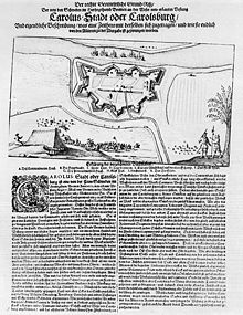
Lower Saxony is a German state in northwestern Germany. It is the second-largest state by land area, with 47,614 km2 (18,384 sq mi), and fourth-largest in population among the 16 Länder federated as the Federal Republic of Germany. In rural areas, Northern Low Saxon and Saterland Frisian are still spoken, albeit in declining numbers.

Rotenburg an der Wümme is a town in Lower Saxony, Germany. It is the capital of the district of Rotenburg.
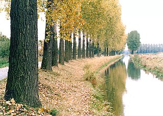
The Aller is a 215-kilometre-long (134 mi) river in the states of Saxony-Anhalt and Lower Saxony in Germany. It is a right-hand, and hence eastern, tributary of the Weser and is also its largest tributary. Its last 117 kilometres (73 mi) form the Lower Aller federal waterway. The Aller was extensively straightened, widened and, in places, dyked, during the 1960s to provide flood control of the river. In a 20-kilometre-long (12 mi) section near Gifhorn, the river meanders in its natural river bed.
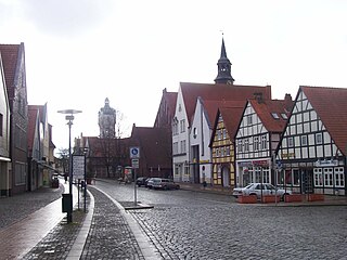
Verden an der Aller (German:[ˈfeːɐ̯dn̩ʔandɐˈʔalɐ] ; Northern Low Saxon: Veern), also called Verden (Aller) or simply Verden, is a town in Lower Saxony, Germany, on the river Aller. It is the district town of the district of Verden in Lower Saxony and an independent municipality (de:Selbständige Gemeinde). The town is located in the middle Weser region on the Aller river immediately before it flows into the Weser. As a center of horse breeding and equestrian sports, it bears the nickname "equestrian town". The suffix "Aller" was introduced at a time when the name "Verden" was also common for the French town of Verdun in the German-speaking area. The town name comes from "ford" or "ferry". The town was conveniently located at a ford through the Aller river, near an important trade route.

The Prince-Archbishopric of Bremen — not to be confused with the modern Archdiocese of Hamburg, founded in 1994 — was an ecclesiastical principality (787–1566/1648) of the Holy Roman Empire and the Catholic Church that after its definitive secularization in 1648 became the hereditary Duchy of Bremen. The prince-archbishopric, which was under the secular rule of the archbishop, consisted of about a third of the diocesan territory. The city of Bremen was de facto and de jure not part of the prince-archbishopric. Most of the prince-archbishopric lay rather in the area to the north of the city of Bremen, between the Weser and Elbe rivers. Even more confusingly, parts of the prince-archbishopric belonged in religious respect to the neighbouring Diocese of Verden, making up 10% of its diocesan territory.

Stade, officially the Hanseatic City of Stade is a city in Lower Saxony in northern Germany. First mentioned in records in 934, it is the seat of the district which bears its name. It is located roughly 45 km (28 mi) to the west of Hamburg and belongs to that city's wider metropolitan region. Within the area of the city are the urban districts of Bützfleth, Hagen, Haddorf and Wiepenkathen, each of which have a council of their own with some autonomous decision-making rights.

Bremen-Verden, formally the Duchies of Bremen and Verden, were two territories and immediate fiefs of the Holy Roman Empire, which emerged and gained imperial immediacy in 1180. By their original constitution they were prince-bishoprics of the Archdiocese of Bremen and Bishopric of Verden.

The Scanian War was a part of the Northern Wars involving the union of Denmark–Norway, Brandenburg and Sweden. It was fought from 1675 to 1679 mainly on Scanian soil, in the former Danish–Norwegian provinces along the border with Sweden, and in Northern Germany. While the latter battles are regarded as a theater of the Scanian war in English, Danish, Norwegian and Swedish historiography, they are seen as a separate war in German historiography, called the Swedish-Brandenburgian War.

Zeven [] is a town in the district of Rotenburg, in Lower Saxony, Germany. It has a population of around 14,000. The nearest large towns are Bremerhaven, Bremen and Hamburg. It is situated approximately 22 km northwest of Rotenburg, and 40 km northeast of Bremen. Zeven is also the seat of the Samtgemeinde Zeven.

Magnus I of Saxe-Lauenburg was a Duke of Saxe-Lauenburg from the House of Ascania.
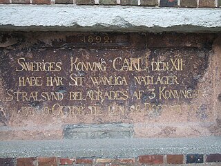
The siege of Stralsund was a battle during the Great Northern War. The Swedish Empire defended her Swedish Pomeranian port of Stralsund against a coalition of Denmark-Norway, the Electorate of Saxony and the Tsardom of Russia, which was joined by the Kingdom of Prussia during the siege.

Bremen, officially the City Municipality of Bremen, is the capital of the German state of the Free Hanseatic City of Bremen, a two-city-state consisting of the cities of Bremen and Bremerhaven. With about 570,000 inhabitants, the Hanseatic city is the 11th largest city of Germany and the second largest city in Northern Germany after Hamburg.

Bremerhaven is a city on the east bank of the Weser estuary in northern Germany. It forms an exclave of the city-state of Bremen. The River Geeste flows through the city before emptying into the Weser.
The Stade Region emerged in 1823 by an administrative reorganisation of the dominions of the Kingdom of Hanover, a sovereign state, whose then territory is almost completely part of today's German federal state of Lower Saxony. Until 1837 the Kingdom of Hanover was ruled in personal union by the Kings of the United Kingdom of Great Britain and Ireland.

The region between the Elbe and Weser rivers forms the Elbe–Weser triangle, also rendered Elbe-Weser Triangle, in northern Germany. It is also colloquially referred to as the Nasses Dreieck or "wet triangle".

The Treaty or Peace of Saint-Germain-en-Laye of 19 June (OS) or 29 June (NS) 1679 was a peace treaty between France and the Electorate of Brandenburg. It restored to France's ally Sweden her dominions Bremen-Verden and Swedish Pomerania, lost to Brandenburg in the Scanian War. Sweden ratified the treaty on 28 July 1679.

The Swedish wars on Bremen were fought between the Swedish Empire and the Hanseatic town of Bremen in 1654 and 1666. Bremen claimed to be subject to the Holy Roman Emperor, maintaining Imperial immediacy, while Sweden claimed Bremen to be a mediatised part of her dominions of Bremen-Verden, themselves territories immediately beneath the emperor. Sweden was able to gain some territory, but despite forcing a formal oath of allegiance on Bremen, did not gain control of the town.

The Bremen-Verden Campaign was a conflict during the Northern Wars in Europe. From 15 September 1675 to 13 August 1676 an anti-Swedish coalition comprising Brandenburg-Prussia, the neighbouring imperial princedoms of Lüneburg and Münster, and Denmark-Norway, conquered the Duchies of Bremen and Verden.
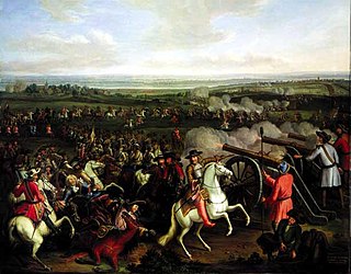
The Swedish invasion of Brandenburg (1674–75) involved the occupation of the undefended Margraviate of Brandenburg by a Swedish army launched from Swedish Pomerania during the period 26 December 1674 to the end of June 1675. The Swedish invasion sparked the Swedish-Brandenburg War that, following further declarations of war by European powers allied with Brandenburg, expanded into a North European conflict that did not end until 1679.
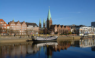
The Schlachte is a promenade along the east bank of the River Weser in the old town of Bremen in the north of Germany. Once one of the city's harbours, it is now popular for its restaurants, beer gardens and river boats.


