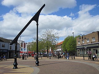
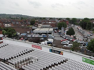
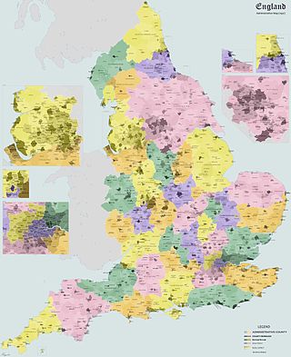
Ashfield is a local government district in Nottinghamshire, England. The council is based in Kirkby-in-Ashfield, but the largest town is neighbouring Sutton-in-Ashfield. The district also contains the town of Hucknall and a few villages. The district is mostly urban, with some of its settlements forming parts of both the Nottingham and Mansfield Urban Areas.

Newark and Sherwood is a local government district in Nottinghamshire, England. It is the largest district by area in the county. The council is based in Newark-on-Trent, the area's largest town. The district also includes the towns of Southwell and Ollerton along with a large rural area containing many villages. Much of the district lies within the ancient Sherwood Forest and there are also extensive forestry plantations in the area.
Rushcliffe is a local government district with borough status in south Nottinghamshire, England. Its council is based in West Bridgford. The borough also includes the towns of Bingham and Cotgrave as well as numerous villages and surrounding rural areas. Some of the built-up areas in the north-west of the borough, including West Bridgford, form part of the Nottingham Urban Area.

Gedling is a local government district with borough status in Nottinghamshire, England. The council is based in Arnold. The borough also includes Carlton along with villages and rural areas to the north-east of Nottingham. The main built-up part of the borough around Arnold and Carlton forms part of the Nottingham Urban Area.
A rural district was a type of local government area – now superseded – established at the end of the 19th century in England, Wales, and Ireland for the administration of predominantly rural areas at a level lower than that of the administrative counties.

Rushcliffe is a constituency in Nottinghamshire represented in the House of Commons of the UK Parliament from 2019 by Ruth Edwards, a Conservative.

Basford was a rural district close to Nottingham, England, from 1894 to 1974. The district consisted of two detached parts, to the north and south of Nottingham. It was created under the Local Government Act 1894 based on the existing Basford rural sanitary district.
Wharfedale was a rural district in the West Riding of Yorkshire from 1894 to 1974. It comprised the northern side of lower Wharfedale, the lower Washburn Valley and several parishes between Leeds and the River Wharfe. Until 1937 it also included a detached part, the parish of Esholt north of Bradford.

Linby is a small village and civil parish in Nottinghamshire, England. The nearest town is Hucknall which is immediately to the south-west. The village grew up around the mills on the River Leen, from which Linby's name is derived. Small streams known as Linby Docks run on both sides of the main street. The population of the civil parish at the 2011 census was 232.

Papplewick is a village and civil parish in Nottinghamshire, England, 7.5 miles (12 km) north of Nottingham and 6 miles (10 km) south of Mansfield. It had a population of 756 at the 2011 census. In the Middle Ages, the village marked the southern gateway to Sherwood Forest.

Bingham was a rural district in Nottinghamshire, England from 1894 to 1974.
East Dean and United Parishes Rural District, later renamed East Dean Rural District, was a rural district in Gloucestershire, England from 1894 to 1974. It included a number of civil parishes, including East Dean, and was subject to a significant boundary reform in 1935.
Carlton was a constituency in Nottinghamshire which returned one Member of Parliament (MP) to the House of Commons of the Parliament of the United Kingdom from 1950 until it was abolished for the 1983 general election. It was then partly replaced by the new Gedling constituency.

Hucknall was an urban district in Nottinghamshire, England, from 1894 to 1974.
Barnsley was a rural district in the West Riding of Yorkshire, England from 1894 to 1938. It encompassed the surrounding area but did not include the town of Barnsley.

Wareside is a small village and civil parish in the East Hertfordshire district, in the county of Hertfordshire, England. The population of the civil parish in the 2011 census was 735. It is approximately 3 miles (5 km) away from the town of Ware and the larger town of Hertford, the county town. Nearby villages include Widford, Hunsdon, Babbs Green and Bakers End. Nearby hamlets include Cold Christmas and Helham Green. The B1004 road linking Ware to Bishop's Stortford goes through the village and the main A10 road can be joined up at Thundridge. Fanhams Hall Road links Wareside back to Ware. Ware railway station on the Hertford East Branch Line is located two and a half miles (4 km) away.

Arnold was an urban district in the English ceremonial county of Nottinghamshire from 1894 to 1974. It was created under the Local Government Act 1894.

Eastwood was an Urban District in Nottinghamshire, England from 1896 to 1974. It was created under the Local Government Act 1894.

Sutton in Ashfield was an Urban District in Nottinghamshire, England from 1894 to 1974. It was created under the Local Government Act 1894.
