Related Research Articles

Lindisfarne, also called Holy Island, is a tidal island off the northeast coast of England, which constitutes the civil parish of Holy Island in Northumberland. Holy Island has a recorded history from the 6th century AD; it was an important centre of Celtic Christianity under Saints Aidan, Cuthbert, Eadfrith, and Eadberht of Lindisfarne. The island was originally home to a monastery, which was destroyed during the Viking invasions but re-established as a priory following the Norman conquest of England. Other notable sites built on the island are St. Mary the Virgin parish church, Lindisfarne Castle, several lighthouses and a complex network of lime kilns. In the present day, the island is an Area of Outstanding Natural Beauty and a hotspot for historical tourism and bird watching. As of February 2020, the island had three pubs, a hotel and a post office.

The Anglo-Saxons were a cultural group that inhabited England in the Early Middle Ages. They traced their origins to settlers who came to Britain from mainland Europe in the 5th century. However, the ethnogenesis of the Anglo-Saxons happened within Britain, and the identity was not merely imported. Anglo-Saxon identity arose from interaction between incoming groups from several Germanic tribes, both amongst themselves, and with indigenous Britons. Many of the natives, over time, adopted Anglo-Saxon culture and language and were assimilated. The Anglo-Saxons established the concept, and the Kingdom, of England, and though the modern English language owes somewhat less than 26% of its words to their language, this includes the vast majority of words used in everyday speech.

Anglo-Saxon architecture was a period in the history of architecture in England from the mid-5th century until the Norman Conquest of 1066. Anglo-Saxon secular buildings in Britain were generally simple, constructed mainly using timber with thatch for roofing. No universally accepted example survives above ground. Generally preferring not to settle within the old Roman cities, the Anglo-Saxons built small towns near their centres of agriculture, at fords in rivers or sited to serve as ports. In each town, a main hall was in the centre, provided with a central hearth.

Carmarthen is the county town of Carmarthenshire and a community in Wales, lying on the River Towy. 8 miles (13 km) north of its estuary in Carmarthen Bay. The population was 14,185 in 2011, down from 15,854 in 2001, but gauged at 16,285 in 2019. It has a claim to be the oldest town in Wales – Old Carmarthen and New Carmarthen became one borough in 1546. It was the most populous borough in Wales in the 16th–18th centuries, described by William Camden as "chief citie of the country". Growth stagnated by the mid-19th century as new settlements developed in the South Wales Coalfield.

Llandeilo is a town and community in Carmarthenshire, Wales, situated at the crossing of the River Towy by the A483 on a 19th-century stone bridge. Its population was 1,795 at the 2011 Census. It is adjacent to the westernmost point of the Brecon Beacons National Park. The town is served by Llandeilo railway station on the Heart of Wales Line.
St Clears is a town on the River Taf and a community in Carmarthenshire, Wales. At the 2011 census, the population was 2,995. The community includes the small settlements of Bancyfelin and Pwlltrap. It is bordered by the Carmarthenshire communities of, Meidrim, Newchurch and Merthyr, Llangynog, Laugharne Township, Llanddowror, Eglwyscummin, Llanboidy and Llangynin.

The National Library of Wales, Aberystwyth, is the national legal deposit library of Wales and is one of the Welsh Government sponsored bodies. It is the biggest library in Wales, holding over 6.5 million books and periodicals, and the largest collections of archives, portraits, maps and photographic images in Wales. The Library is also home to the national collection of Welsh manuscripts, the National Screen and Sound Archive of Wales, and the most comprehensive collection of paintings and topographical prints in Wales. As the primary research library and archive in Wales and one of the largest research libraries in the United Kingdom, the National Library is a member of Research Libraries UK (RLUK) and the Consortium of European Research Libraries (CERL).

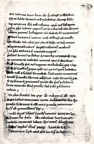
The Black Book of Carmarthen is thought to be the earliest surviving manuscript written solely in Welsh. The book dates from the mid-13th century; its name comes from its association with the Priory of St. John the Evangelist and Teulyddog at Carmarthen, and is referred to as black due to the colour of its binding. It is currently part of the collection of the National Library of Wales, where it is catalogued as NLW Peniarth MS 1.
St Illtyd's Church is a church complex in Llantwit Major, Vale of Glamorgan, southeast Wales. It is located at the site of the oldest college in the United Kingdom, once believed to have been founded as Côr Tewdws c. AD 395 by the Roman Emperor Theodosius II. It is now generally accepted as having been founded by St. Illtud c. AD 508, from whom it derives its name. The current church building was built in the 11th century by the Normans, with portions being rebuilt in the 13th and 15th centuries. The church building is one of the oldest and best-known parish churches in Wales. It is a grade I listed building, or building of exceptional interest, and has been called both the "Westminster Abbey of Wales" for its unique collection of carved stones and effigies, and "the most beautiful church in Wales."
The Kingdom of Dyfed, one of several Welsh petty kingdoms that emerged in 5th-century sub-Roman Britain in southwest Wales, was based on the former territory of the Demetae. The medieval Irish narrative, The Expulsion of the Déisi, attributing the kingdom's founding to Eochaid, son of Artchorp, being forced across the Irish sea, in the 5th century; his descendants founding the line of the kings of Dyfed, down to "Tualodor mac Rígin". The Normans invaded Wales, and by 1138 incorporated Dyfed into a new shire called Pembrokeshire after the Norman castle built in the Cantref of Penfro and under the rule of the Marcher Earl of Pembroke.

Saint Padarn's Church is a parish church of the Church in Wales, and the largest mediaeval church in mid-Wales. It is at Llanbadarn Fawr, near Aberystwyth, in Ceredigion, Wales, United Kingdom.

Llanllwch is a hamlet in Wales approximately 2 miles (3.2 km) west of Carmarthen.
Henry Royston Loyn, FBA, was a British historian specialising in the history of Anglo-Saxon England. His eminence in his field made him a natural candidate to run the Sylloge of the Coins of the British Isles, which he chaired from 1979 to 1993. He was Professor of Medieval History in the University College of South Wales and Monmouthshire and afterwards Professor of Medieval History at Westfield College in the University of London.
Culture and Society in Gwynedd during the High Middle Ages refers to a period in the History of Wales spanning the 11th, 12th, and 13th centuries. The High Middle Ages were preceded by the Early Middle Ages and followed by the Late Middle Ages. Gwynedd is located in the north of Wales.
Hemming's Cartulary is a manuscript cartulary, or collection of charters and other land records, collected by a monk named Hemming around the time of the Norman Conquest of England. The manuscript comprises two separate cartularies that were made at different times and later bound together; it is in the British Library as MS Cotton Tiberius A xiii. The first was composed at the end of the 10th or beginning of the 11th century. The second section was compiled by Hemming and was written around the end of the 11th or the beginning of the 12th century. The first section, traditionally titled the Liber Wigorniensis, is a collection of Anglo-Saxon charters and other land records, most of which are organized geographically. The second section, Hemming's Cartulary proper, combines charters and other land records with a narrative of deprivation of property owned by the church of Worcester.

The Abbey Church of Saint Peter and Saint Paul, Monkwearmouth–Jarrow, known simply as Monkwearmouth–Jarrow Abbey, was a Benedictine double monastery in the Kingdom of Northumbria, England.

Kidwelly Priory was a Benedictine abbey in Kidwelly, Wales.

St Peter's Church is the Church in Wales parish church for the town of Carmarthen, Wales. Though founded much earlier, the present building dates from at least the 14th century. It is the largest church in the Diocese of St David's and is a Grade I listed building. It is also the oldest surviving building in Carmarthen.

Capel Heol Awst is an Independent Welsh chapel in the town of Carmarthen, Carmarthenshire, Wales. The present building dates from 1826 to 1827, replacing a 1726 building which itself had been enlarged in 1802 and again in 1826 to seat a congregation of 1000. It is located at 7 Friars Park, Carmarthen. It was designated as a Grade II* listed building on 19 May 1981.
References
- ↑ Lodwick 1994, pp. 87–9.
- ↑ Lodwick 1994, p. 87.
- ↑ Lodwick 1994, p. 89.