Related Research Articles

Plate tectonics is the scientific theory that Earth's lithosphere comprises a number of large tectonic plates, which have been slowly moving since about 3.4 billion years ago. The model builds on the concept of continental drift, an idea developed during the first decades of the 20th century. Plate tectonics came to be accepted by geoscientists after seafloor spreading was validated in the mid-to-late 1960s.

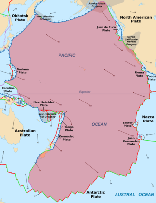
The Pacific Plate is an oceanic tectonic plate that lies beneath the Pacific Ocean. At 103 million km2 (40 million sq mi), it is the largest tectonic plate.

A mid-ocean ridge (MOR) is a seafloor mountain system formed by plate tectonics. It typically has a depth of about 2,600 meters (8,500 ft) and rises about 2,000 meters (6,600 ft) above the deepest portion of an ocean basin. This feature is where seafloor spreading takes place along a divergent plate boundary. The rate of seafloor spreading determines the morphology of the crest of the mid-ocean ridge and its width in an ocean basin.

The Izanagi Plate was an ancient tectonic plate, which began subducting beneath the Okhotsk Plate 130–100 Ma. The rapid plate motion of the Izanagi Plate caused north-west Japan and the outer zone of south-west Japan to drift northward. High-pressure metamorphic rocks were formed at the eastern margin of the drifting land mass in the Sanbagawa metamorphic belt, while low-pressure metamorphic rocks were formed at its western margin in the Abukuma metamorphic belt. At approximately 55 Ma, the Izanagi Plate was completely subducted and replaced by the western Pacific Plate, which also subducted in the north-western direction. Subduction-related magmatism took place near the Ryoke belt. No marked tectonics occurred in the Abunkuma belt after the change of the subducted plate.

Mantle convection is the very slow creeping motion of Earth's solid silicate mantle as convection currents carry heat from the interior to the planet's surface.

The Kerguelen hotspot is a volcanic hotspot at the Kerguelen Plateau in the Southern Indian Ocean. The Kerguelen hotspot has produced basaltic lava for about 130 million years and has also produced the Kerguelen Islands, Naturaliste Plateau, Heard Island, the McDonald Islands, and Rajmahal Traps. One of the associated features, the Ninety East Ridge, is distinguished by its over 5,000 km (3,100 mi) length, being the longest linear tectonic feature on Earth. The total volume of magma erupted in 130 million years with associated features has been estimated to be about 25,000,000 km3 (6,000,000 cu mi). However, as well as large igneous provinces and seamounts the hotspot has interacted with other seafloor spreading features, so this volume figure has some uncertainty.

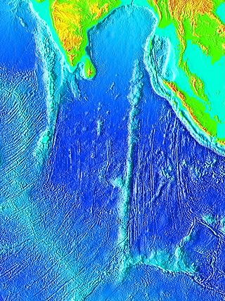
The Ninety East Ridge is a mid-ocean ridge on the Indian Ocean floor named for its near-parallel strike along the 90th meridian at the center of the Eastern Hemisphere. It is approximately 5,000 kilometres (3,100 mi) in length and can be traced topographically from the Bay of Bengal southward towards the Southeast Indian Ridge (SEIR), though the feature continues to the north where it is hidden beneath the sediments of the Bengal Fan. The ridge extends between latitudes 31°S and 9°N and has an average width of 200 km.

The North Atlantic Igneous Province (NAIP) is a large igneous province in the North Atlantic, centered on Iceland. In the Paleogene, the province formed the Thulean Plateau, a large basaltic lava plain, which extended over at least 1.3 million km2 (500 thousand sq mi) in area and 6.6 million km3 (1.6 million cu mi) in volume. The plateau was broken up during the opening of the North Atlantic Ocean leaving remnants preserved in north Ireland, west Scotland, the Faroe Islands, northwest Iceland, east Greenland, western Norway and many of the islands located in the north eastern portion of the North Atlantic Ocean. The igneous province is the origin of the Giant's Causeway and Fingal's Cave. The province is also known as Brito–Arctic province and the portion of the province in the British Isles is also called the British Tertiary Volcanic Province or British Tertiary Igneous Province.

The Manihiki Plateau is an oceanic plateau in the south-west Pacific Ocean. The Manihiki Plateau was formed by volcanic activity 126 to 116 million years ago during the mid-Cretaceous period at a triple junction plate boundary called the Tongareva triple junction. Initially at 125 million years ago the Manihiki Plateau formed part of the giant Ontong Java-Manihiki-Hikurangi plateau.

The Seychelles Microcontinent is a microcontinent underlying Seychelles in the western Indian Ocean made of Late Precambrian rock.
Plate reconstruction is the process of reconstructing the positions of tectonic plates relative to each other or to other reference frames, such as the Earth's magnetic field or groups of hotspots, in the geological past. This helps determine the shape and make-up of ancient supercontinents and provides a basis for paleogeographic reconstructions.
Tectonic subsidence is the sinking of the Earth's crust on a large scale, relative to crustal-scale features or the geoid. The movement of crustal plates and accommodation spaces produced by faulting brought about subsidence on a large scale in a variety of environments, including passive margins, aulacogens, fore-arc basins, foreland basins, intercontinental basins and pull-apart basins. Three mechanisms are common in the tectonic environments in which subsidence occurs: extension, cooling and loading.
The evolution of tectonophysics is closely linked to the history of the continental drift and plate tectonics hypotheses. The continental drift/ Airy-Heiskanen isostasy hypothesis had many flaws and scarce data. The fixist/ Pratt-Hayford isostasy, the contracting Earth and the expanding Earth concepts had many flaws as well.

The East Antarctic Shield or Craton is a cratonic rock body that covers 10.2 million square kilometers or roughly 73% of the continent of Antarctica. The shield is almost entirely buried by the East Antarctic Ice Sheet that has an average thickness of 2200 meters but reaches up to 4700 meters in some locations. East Antarctica is separated from West Antarctica by the 100–300 kilometer wide Transantarctic Mountains, which span nearly 3,500 kilometers from the Weddell Sea to the Ross Sea. The East Antarctic Shield is then divided into an extensive central craton that occupies most of the continental interior and various other marginal cratons that are exposed along the coast.
Maria Seton is an Australian geologist in the Faculty of Science EarthByte Group School of Geosciences at the University of Sydney. Seton's research is in the field of geophysics and geodynamics. Her main focus is the link between plate tectonic and mantle processes. Seton also works on kinematic controls on subduction and back-arc basin formation and the relationship between tectonics and palaeo-climate.

GPlates is open-source application software offering a novel combination of interactive plate-tectonic reconstructions, geographic information system (GIS) functionality and raster data visualisation.

The Scandinavian Caledonides are the vestiges of an ancient, today deeply eroded orogenic belt formed during the Silurian–Devonian continental collision of Baltica and Laurentia, which is referred to as the Scandian phase of the Caledonian orogeny. The size of the Scandinavian Caledonides at the time of their formation can be compared with the size of the Himalayas. The area east of the Scandinavian Caledonides, including parts of Finland, developed into a foreland basin where old rocks and surfaces were covered by sediments. Today, the Scandinavian Caledonides underlay most of the western and northern Scandinavian Peninsula, whereas other parts of the Caledonides can be traced into West and Central Europe as well as parts of Greenland and eastern North America.

Kevin C. A. Burke was a geologist known for his contributions in the theory of plate tectonics. In the course of his life, Burke held multiple professorships, most recent of which (1983-2018) was the position of professor of geology and tectonics at the Department of Earth and Atmospheric Science, University of Houston. His studies on plate tectonics, deep mantle processes, sedimentology, erosion, soil formation and other topics extended over several decades and influenced multiple generations of geologists and geophysicists around the world.
Dietmar Müller is a professor of geophysics at the school of geosciences, the University of Sydney.
A continent is a large geographical region defined by the continental shelves and the cultures on the continent. In the modern day, there are seven continents. However, there have been more continents throughout history. Vaalbara was the first supercontinent. Europe is the newest continent. Geologists have predicted that certain continents will appear, these being Pangaea Proxima, Novopangaea, Aurica, and Amasia.
References
- ↑ Carmen Gaina: Curriculum vitae Archived July 23, 2011, at the Wayback Machine
- 1 2 Carmen Gaina: Curriculum vitae Archived April 9, 2011, at the Wayback Machine
- ↑ "Home - Department of Geosciences". www.mn.uio.no. Retrieved 2018-08-28.
- ↑ "Circum-Arctic Mapping Project". Archived from the original on 2011-07-23. Retrieved 2010-06-29.
- ↑ "New Members-Group 2: Physics studies (including Astronomy, Physics and Geophysics)". www.dnva.no. Archived from the original on 2017-12-22. Retrieved 2018-10-10.