
Lanarkshire, also called the County of Lanark, is a historic county, lieutenancy area and registration county in the Central Lowlands and Southern Uplands of Scotland. The county is no longer used for local government purposes, but gives its name to the two modern council areas of North Lanarkshire and South Lanarkshire.

Larkhall Thistle Football Club is a football club from Larkhall, in South Lanarkshire, Scotland. Formed in 1878, "the Jags" are Scotland's oldest continuous Junior football club and currently compete in the West of Scotland League Second Division. The team plays in red and white stripes and its home ground since 1881 has been Gasworks Park.

Clydesdale was a local government district in the Strathclyde region of Scotland from 1975 to 1996. The district was initially called Lanark when created in 1975, but changed its name to Clydesdale in 1980. Clydesdale was an old name for the county of Lanarkshire, one of the historic counties of Scotland. Both the names Clydesdale and Strathclyde reference the area's position in the valley of the River Clyde.
Carluke Rovers Football Club are a Scottish football club based in Carluke, South Lanarkshire. Nicknamed The Rovers, they were formed in 1887, although documented evidence shows a club called Milton Rovers, Carluke's original name, were playing matches during 1886, and are based in the John Cumming Stadium. The club compete in the West of Scotland League Fourth Division. The team are managed by Thomas Devine along with Mark McRoberts (Coach), Peter Kane (Coach), Tony Boyce (Coach), Scott Mathieson (Coach) & Cieran Henderson
Forth Wanderers Football Club are a Scottish football club based in the village of Forth, South Lanarkshire. Formed in 1904 they compete in the West of Scotland League Second Division and play in red strips with a white trim with a second strip of all black.

Lanark United Football Club are a Scottish football club based in the town of Lanark, South Lanarkshire. Nicknamed the Yowes, they were formed in 1920, and play at Moor Park. They currently compete in the West of Scotland League Second Division and play in blue strips with a white trim.

Cumbernauld and Kirkintilloch is a constituency of the House of Commons of the Parliament of the United Kingdom. It was created for the 2005 general election, replacing Cumbernauld and Kilsyth and part of Strathkelvin and Bearsden.

Lanark and Hamilton East was a county constituency of the House of Commons of the Parliament of the United Kingdom, which was first used at the 2005 general election. It covered parts of the former Clydesdale, Hamilton North and Bellshill and Hamilton South constituencies, and it elected one Member of Parliament (MP) by the first past the post voting system.
East Kilbride, Strathaven and Lesmahagow was a county constituency of the House of Commons of the Parliament of the United Kingdom, which was first used in the general election of 2005. It replaced East Kilbride and some of Clydesdale, and it elected one Member of Parliament (MP) by the first past the post system of election.
Lanarkshire was a Scottish county constituency of the House of Commons of the Parliament of the United Kingdom (Westminster) from 1708 to 1868. It elected one Member of Parliament (MP) by the first past the post voting system.

Crawford Castle, substantially in ruins, is located on the north bank of the River Clyde, around 1⁄2 mile north of Crawford, South Lanarkshire, Scotland. The ruins stand on an earlier motte and bailey earthwork. The castle is also known as Lindsay Tower, after its former owners, the Lindsay family. The strategic location of the castle, at NS954213, guards the strategically important Mennock Pass from England into the upper Clyde Valley.

The lands of Daldowie in Glasgow, Scotland lie astride the River Clyde on the south and the North Calder Water to the east, and stretch to the present area of Broomhouse in the north.
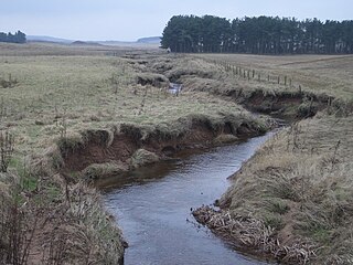
South Medwin, sometimes spelled Medwyn, is a river in the Lanarkshire region of Scotland. Along with the confluence of the North Medwin River it forms the Medwin water basin. The South Medwin flows westward to join the River Clyde a mile (1.5 km) south of Carnwath at a point called "The Meeting".
Harthill Royal Football Club are a Scottish football club based in the Greenrigg area of Harthill, West Lothian. Previously an amateur side called Harthill Royal Bar, the club shortened their name on joining the Scottish Junior Football Association, East Region in 1992. Club colours are royal blue. Their Gibbshill Park ground was previously the home of Polkemmet Juniors F.C. and known as Beechbank Park.

East Kilbride was a local government district in the Strathclyde region of Scotland from 1975 to 1996, lying to the south of the regional capital Glasgow.
Cartland is a village in South Lanarkshire, Scotland.
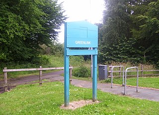
The Greenlink Cycle Path is a cycle path in North Lanarkshire that is a direct route running from Strathclyde Country Park to Motherwell Town Centre. The path is 7 kilometres in length. The Greenlink project was established in 2005, and was part of a 3-year partnership between many organisations, such as North Lanarkshire Council, Scottish Natural Heritage and Forestry Commission Scotland.

The Auchlochan Collieries were several collieries in Auchlochan and Coalburn, South Lanarkshire, Scotland. Production started in 1894 - run by Caprington and Auchlochan Collieries Ltd and then by William Dixon & Company from the 1930s before the NCB took over in 1947 - ending in 1968 when the collieries closed. They were served at Auchlochan Platform railway station, part of the Coalburn Branch of the Caledonian Railway. Eight people were killed at the collieries.
Crawfordjohn Castle, was a 12th-century castle, constructed by John, stepson of Baldwin de Biggar, near Crawfordjohn, South Lanarkshire, Scotland. The site of the castle has yet to be confirmed and appears to have been abandoned in the 14th century after the construction of Boghouse Castle.

