Related Research Articles

Jefferson City,informally Jeff City,is the capital of the U.S. state of Missouri. It had a population of 43,228 at the 2020 census,ranking as the 15th most populous city in the state. It is also the county seat of Cole County and the principal city of the Jefferson City Metropolitan Statistical Area,the second-most-populous metropolitan area in Mid-Missouri and the fifth-largest in the state. Most of the city is in Cole County,with a small northern section extending into Callaway County. Jefferson City is named for Thomas Jefferson,the third President of the United States.

Chesterfield is a city in St. Louis County,Missouri,United States. It is a western suburb of St. Louis. As of the 2020 census,the population was 49,999,making it the state's 14th most populous city. The broader valley of Chesterfield was originally referred to as "Gumbo Flats",derived from its soil,which though very rich and silty,resembled gumbo when wet.
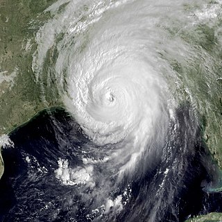
Hurricane Katrina's winds and storm surge reached the Mississippi coastline on the morning of August 29,2005. beginning a two-day path of destruction through central Mississippi;by 10 a.m. CDT on August 29,2005,the eye of Katrina began traveling up the entire state,only slowing from hurricane-force winds at Meridian near 7 p.m. and entering Tennessee as a tropical storm. Many coastal towns of Mississippi had already been obliterated,in a single night. Hurricane-force winds reached coastal Mississippi by 2 a.m. and lasted over 17 hours,spawning 11 tornadoes and a 28-foot (8.5 m) storm surge flooding 6–12 miles (9.7–19.3 km) inland. Many,unable to evacuate,survived by climbing to attics or rooftops,or swimming to higher buildings and trees. The worst property damage from Katrina occurred in coastal Mississippi,where all towns flooded over 90% in hours,and waves destroyed many historic buildings,with others gutted to the 3rd story. Afterward,238 people died in Mississippi,and all counties in Mississippi were declared disaster areas,49 for full federal assistance. Regulations were changed later for emergency centers and casinos. The emergency command centers were moved higher because all 3 coastal centers flooded at 30 ft (9.1 m) above sea level. Casinos were allowed on land rather than limited to floating casino barges as in 2005.

Hurricane Rita was the most intense tropical cyclone on record in the Gulf of Mexico and the fourth-most intense Atlantic hurricane ever recorded. Part of the record-breaking 2005 Atlantic hurricane season,which included three of the top ten most intense Atlantic hurricanes in terms of barometric pressure ever recorded,Rita was the seventeenth named storm,tenth hurricane,and fifth major hurricane of the 2005 season. It was also the earliest-forming 17th named storm in the Atlantic until Tropical Storm Rene in 2020. Rita formed near The Bahamas from a tropical wave on September 18,2005 that originally developed off the coast of West Africa. It moved westward,and after passing through the Florida Straits,Rita entered an environment of abnormally warm waters. Moving west-northwest,it rapidly intensified to reach peak winds of 180 mph (285 km/h),achieving Category 5 status on September 21. However,it weakened to a Category 3 hurricane before making landfall in Johnson's Bayou,Louisiana,between Sabine Pass,Texas and Holly Beach,Louisiana,with winds of 115 mph (185 km/h). Rapidly weakening over land,Rita degenerated into a large low-pressure area over the lower Mississippi Valley by September 26th.

Urban Search and Rescue Missouri Task Force 1 (MO-TF1) is a FEMA Urban Search and Rescue Task Force based in Boone County,Missouri. The task force is sponsored by the Boone County Fire Protection District and is designated as the Weapons of Mass Destruction (WMD) Response Team for the state of Missouri.
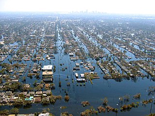
Floods in the United States (2000–present) is a list of flood events which were of significant impact to the country during the 21st century,since 2000. Floods are generally caused by excessive rainfall,excessive snowmelt,storm surge from hurricanes,and dam failure.
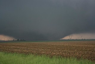
The tornado outbreak sequence of June 3–11,2008 was a series of tornado outbreaks affecting most of central and eastern North America from June 3–11,2008. 192 tornadoes were confirmed,along with widespread straight–line wind wind damage. Seven people were killed from a direct result of tornadoes;four in Iowa,two in Kansas,and one in Indiana. Eleven additional people were killed across five states by other weather events including lightning,flash flooding,and straight-line winds. Severe flooding was also reported in much of Indiana,Wisconsin,Minnesota and Iowa as a result of the same thunderstorms,while high heat and humidity affected much of eastern North America;particularly along the eastern seaboard of the United States from New York City to the Carolinas.

The June 2008 Midwestern United States floods were flooding events which affected portions of the Midwestern United States. After months of heavy precipitation,a number of rivers overflowed their banks for several weeks at a time and broke through levees at numerous locations. Flooding continued into July. States affected by the flooding included Illinois,Indiana,Iowa,Michigan,Minnesota,Missouri and Wisconsin. The American Red Cross assisted the victims of flooding and tornadoes across seven states and the National Guard was mobilized to assist in disaster relief and evacuation.

The May 2009 Southern Midwest Derecho was an extreme progressive derecho and mesoscale convective vortex (MCV) event that struck southeastern Kansas,southern Missouri,and southwestern Illinois on May 8,2009. Thirty-nine tornadoes,including two of EF3 strength on the Enhanced Fujita Scale,were reported in addition to high non-tornadic winds associated with the derecho and MCV. Due to the abnormal shape of the storm on radar and the extremely strong winds,many called this an "inland hurricane." A new class of storm,the Super Derecho,has been used to describe this event after analysis in 2010. Embedded supercells produced hail up to baseball size in southern Missouri,a rare event in a derecho. A wind gust of 106 mph (171 km/h) was recorded by a backup anemometer at the Southern Illinois Airport after official National Weather Service equipment failed. This derecho was the last of a series of derechos that occurred at the beginning of May.

From May 3 to May 11,2003,a prolonged and destructive series of tornado outbreaks affected much of the Great Plains and Eastern United States. Most of the severe activity was concentrated between May 4 and May 10,which saw more tornadoes than any other week-long span in recorded history;335 tornadoes occurred during this period,concentrated in the Ozarks and central Mississippi River Valley. Additional tornadoes were produced by the same storm systems from May 3 to May 11,producing 363 tornadoes overall,of which 62 were significant. Six of the tornadoes were rated F4,and of these four occurred on May 4,the most prolific day of the tornado outbreak sequence;these were the outbreak's strongest tornadoes. Damage caused by the severe weather and associated flooding amounted to US$4.1 billion,making it the costliest U.S. tornado outbreak of the 2000s. A total of 50 deaths and 713 injuries were caused by the severe weather,with a majority caused by tornadoes;the deadliest tornado was an F4 that struck Madison and Henderson counties in Tennessee,killing 11.
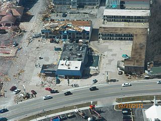
The 2012 Leap Day tornado outbreak was a significant and deadly tornado outbreak on February 28 and February 29,2012,leap day. It caused severe damage in several regions,especially the Great Plains and Ohio Valley regions. It also resulted in several tornadoes in the Central Plains,a rarity for the time of year. The most destructive and deadly tornado was a violent early-morning EF4 that hit Harrisburg,Illinois,killing 8 people. In total,15 people died in the outbreak. Just two days later,a larger and deadlier outbreak devastated the Ohio Valley and Southern United States.
Nancy Vaughan is the 48th mayor of Greensboro,North Carolina. Having previously served on the city council in district 4 and at large,she was elected mayor on November 5,2013,with 59% of the vote. Vaughan was sworn in on December 3,2013. She was reelected in 2015,2017 and 2021.

A relatively widespread,damaging,and deadly tornado outbreak struck the central and southern United States in late April 2014. The storm complex responsible for the outbreak produced multiple long-track tornadoes –seven of which were deadly,causing 35 fatalities. One additional death occurred in Florida,due to severe flooding associated with this system.

Preceded by more than a week of heavy rain,a slow-moving storm system dropped tremendous precipitation across much of Texas and Oklahoma during the nights of May 24–26,2015,triggering record-breaking floods. Additionally,many areas reported tornado activity and lightning. Particularly hard hit were areas along the Blanco River in Hays County,Texas,where entire blocks of homes were leveled. On the morning of May 26,the National Weather Service issued a flash flood emergency for southwest Harris County and northeast Fort Bend County. The system also produced deadly tornadoes in parts of Mexico,Texas,and Oklahoma. This flood significantly contributed to the wettest month ever for Texas and Oklahoma.

The tornado outbreak and floods of April 28 –May 1,2017 were a series of severe weather events that affected the central United States,producing life-threatening flooding and a major tornado outbreak. It formed out of a disturbance in the Southwestern United States on April 28,and caused significant impacts,including a heavy snowstorm in the Rockies,and other types of severe weather. Up to 3 feet (36 in) of snow fell on the cold side of the system,and up to a foot of rain fell in and around the central parts of the nation.

The March 2019 North American blizzard was a powerful Colorado Low that produced up to two feet of snow in the plains and Midwest. Rapid snowmelt following the storm caused historic flooding,and some areas received hurricane-force wind gusts. Comparable to the 1993 Storm of the Century,the storm was labeled a bomb cyclone after barometric pressure readings dropped in excess of 24 mbar (0.71 inHg) over a 24-hour period. After the storm entered Colorado from its origination in Arizona,the pressure dropped more than 30 mbar (0.89 inHg) and rapidly intensified over the western High Plains. The severe storm set new all-time record low barometric pressure readings in Colorado,Kansas and New Mexico. The storm itself killed only one person in Colorado,but flooding caused by the storm killed at least 3,one in Iowa and at least two in Nebraska and left ~140,000 without power in Texas.

The tornado outbreak sequence of May 2019 was a prolonged series of destructive tornadoes and tornado outbreaks affecting the United States over the course of nearly two weeks,producing a total of 402 tornadoes,including 53 significant events (EF2+). Eighteen of these were EF3 tornadoes,spanning over multiple states,including Nebraska,Kansas,Texas,Missouri,Oklahoma,Indiana,Iowa,and Ohio,with additional tornadoes confirmed across a region extending from California to New Jersey. Two EF4 tornadoes occurred,one in Dayton,Ohio,and the other in Linwood,Kansas. Four tornadoes during this outbreak were fatal,causing a total of eight fatalities. The deadliest of these occurred on May 22 near Golden City,Missouri,where an EF3 tornado took three lives,including an elderly couple in their eighties. The damaging series of tornadoes that occurred in Indiana and Ohio on the evening of May 27 during this event is sometimes locally referred to as the Memorial Day tornado outbreak of 2019,which became the fourth costliest weather event in Ohio history. The near continuous stream of systems also produced to widespread flash and river flooding,along with damaging winds and large hail.
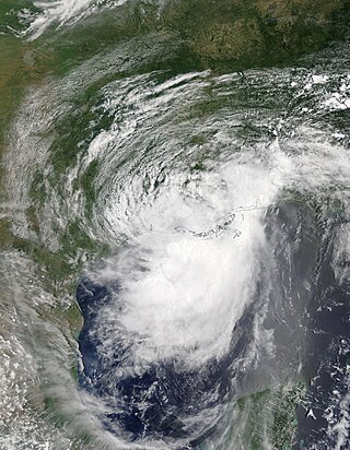
Hurricane Barry was an asymmetrical Category 1 hurricane that was the wettest tropical cyclone on record in Arkansas and the fourth-wettest in Louisiana. The second tropical or subtropical storm and first hurricane of the 2019 Atlantic hurricane season,Barry originated as a mesoscale convective vortex over southwestern Kansas on July 2. The system eventually emerged into the Gulf of Mexico from the Florida Panhandle on July 10,whereupon the National Hurricane Center (NHC) designated it as a potential tropical cyclone. Early on July 11,the system developed into a tropical depression,and strengthened into a tropical storm later that day. Dry air and wind shear caused most of the convection,or thunderstorms,to be displaced south of the center. Nevertheless,Barry gradually intensified. On July 13,Barry attained its peak intensity as Category 1 hurricane with 1-minute sustained winds of 75 mph (120 km/h) and a minimum central pressure of 993 millibars (29.3 inHg). At 15:00 UTC,Barry made its first landfall at Marsh Island,and another landfall in Intracoastal City,Louisiana,both times as a Category 1 hurricane. Barry quickly weakened after landfall,falling to tropical depression status on July 15. The storm finally degenerated into a remnant low over northern Arkansas on the same day,subsequently opening up into a trough on July 16. The storm's remnants persisted for another few days,while continuing its eastward motion,before being absorbed into another frontal storm to the south of Nova Scotia on July 19.

Hurricane Isaias was a destructive Category 1 hurricane that caused extensive damage across the Caribbean and the East Coast of the United States while also spawning the strongest tropical cyclone-spawned tornado since Hurricane Rita in 2005. The ninth named storm and second hurricane of the extremely active and record-breaking 2020 Atlantic hurricane season,Isaias originated from a vigorous tropical wave off the coast of Africa that was first identified by the National Hurricane Center on July 23. The tropical wave gradually became more organized and obtained gale-force winds on July 28 before organizing into Tropical Storm Isaias on July 30. Isaias marked the earliest ninth named storm on record,surpassing 2005's Hurricane Irene by eight days. Isaias strengthened into a Category 1 hurricane on the next day,reaching an initial peak of 85 mph (137 km/h),with a minimum central pressure of 987 mbar. On August 1,the storm made landfall on North Andros,Bahamas and subsequently weakened to a tropical storm,before paralleling the east coast of Florida and Georgia. As Isaias approached the Carolina coastline,it reintensified back into a hurricane. Soon afterward,Isaias reached its peak intensity,with maximum 1-minute sustained winds of 90 mph (140 km/h) and a minimum central pressure of 986 millibars (29.1 inHg),before making landfall near Ocean Isle Beach,North Carolina,at 03:10 UTC on August 4,at the same intensity. The storm proceeded to accelerate up the East Coast of the United States as a strong tropical storm,before transitioning into an extratropical cyclone over Quebec on August 4. Isaias's extratropical remnants persisted for another day,before dissipating on August 5.

Hurricane Sally was a destructive and slow-moving Atlantic hurricane that was the first hurricane to make landfall in the U.S. state of Alabama since Ivan in 2004,coincidentally on the same date in the same place. The eighteenth named storm and seventh hurricane of the extremely active 2020 Atlantic hurricane season,Sally developed from an area of disturbed weather which was first monitored over the Bahamas on September 10. The system grew a broad area of low-pressure on September 11,and was designated as a tropical depression late that day. Early the next day,the depression made landfall at Key Biscayne and subsequently strengthened into Tropical Storm Sally that afternoon. Moderate northwesterly shear prevented significant intensification for the first two days,but convection continued to grow towards the center and Sally slowly intensified. On September 14,a center reformation into the center of the convection occurred,and data from a hurricane hunter reconnaissance aircraft showed that Sally had rapidly intensified into a strong Category 1 hurricane. However,an increase in wind shear and upwelling of colder waters halted the intensification and Sally weakened slightly on September 15 before turning slowly northeastward. Despite this increase in wind shear,it unexpectedly re-intensified,reaching Category 2 status early on September 16 before making landfall at peak intensity at 09:45 UTC on September 16,near Gulf Shores,Alabama,with maximum sustained winds of 110 mph (180 km/h) and a minimum central pressure of 965 millibars (28.5 inHg). The storm rapidly weakened after landfall before transitioning into an extratropical low at 12:00 UTC the next day. Sally's remnants lasted for another day as they moved off the coast of the Southeastern United States before being absorbed into another extratropical storm on September 18.
References
- ↑ Meet the new Jefferson City mayor-elect
- 1 2 Metivier, Andy Humphrey, Mary Kate. "Tergin Wins Jefferson City Race for Mayor". www.kbia.org. Retrieved 2019-08-19.
{{cite web}}: CS1 maint: multiple names: authors list (link) - 1 2 "Jefferson City Mayor Carrie Tergin wins reelection". KOMU.com. Retrieved 2019-08-19.
- ↑ Roberts, Nicole (2019-10-02). "Mayor Carrie Tergin aspires for inclusion, openness like Missouri first lady Teresa Parson". Jefferson City News Tribune. Retrieved 2020-06-11.
- ↑ "Mayor Tergin speaks on emergency proclamation, state workers having to continue work". KRCG.com. 2020-03-30. Retrieved 2020-06-11.
- ↑ Cole, Emily (2020-06-02). "Jefferson City Council selects Chesterfield group as MSP developer". Jefferson City News Tribune. Retrieved 2020-06-11.
- ↑ "UPDATE 3-Death toll from storms lashing central U.S. rises to 7". Reuters. 2019-05-23. Archived from the original on 2019-08-19. Retrieved 2019-08-28.
- ↑ Missouri mayor: Biggest concern is that everyone is OK - CNN Video , retrieved 2019-08-28
- 1 2 Bosman, Julie; Davey, Monica (2019-05-23). "Missouri Tornadoes: Rain, Floods and 'Then the Sirens Go'". The New York Times. ISSN 0362-4331 . Retrieved 2019-08-28.
- ↑ Jefferson City mayor speaks on tornado damage and injuries , retrieved 2019-08-28
- 1 2 "'Large and Destructive' Tornado Strikes Jefferson City, Mo". www.govtech.com. Retrieved 2019-08-28.
- ↑ Bosman, Julie; Williams, Timothy; Hacker, John (2019-05-23). "Storms Leave Trail of Debris and Waterlogged Cities". The New York Times. ISSN 0362-4331 . Retrieved 2019-08-28.
- ↑ Jolly, Bradley (2019-05-25). "Inside the post-apocalyptic city ripped apart by devastating killer tornado". mirror. Retrieved 2019-08-28.
- ↑ "Jefferson City mayor speaks on tornado damage". CBS News. 23 May 2019. Retrieved 27 August 2019.
- ↑ Roberts, Nicole (2019-10-04). "Physician finds inspiration in Jefferson City mayor after tornado, flooding". Jefferson City News Tribune. Retrieved 2020-06-11.
- ↑ Wright, Molly (2013-09-04). "Downtown Evolution". Jefferson City Magazine. Retrieved 2020-06-11.
- ↑ "Carrie Tergin". www.missouristate.edu. Retrieved 2019-08-19.
- 1 2 3 "Board of Governors to be led by two women for first time - News - Missouri State University". News. 2017-04-06. Retrieved 2019-08-19.