Carterton Town Hall

Last updated

Carterton Town Hall
Carterton Town Hall - geograph.org.uk - 1501661.jpg
The building in 2009
LocationAlvescot Road, Carterton
Coordinates 51°45′30″N1°35′47″W / 51.7583°N 1.5963°W / 51.7583; -1.5963
Built1983
Architectural style(s) Neoclassical style
Oxfordshire UK location map.svg
Red pog.svg
Shown in Oxfordshire

Carterton Town Hall is a municipal building in Alvescot Road in Carterton, Oxfordshire, a town in England. It accommodates the offices and meeting place of Carterton Town Council.

Contents

History

The settlement of Carterton was founded by a property speculator, William Carter, in May 1900. [1] Following the establishment of RAF Brize Norton, just to the south of the settlement, in 1937, the settlement grew steadily, and it adopted town status in about 1980. [2] In the early 1980s, the new council decided to commission a town hall. [2] The site they selected, on the southeast side of Alvescot Road, was open land. [3]

Construction of the new building started in 1982. It was designed broadly in the neoclassical style, built in yellow brick and was officially opened by the mayor, Ernest Crapper, in March 1983. [4] The design involved an asymmetrical main frontage of two bays facing onto a small garden adjacent to the building. On the ground floor, there were two segmental headed openings, the left of which contained a recessed doorway and the right of which contained a casement window with a wooden panel below. On the first floor, there was a segmental headed casement window on the left, and a French door with a balcony and iron railings on the right. The building was surmounted by a pitched roof with a weather vane. Internally, the principal room was a small assembly hall which was suitable for meetings but not for social events. [5]

A war memorial, in the form of a cross pattée on a pedestal, which was intended to commemorate the lives of local people who had died in the First World War, and which had originally been erected at the crossroads after the war, was relocated to the garden in front of the town hall at that time. [6] [7] [8] In 2004, a blue plaque, intended to commemorate founding of the town by William Carter a century beforehand, was fixed to the front of the building. [9]

A small single storey building to the northeast off the town hall, which had accommodated a veterinary practice, was demolished in 2014, allowing the creation of a small market square and landscaping. The town hall was extended to the southeast at that time to create new accommodation for the veterinary practice as well as a new entrance with a porch for the town hall. The previous doorway was partially bricked up and another casement window was installed in its place. [10] The new market square was enhanced by the creation of a sensory garden which was officially opened, adjacent to the town hall, in September 2022. [11] [12]

Related Research Articles

<span class="mw-page-title-main">Bicester</span> Town in Oxfordshire, England

Bicester is a historical market town, garden town, and civil parish in the Cherwell district of northeastern Oxfordshire in south-central England that also comprises an eco town development at North West Bicester and a self-build village at Graven Hill. Its local market continues to thrive and is now located on Sheep Street, a very wide pedestrian zone in the conservation area of the town. Bicester is also known for Bicester Village, a nearby shopping centre. In 2024 Bicester elected its first Green Party mayor.

<span class="mw-page-title-main">Carterton, Oxfordshire</span> Human settlement in England

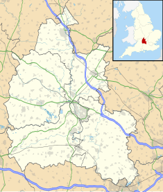
Carterton is a town in West Oxfordshire district in the county of Oxfordshire, England and is 4 miles (6.4 km) south-west of Witney. The 2011 Census recorded the parish's population as 15,769.

<span class="mw-page-title-main">Carterton, New Zealand</span> Town and District in Wellington Region, New Zealand

Carterton is a small town in the Wellington Region of New Zealand and the seat of the Carterton District. It lies in a farming area of the Wairarapa in New Zealand's North Island. It is located 14 km (8.7 mi) southwest of Masterton and 80 km (50 mi) northeast of Wellington. The town has a population of 5,960, out of a total district population of 10,250.

<span class="mw-page-title-main">Witney (UK Parliament constituency)</span> Parliamentary constituency in the United Kingdom since 1983

Witney is a county constituency in Oxfordshire represented in the House of Commons of the Parliament of the United Kingdom since 2024 by Charles Maynard of the Liberal Democrats. It elects one Member of Parliament by the first-past-the-post system of election, and was created for the 1983 general election.

<span class="mw-page-title-main">Brize Norton</span> Human settlement in England

Brize Norton is a village and civil parish 1 mile (1.6 km) east of Carterton in West Oxfordshire. The 2011 Census recorded the parish population as 938. The original part of RAF Brize Norton is in the parish.

<span class="mw-page-title-main">Shilton, Oxfordshire</span> Human settlement in England

Shilton is a village and civil parish about 1+12 miles (2.4 km) northwest of Carterton, Oxfordshire. The 2011 Census recorded the parish's population as 626.

<span class="mw-page-title-main">Black Bourton</span> Human settlement in England

Black Bourton is a village and civil parish about 2 miles (3 km) south of Carterton, Oxfordshire. The village is on Black Bourton Brook, a tributary of the River Thames. The 2011 Census recorded the parish population as 266. RAF Brize Norton adjoins the parish. The northern boundary of the parish is along the middle of the main runway of the airfield.

<span class="mw-page-title-main">Carterton F.C.</span> Association football club in England

Carterton Football Club is a football club based in Carterton, Oxfordshire, England. They are currently members of the Hellenic League Division One and play at Kilkenny Lane.

<span class="mw-page-title-main">Broughton Poggs</span> Human settlement in England

Broughton Poggs is a village in the civil parish of Filkins and Broughton Poggs, in the West Oxfordshire district, in the county of Oxfordshire, England. Broughton Poggs is 3 miles (5 km) southwest of Carterton.

<span class="mw-page-title-main">Little Faringdon</span> Human settlement in England

Little Faringdon is a village and civil parish in West Oxfordshire, about 1 mile (1.6 km) north of Lechlade in neighbouring Gloucestershire. The 2001 Census recorded its population as 63.

<span class="mw-page-title-main">Westwell, Oxfordshire</span> Human settlement in England

Westwell is a small village and civil parish about 2 miles (3 km) southwest of the market town of Burford in Oxfordshire. It is the westernmost village in the county, close to the border with Gloucestershire.

<span class="mw-page-title-main">Kencot</span> Human settlement in England

Kencot is a village and civil parish about 2 miles (3 km) south-west of Carterton in West Oxfordshire. The 2011 Census recorded the parish's population as 101.

<span class="mw-page-title-main">2007 West Oxfordshire District Council election</span> 2007 UK local government election

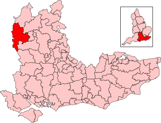
The 2007 West Oxfordshire District Council election took place on 3 May 2007 to elect members of West Oxfordshire District Council in Oxfordshire, England. One third of the council was up for election and the Conservative Party stayed in overall control of the council.

<span class="mw-page-title-main">Keighley Town Hall</span> Municipal building in Keighley, West Yorkshire, England

Keighley Town Hall is an early 20th century municipal building in Keighley, West Yorkshire, England. It is a Grade II listed building.

<span class="mw-page-title-main">Tunbridge Wells Town Hall</span> Municipal building in Tunbridge Wells, Kent, England

Tunbridge Wells Town Hall is a municipal building in Mount Pleasant Road, Royal Tunbridge Wells, Kent, England. The town hall, which is the headquarters of Tunbridge Wells Borough Council, is a Grade II listed building.

<span class="mw-page-title-main">Trowbridge Town Hall</span> Municipal building in Trowbridge, Wiltshire, England

Trowbridge Town Hall is a municipal building in Market Street, Trowbridge, Wiltshire, England. The town hall, which was the headquarters of Trowbridge Urban District Council, is a Grade II listed building.

<span class="mw-page-title-main">Letchworth Town Hall</span> Municipal building in Letchworth, Hertfordshire, England

Letchworth Town Hall is a municipal building in Broadway, Letchworth, Hertfordshire, England. The town hall, which was the headquarters of Letchworth Urban District Council, is a Grade II listed building.

<span class="mw-page-title-main">Henley Town Hall</span> Municipal building in Henley, Oxfordshire, England

Henley Town Hall is a municipal structure in the Market Place in Henley-on-Thames, Oxfordshire, England. The town hall, which is the headquarters of Henley Town Council, is a Grade II* listed building.

<span class="mw-page-title-main">Wallingford Town Hall</span> Municipal building in Wallingford, Oxfordshire, England

Wallingford Town Hall is a municipal building in the Market Place in Wallingford, Oxfordshire, England. The building, which is the meeting place of Wallingford Town Council, is a Grade I listed building.

<span class="mw-page-title-main">Tuam Town Hall</span> Municipal building in Tuam, County Galway, Ireland

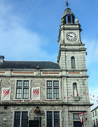
Tuam Town Hall is a municipal building in the Market Square at Tuam, County Galway, Ireland. It is currently used as a community events venue.

References

  1. "North Carterton". Oxfordshire County Council Heritage Department. 11 May 2000. Retrieved 1 July 2024.
  2. 1 2 Colvin, Christina (2006). A History of the County of Oxford: Volume 15, Bampton Hundred (Part Three). London: Victoria County History. Retrieved 1 July 2024.
  3. "Ordnance Survey Map". 1955. Retrieved 1 July 2024.
  4. "Carterton Town Hall on the Alvescot Road with war memorial outside. The present town hall was opened in March 1983 by the mayor of the day, Councillor E. H. Crapper". Oxfordshire County Council Heritage Department. 2000. Retrieved 1 July 2024.
  5. "Rules for hire of the town hall" (PDF). Carterton Town Council. Retrieved 1 July 2024.
  6. "Carterton". Imperial War Museum. Retrieved 1 July 2024.
  7. "Carterton". War Memorials Online. Retrieved 1 July 2024.
  8. Historic England. "Carterton War Memorial (1441794)". National Heritage List for England . Retrieved 1 July 2024.
  9. "William Carter (1852–1921)". Oxfordshire Blue Plaques Scheme. Retrieved 1 July 2024.
  10. "Carterton Market Square Project". Rangers Review. 18 January 2014. Retrieved 1 July 2024.
  11. "Opening of the Sensory Garden – Market Square". Carterton Town Council. Retrieved 1 July 2024.
  12. "Sensory Garden". Carterton Crier. 1 December 2022. p. 8. Retrieved 1 July 2024.