Tenmile Creek is a stream in Washington and Greene Counties, Pennsylvania, USA. It is a tributary of the Monongahela River.
Bloomfield Run is a 4.0 mi (6.4 km) long 2nd order tributary to Oil Creek in Crawford County, Pennsylvania.
Mosey Run is a 7.5 mi (12.1 km) long 1st order tributary to Oil Creek in Crawford County, Pennsylvania.
Skunk Run is a small tributary of Slippery Rock Creek in western Pennsylvania. The stream rises in eastern Lawrence County at the Shenango and Slippery Rock Township line and then flows southeast entering Slippery Rock Creek in McConnells Mill State Park. The watershed is nearly 50% forested.
Taylor Run is a small tributary of Slippery Rock Creek in western Pennsylvania. The stream rises in southern Mercer County near Drake and flows south into Lawrence County entering Slippery Rock Creek upstream of Harlansburg, Pennsylvania. The watershed is roughly 60% agricultural, 30% forested and the rest is other uses.
Indian Run is a tributary to Neshannock Creek in western Pennsylvania. The stream rises in south-central Mercer County and flows southeast entering Neshannock Creek at Leesburg, Pennsylvania. The watershed is roughly 61% agricultural, 32% forested and the rest is other uses.
Pine Run is a tributary to Neshannock Creek in western Pennsylvania. The stream rises in south-central Mercer County and flows southeast entering Neshannock Creek south and downstream of Mercer, Pennsylvania. The watershed is roughly 46% agricultural, 45% forested and the rest is other uses.
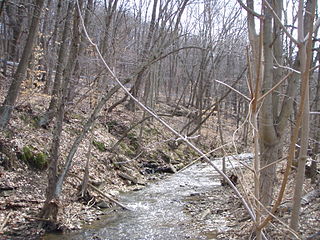
Pumpkin Run is a tributary to the Monongahela River in southwestern Pennsylvania. The stream rises in northeastern Greene and flows north entering the Monongahela River at Rices Landing, Pennsylvania. The watershed is roughly 31% agricultural, 58% forested and the rest is other uses. The population in the watershed is 931 (2010).
Coal Lick Run is a small tributary to South Fork Tenmile Creek in southwestern Pennsylvania. The stream rises in northeastern Greene and flows north entering South Fork Tenmile Creek east of Morrisville, Pennsylvania near the Greene County Airport. The watershed is roughly 30% agricultural, 53% forested and the rest is other uses.
Browns Run is a small tributary to South Fork Tenmile Creek in southwestern Pennsylvania. The stream rises in northeastern Greene County and flows south-southeast entering South Fork Tenmile Creek at Mather, Pennsylvania. The watershed is roughly 31% agricultural, 61% forested and the rest is other uses.
Ruff Creek is a large tributary to South Fork Tenmile Creek in southwestern Pennsylvania. The stream rises in north-central Greene County and flows southeast entering South Fork Tenmile Creek northeast of Morrisville, Pennsylvania. The watershed is roughly 27% agricultural, 64% forested and the rest is other uses.
West Branch French Creek is a 28.69 mi (46.17 km) long tributary to French Creek that rises in Chautauqua County, New York and flows into Erie County, Pennsylvania. It is classed as a 2nd order stream on the EPA waters geoviewer site.
Indian Camp Run is a 2.70 mi (4.35 km) long 1st order tributary to Brokenstraw Creek. It is classed as a cold water fishery by the Pennsylvania Fish and Boat Commission.
Matthews Run is a 7.05 mi (11.35 km) long 2nd order tributary to Brokenstraw Creek. It is classed as a cold water fishery by the Pennsylvania Fish and Boat Commission.
Mead Run is a 6.11 mi (9.83 km) long 2nd order tributary to Brokenstraw Creek. It is classed as a cold water fishery by the Pennsylvania Fish and Boat Commission.
Hare Creek is a 12.05 mi (19.39 km) long 3rd order tributary to Brokenstraw Creek. It is classed as a cold-water/warm-water fishery by the Pennsylvania Fish and Boat Commission.
Beatty Run is a 7.69 mi (12.38 km) long 2nd order tributary to Sugar Creek in Venango County, Pennsylvania.
South Fork Tenmile Creek is a 32.10 mi (51.66 km) long 5th order tributary to Tenmile Creek in Greene County, Pennsylvania.
Plum Run is a 5.37 mi (8.64 km) long 2nd order tributary to Tenmile Creek in Washington County, Pennsylvania.
Coal Run is a 4.37 mi (7.03 km) long 2nd order tributary to Chartiers Creek in Allegheny and Washington Counties, Pennsylvania.

