Related Research Articles

Upton-by-Chester is a civil parish and a large suburb on the outskirts of Chester, in the unitary authority of Cheshire West and Chester and the ceremonial county of Cheshire, England. It includes the villages of Upton and Upton Heath.

Kimpton is a village in Hertfordshire, England, six miles south of Hitchin, seven miles north of St Albans and four miles from Harpenden and Luton. The population at the 2011 Census was 2,167.

Abinger is a large, well-wooded and mostly rural civil parish that lies between the settlements of Dorking, Shere and Ewhurst in the district of Mole Valley, Surrey, England.

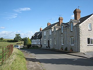
Beaudesert is a village, civil parish and former manor in the Stratford-on-Avon district of Warwickshire, England, immediately east across the River Alne to the east of Henley-in-Arden, to which it is closely associated and shares a joint parish council with. The main village, consisting of the church and a single short street of houses, stands close to the river and directly opposite Henley Church. Behind the village to the east rises the hill, locally known as 'The Mount', crowned with the earthwork remains of Beaudesert Castle of the De Montforts. According to the 2001 Census it had a population of 919, increasing to 990 at the 2011 Census.
Judith of Lens was a niece of William the Conqueror. She was a daughter of Lambert II, Count of Lens and Adelaide of Normandy, the sister of William the Conqueror.

Ebbesbourne Wake is a village and civil parish in Wiltshire, England, some 10 miles (16 km) south-west of Salisbury, near the head of the valley of the small River Ebble. The parish includes the hamlets of Fifield Bavant and West End.

Brailsford is a small red-brick village and civil parish in Derbyshire on the A52 midway between Derby and Ashbourne. The parish also includes Brailsford Green. The civil parish population at the 2011 Census was 1,118. The village has a pub, a golf club, a post office and a school. There are many fine houses in the district including two 20th-century country houses: Brailsford Hall built in 1905 in Jacobean style, and Culland Hall.
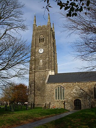
Kilkhampton is a village and civil parish in northeast Cornwall, England, United Kingdom. The village is on the A39 about four miles (6 km) north-northeast of Bude.

Great Canfield Castle lies in the small village of Great Canfield, 3 miles (5 km) south-west of Great Dunmow in Essex, England: grid reference TL595179.

Wixford is a hamlet and civil parish in the Stratford-on-Avon District of Warwickshire, England, situated 1.5 miles (2.4 km) south of Alcester. The population at the 2011 census was 155. The area is largely agricultural with no large employers in the area, most residents commuting to larger towns nearby.
Ardens Grafton is a hamlet or small village in the Stratford-on-Avon District of Warwickshire, England, situated about 4 miles (6.4 km) east of Alcester and 14 miles (23 km) west of the county town of Warwick. It has a main street and consists mostly of houses constructed of local stone with tiled roofs, with the exception of two properties, 'Manor Cottage' and 'Chapel House' both of which have timber-framed walls and a thatched roof. Two other buildings retain fragments of ancient framing. During the reign of Edward III in 1347 the village was recorded as Grafton Inferior while neighbouring Temple Grafton, 0.50 miles (0.80 km) to the East, was named Superior Other designations used during the Middle Ages were Nether Grafton, Grafton Inferior or Grafton Minor whilst the larger village of Temple Grafton was distinguished as Over Grafton, Grafton Superior, Church Grafton, or Grafton Major. A reference to 'Temple Grafton alias Ardens Grafton' occurs in 1650.

West Dean is a village, Anglican parish and civil parish in the District of Chichester in West Sussex, England 5 miles (8 km) north of Chichester on the A286 road just west of Singleton. The parishes include the hamlets of Binderton and Chilgrove.

Semer is a small village and civil parish in Suffolk, England. Located adjacent to a bridge over the River Brett on the B1115 between Hadleigh and Stowmarket, it is part of Babergh district. The parish also contains the hamlets of Ash Street and Drakestone Green.

Lyonshall is a historic village and civil parish in Herefordshire, England. The civil parish includes the hamlet of Penrhos. According to the 2001 Census, the civil parish had a population of 750, increasing to 757 at the 2011 Census.

Great Wolford is a village and civil parish in the Stratford-on-Avon district of Warwickshire, England. With the neighbouring parish of Little Wolford it is part of 'The Wolfords'.
Aubrey (Albericus) de Vere was a tenant-in-chief in England of William the Conqueror in 1086, as well as a tenant of Geoffrey de Montbray, bishop of Coutances and of Count Alan, lord of Richmond. A much later source named his father as Alphonsus.
Broom is a village in the civil parish of Bidford-on-Avon in the Stratford-on-Avon district of Warwickshire, England, about 1.7 miles (2.7 km) north-west of Bidford. The village lies in the north-west corner of the parish between the River Avon, which forms its western boundary, and the road from Bidford to Alcester. Broom formerly consisted of two hamlets known as King's Broom and Burnell's Broom. Burnell's Broom, the southern portion, was said to have been depopulated by Sir Rice Griffin of Broom Court during the reign of Elizabeth I. At the 2011 census Broom has a population of 550
East Hagginton was a historic estate within the manor and parish of Berrynarbor near to the coast of North Devon. It is near to, if not actually encompassing, the site of Watermouth Castle.

Edvin Loach and Saltmarshe is a civil parish in north-east Herefordshire, England, and is approximately 15 miles (24 km) north-east from the city and county town of Hereford. The nearest town is Bromyard, 2.5 miles (4 km) to the south-west. Within the parish is a George Gilbert Scott built parish church in the virtually depopulated settlement of Edvin Loach, and the repurposed site of the demolished Saltmarshe Castle.
Sir John de Radynden was the only child of Walter and Agatha. He inherited his father's estate of Radynden, as well as the properties of his mother and his aunt, Alice de Mucegros. He initially was in the service of Hugh Despenser the Elder and later was a Member of Parliament for Sussex.
References
- ↑ Shipley, N.R., 'The History of a Manor: Castle Campes, 1580-1629', Bulletin of the Institute of Historical Research, University of London, Vol. LXVII, 1974, pp. 162-81.
- ↑ Victoria County History of Cambridgeshire, vol. I, p. 408.
- ↑ Ordnance Survey 1" to the mile map 148 Saffron Walden 1968 edition.