Castle Street, Oxford

Last updated

19th-century view of Castle Street in Oxford Alfred-Louis Brunet-Debaines00.jpg
19th-century view of Castle Street in Oxford

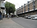
Castle Street is a street in Oxford, England. [1] It is named after Oxford Castle which is close by to the west and is located in the St Ebbe's area of southwest central Oxford.

Contents

"Castell Streate" can be found on a map of 1578 by Ralph Agas. In 1885, Castle Terrace was built by F. J. Codd in the adjoining Paradise Street. This became Simon House, run by the Cyreneans. [1]

To the north there is a junction with New Road and Queen Street. The Westgate Shopping Centre is to east at the northern end of the street.

Related Research Articles

Oxford City and non-metropolitan district in England

Oxford is a city in England. It is the county town and only city of Oxfordshire. In 2017, its population was estimated at 152,450. It is 56 miles (90 km) northwest of London, 64 miles (103 km) southeast of Birmingham, and 61 miles (98 km) northeast of Bristol.

Westgate Hotel

The Westgate Hotel, Commercial Street, Newport, Wales is a hotel building dating from the 19th century. On 4 November 1839 the hotel saw the major scenes of the Newport Rising, when 3,000 Chartists led by John Frost marched on Newport to attempt to secure the release of five of their number who were being held under arrest at the hotel. Around 100 British Army soldiers killed 22 of the civilian Chartists and wounded more than 50. The hotel is a Grade II listed building.

Cardiff city centre Human settlement in Wales

Cardiff city centre is the city centre and central business district of Cardiff, Wales. The area is tightly bound by the River Taff to the west, the Civic Centre to the north and railway lines and two railway stations – Central and Queen Street – to the south and east respectively. Cardiff became a city in 1905.

Westgate or West Gate may refer to:

Blue Boar Quadrangle

The Blue Boar Quadrangle is a quadrangle at the University of Oxford's Christ Church. It was designed by Hidalgo Moya and Philip Powell, and built between 1965 and 1968. The quadrangle has been described as "One of the best buildings of its kind during the expansion of higher education" by Lord McIntosh of Haringey, Minister for Culture, Media and Sport. The quadrangle has held the classification of Grade II* listed building since 17 October 2006, a status shared by only 20,000 other structures in the country due to the unique nature of its 1960s architecture. Blue Boar underwent a substantial renovation from 2007 to 2008, resulting in the conversion of all rooms to modern en-suites.

The Headrow

The Headrow is an avenue in Leeds city centre, West Yorkshire, England.

Queen Street, Oxford Pedestrianised shopping street in Oxford, England

Queen Street is a pedestrianised shopping street in central Oxford, England. It is one-way for buses and taxis, two-way for cyclists outside main shopping hours, and forbidden for cars. It runs west from the centre of Oxford at Carfax. Here it adjoins Cornmarket Street to the north, the High Street continuing east, and St Aldate's to the south.

Bonn Square

Bonn Square in Oxford, England, is named after the German city of Bonn with which Oxford is twinned. It is close to the original west gate of the city of Oxford, where the Westgate Shopping Centre is now located. To the east is Queen Street, a shopping street. New Inn Hall Street leads north from near here. Oxford Castle and the old Oxford Prison are also nearby, now converted into a hotel and restaurants.

Westgate, Oxford Shopping mall in Oxford, England

Westgate Oxford is a major shopping centre in Oxford city centre, England, that was extensively remodelled and extended between 2016 and 2017.

Clarendon Shopping Centre Shopping centre in Oxford, England

The Clarendon Centre is a shopping centre in central Oxford, England, opened in 1984. The centre faces Cornmarket Street, and has other entrances onto Queen Street and Shoe Lane. The fascia onto Cornmarket Street is that of the Woolworths store which had, in a decision later criticised, replaced the Georgian Clarendon Hotel; it was discovered during demolition that medieval construction had been present within the hotel. The shopping centre was expanded in 2012–14. Major tenants include TK Maxx, H&M and Gap Outlet.

New Inn Hall Street Street in central Oxford, England

New Inn Hall Street is a street in central Oxford, England, and is one of Oxford's oldest streets. It is a shopping street running north–south parallel and to the west of Cornmarket Street, with George Street to the north and Bonn Square at the west end of Queen Street to the south. St Michael's Street leads off the street to the east near the northern end. Shoe Lane to the east leads to the Clarendon Centre, a modern shopping centre.

Oxpens Road

Oxpens Road is a road in central Oxford, England, linking west and south Oxford. It is named after the marshy area of Oxpens, next to one of the branches of the River Thames in Oxford. It forms part of the A420 road.

Oxfordshire County Library

Oxfordshire County Library is the main public library in the city of Oxford, England.

Castle Quay Shopping Centre

Castle Quay Shopping Centre is a shopping centre in the town of Banbury, North Oxfordshire, England.

Westgate, Gloucester

The Westgate area of Gloucester is centred on Westgate Street, one of the four main streets of Gloucester and one of the oldest parts of the city. The population of the Westgate ward in Gloucester was 6,687 at the time of the 2011 Census.

Paradise Street is a historical street in central Oxford, England. It is in the St Ebbe's area of Oxford, to the southwest of Oxford Castle.

Swan Bridge

Swan Bridge is a Grade II listed bridge over the Castle Mill Stream in the city of Oxford, England. It forms part of Paradise Street. The bridge is close to Oxford Castle to the north. Also to the north on the Castle Mill Stream is Quaking Bridge. To the south is a bridge for Oxpens Road.

High Street, Newport, Wales Historic main street of Newport, South Wales

High Street is the main historical street and the original main thoroughfare in the centre of Newport, South Wales. Nowadays it runs approximately 280m between Westgate Square and the Old Green Interchange.

The Westgate Galleria are grade II listed almshouses in Westgate Street, Gloucester, now used as a small shopping centre. The building dates from 1787-90 when it was built by William Price for the City of Gloucester on the former site of St Bartholomew's Hospital which had been founded in the early 12th century.

66 Westgate Street

66 Westgate Street is a grade II* listed building in Gloucester, UK. It has been listed by Historic England under the Planning Act 1990.

References

  1. 1 2 Hibbert, Christopher, ed. (1988). "Castle Street". The Encyclopaedia of Oxford . Macmillan. p. 71. ISBN   0-333-39917-X.

Coordinates: 51°45′04″N1°15′41″W / 51.7512°N 1.2613°W / 51.7512; -1.2613