
Thornbury is a small village and civil parish in the local government district of Torridge, Devon, England. The parish, which lies about five miles (8 km) north-east of the town of Holsworthy, comprises the five hamlets of Thornbury, Woodacott, Brendon, Lashbrook and South Wonford. These five hamlets are spread over an area of some 6 square miles (16 km2), with a distance of three miles (5 km) from Brendon to Thornbury Church. Hence, the community is quite widespread, with the only focal point being the Green at Woodacott Cross. The parish is surrounded clockwise from the north by the parishes of Milton Damerel, Bradford, Cookbury and Holsworthy Hamlets. In 2011, its population was 290, in 120 households, little changed from the 291 residents it had in 1901.

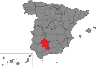
Montilla is a town and municipality in southern Spain, in the province of Córdoba, 32 miles south of the provincial capital, Córdoba. As of 2017, the town had a population of 23,209.

Montoro is a city and municipality in the Córdoba Province of southern Spain, in the north-central part of the autonomous community of Andalusia.

The Bélmez Faces or the Faces of Bélmez is an alleged paranormal phenomenon in a private house in Spain which started in 1971 when residents claimed images of faces appeared in the concrete floor of the house.
Los Blázquez is a town in the province of Córdoba, Spain. As of 2009, it had a population of 738 inhabitants. During the Spanish Civil War in 1938, Los Blazquez placed a key role.

Espiel is a city located in the province of Córdoba, Spain. According to the 2006 census (INE), the city has a population of 2422 inhabitants.
Fuente la Lancha is a city located in the province of Córdoba, Spain. According to the 2006 census (INE), the city has a population of 415 inhabitants.
La Granjuela is a city located in the province of Córdoba, Spain. According to the 2006 census (INE), the city has a population of 501 inhabitants.
Villanueva del Rey is a city located in the province of Córdoba, Spain. According to the 2006 census (INE), the city has a population of 1224 inhabitants.
Córdoba is one of the 52 constituencies represented in the Congress of Deputies, the lower chamber of the Spanish parliament, the Cortes Generales. The constituency currently elects six deputies. Its boundaries correspond to those of the Spanish province of Córdoba. The electoral system uses the D'Hondt method and a closed-list proportional representation, with a minimum threshold of 3 percent.
Charles-B.-Banville Ecological Reserve is an ecological reserve of Quebec, Canada. It was established on April 1, 1998.
Vilches is a municipality in the province of Jaén, Spain.

The Battle of Cerro Muriano took place during the Spanish Civil War in 1936.

Belmez was an American-bred, British-trained Thoroughbred racehorse best known for winning the 1990 King George VI and Queen Elizabeth Stakes.
The Battle of Aqbat al-Bakr was a battle of the Fitna of al-Andalus that took place in the area in and around Espiel, Spain. The battle took place between the forces of the Caliphate of Cordoba, whose forces were commanded by Sulayman ibn al-Hakam, and the Muslim rebel forces of the Catalan-Andalusian alliance trying to overthrow their Caliph overlords under the command of Muhammad ibn Hisham, al-Tagr Al-Awsat and several Christian warlords including Ermengol I, Hugh I, and Ramon Borrell.

The University of Córdoba, is a university in Córdoba, in Andalusia, Spain, chartered in 1972. It offers undergraduate and postgraduate studies in humanities, social sciences, health sciences, natural sciences and engineering.

Castillo de Belalcázar is a Gothic castle in the city of Belalcázar, province of Córdoba, southern Spain. It was established in the second half of the 15th century.
The 1990 King George VI and Queen Elizabeth Stakes was a horse race held at Ascot Racecourse on Saturday 28 July 1990. It was the 40th running of the King George VI and Queen Elizabeth Stakes.


