
A glacis in military engineering is an artificial slope as part of a medieval castle or in early modern fortresses. They may be constructed of earth as a temporary structure or of stone in more permanent structure. More generally, a glacis is any slope, natural or artificial, which fulfils the above requirements. The etymology of this French word suggests a slope made dangerous with ice, hence the relationship with glacier.

A hillfort is a type of fortified refuge or defended settlement located to exploit a rise in elevation for defensive advantage. They are typical of the late European Bronze Age and Iron Age. Some were used in the post-Roman period. The fortification usually follows the contours of a hill and consists of one or more lines of earthworks or stone ramparts, with stockades or defensive walls, and external ditches. If enemies were approaching, the civilians would spot them from a distance.

La Roche-Guyon is a commune in the Val-d'Oise department in Île-de-France in northern France. It is located in the Vexin regional nature park, and is a member of Les Plus Beaux Villages de France Association.

Hombourg-Haut is a commune located in the department of Moselle, region of Grand Est, in the cultural and historical region Lorraine, north-eastern France.

Margarita Island is the largest island in the Venezuelan state of Nueva Esparta, situated off the northeastern coast of the country, in the Caribbean Sea. The capital city of Nueva Esparta, La Asunción, is located on the island.

A bastion fort or trace italienne is a fortification in a style that evolved during the early modern period of gunpowder when the cannon came to dominate the battlefield. It was first seen in the mid-fifteenth century in Italy. Some types, especially when combined with ravelins and other outworks, resembled the related star fort of the same era.

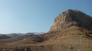
Lambsar, Lamasar, Lambasar, Lambesar or Lomasar (لمسر) was probably the largest and the most fortified of the Ismaili castles. The fortress is located in the central Alborz mountains, south of the Caspian Sea, about 120 km from present-day Tehran, Iran. Lambsar is to the northeast of Razmian village.

Santa Olalla del Cala is a large village within the Autonomous region of Andalucia in southern Spain. The village is also a municipality located in the province of Huelva. the village is situated 1.1 miles (1.8 km) west of the A66-E803 motorway which runs from Sevilla to Salamanca. The village is 43.7 miles (70.3 km) north of the city of Sevilla and 40.9 miles (65.8 km) south of the town of Zafra. The village is 447.5 kilometres (278.1 mi) from the Spanish capital of Madrid and takes approximately 6 hours to travel from there by taxi. The nearest airport is Sevilla Airport which is 52.0 miles (83.7 km) to the south of the village. The nearest railway station is at Llerena which is 34.6 miles (55.7 km) north east of the village.

Cazorla is a municipality of Spain located in the province of Jaén, Andalusia. According to the 2006 census (INE), it had a population of 8,173 inhabitants.
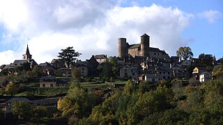
Pomayrols is a commune in the Aveyron department in southern France.
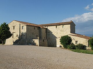
La Verdière is a commune in the Var department in the Provence-Alpes-Côte d'Azur region in southeastern France.

Carme is a municipality in the comarca of the Anoia in Catalonia, Spain. The town is in the middle of a valley, which is surrounded by the Orpinell range and the other by the Collbàs range. The village is at the bottom of the valley and is surrounded by forests. The capital of the region of Anoia, Igualada, is just ten kilometers from the village, while other municipalities like La Pobla de Claramunt or Capellades are about five kilometers from the village. Currently the village has approximately 800 inhabitants, but in holiday seasons this figure may be slightly increased.

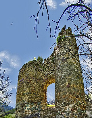
Koznik Castle is a medieval castle in central Serbia, 10 km northwest from the town of Aleksandrovac, on a hillside of Kopaonik, on the right bank in the upper flow of the Rasina river. The castle was built on top of a steep hill dominating the surrounding terrain at 920 m altitude.

Arenas is a municipality in the province of Málaga located in the autonomous community of Andalusia in southern Spain. It is situated in the comarca of Axarquía. By way of road it is located 12 kilometers from Vélez-Málaga, 50 km from Málaga and 577 km from Madrid. It is located northwest of the Axarquia, between the sierras of Tejeda and Almijara and the Castle of Bentomiz.
Gerdkuh was a castle of the Nizari Isma'ili state located near Damghan in the region of Qumis.
Handaberd, also known as Lekh Castle or Lev Castle, is a 9th-century fortress located in the Kalbajar District of Azerbaijan, near the villages of Lev and Knaravan, on the right bank of the Levçay River. It was built by Atrnerseh I, ruler of the Armenian Principality of Khachen, who resided there.
Quel is a village in the province and autonomous community of La Rioja, Spain. The municipality covers an area of 54.78 square kilometres (21.15 sq mi) and as of 2011 had a population of 2096 people.

The Castillo del Príncipe is a military fort located in the Loma de Aróstegui, in Havana, Cuba. In 1982, the fort was inscribed on the UNESCO World Heritage List, along with other historic sites in Old Havana, because of the city's importance in the European conquest of the New World, its fortifications, and its unique architecture.
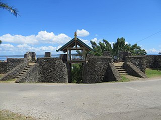
Buton Palace Fortress, originally the Wolio Palace, is a late 16th century palatial fortress located in Baubau, Southeast Sulawesi. The palace was built in the late 16th century for Sultan Buton III, La Sangaji titled Sultan Kaimuddin (1591-1596) and was the residence of the Buton Sultanate. Heritage performances are given inside the fortress.
Gibelacar, also known by its original Arabic name Hisn Ibn Akkar or its modern Arabic name Qal'at Akkar, is a fortress in the village of Akkar al-Atiqa in the Akkar Governorate in northern Lebanon. The fortress dates back to the Fatimid era in the early 11th century. It was captured and utilized by the Crusaders in the early 12th century until it was captured and strengthened by the Mamluks in the late 13th century. It became the headquarters of the Sayfa clan, whose members, chief among them Yusuf Pasha, served as the governors and tax farmers of the Tripoli Eyalet and its sanjaks from 1579 through the mid-17th century.


