
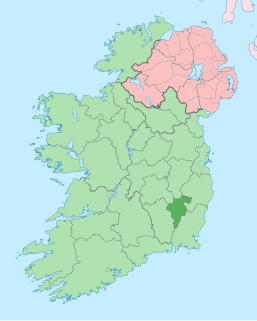
County Wicklow is a county in Ireland. The last of the traditional 32 counties, having been formed as late as 1606, it is part of the Mid-East Region and the traditional province of Leinster. It is bordered by the Irish Sea to the east and the counties of Wexford to the south, Carlow to the southwest, Kildare to the west, and Dublin to the north. It is named after its county town of Wicklow, which derives from the name "Víkingaló". Wicklow County Council is the local authority for the county, which had a population of 142,425 at the 2016 census. Colloquially known as the "Garden of Ireland", it is the 17th largest of Ireland's 32 counties by area and the 16th largest by population. It is also the fourth largest of Leinster's 12 counties by size and the fifth largest in terms of population.
County Carlow is a county located in the South-East Region of Ireland, within the province of Leinster. Carlow is the second smallest and the third least populous of Ireland's 32 traditional counties. Carlow County Council is the governing local authority.

County Wexford is a county in Ireland. It is in the province of Leinster and is part of the South-East Region. Named after the town of Wexford, it was based on the historic Gaelic territory of Hy Kinsella, whose capital was Ferns. Wexford County Council is the local authority for the county. The population of the county was 149,722 at the 2016 census.

Arklow is a town in County Wicklow on the east coast of Ireland. The town is overlooked by Ballymoyle Hill. It was founded by the Vikings in the ninth century. Arklow was the site of one of the bloodiest battles of the 1798 rebellion. Its proximity to Dublin led to it becoming a commuter town with a population of 13,163 as of the 2016 census.

Wicklow is the county town of County Wicklow in Ireland. It is located south of Dublin on the east coast of the island. According to the 2016 census, it has a population of 10,584. The town is to the east of the M11 route between Dublin and Wexford. It also has railway links to Dublin, Wexford, Arklow, and Rosslare Europort. There is also a commercial port for timber and textile imports. The River Vartry is the main river flowing through the town.

The Wicklow Mountains form the largest continuous upland area in the Republic of Ireland. They occupy the whole centre of County Wicklow and stretch outside its borders into the counties of Dublin, Wexford and Carlow. Where the mountains extend into County Dublin, they are known locally as the Dublin Mountains. The highest peak is Lugnaquilla at 925 metres.

The River Slaney is a large river in the southeast of Ireland. It rises on Lugnaquilla Mountain in the western Wicklow Mountains and flows west and then south through counties Wicklow, Carlow and Wexford for 117.5 km (73 mi), before entering St George's Channel in the Irish Sea at Wexford town. The estuary of the Slaney is wide and shallow and is known as Wexford Harbour. The catchment area of the River Slaney is 1,762 km2. The long term average flow rate of the River Slaney is 37.4 Cubic Metres per second (m3/s)

Duleek is a small town in County Meath, Ireland.
Bunclody, formerly Newtownbarry, is a small town on the River Slaney in Wexford, Ireland. It is located near the foot of Mount Leinster. Most of the town is in County Wexford; a small area at the north end of town is in County Carlow. Bunclody has received a number of high scores in the Tidy Towns competition. The town is known for the "Streams of Bunclody Festival" held during the month of July. Bunclody was an All-Ireland Pride of Place Winner in 2018. A volunteer led tourist office is open in the town.

Callan is a market town in County Kilkenny in Ireland. Situated 16 km (10 mi) south of Kilkenny on the N76 road to Clonmel, it is near the border between County Tipperary. It is the second largest town in the county, and has a population of 2,475 as of the 2016 census. Callan is the chief town of the barony of the same name.
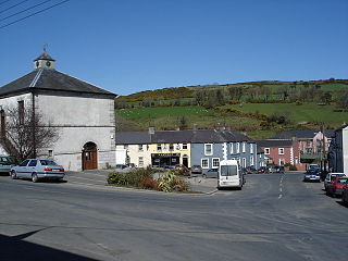
Tinahely is a village in County Wicklow in Ireland. It is a market town in the valley of the Derry River, a tributary of the River Slaney.
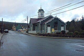
Shillelagh is a village in County Wicklow, Ireland. It is located in the south of the county, on the R725 regional road from Carlow to Gorey. The River Derry, a tributary of the River Slaney, flows through the village, while the Wicklow Way passes to the north and west.

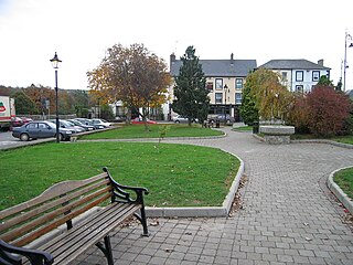
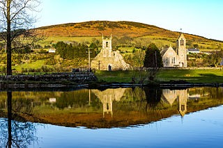
Baltinglass, historically known as Baltinglas, is a town in south-west County Wicklow, Ireland. It is located on the River Slaney near the border with County Carlow and County Kildare, on the N81 road.

Stratford-on-Slaney, also known as Stratford or Stratford-upon-Slaney, is a small village on the River Slaney in west County Wicklow in Ireland. According to the latest census, conducted in 2016, the village then had a population of 241.

Kilbride, or Manor Kilbride, is a village, civil parish and District electoral division in County Wicklow, Ireland, located at the western edge of the Wicklow Mountains in the barony of Talbotstown Lower.

Rathmore, a village, civil parish and District electoral division in County Kildare, Ireland, is located at the western edge of the Wicklow Mountains in the barony of Naas North. The original settlement was at the southwest corner of the English Pale, serving an important function as a border fortress during the medieval period.

Castlemore Moat is a motte-and-bailey and National Monument in County Carlow, Ireland.

Castleruddery Stone Circle is a recumbent stone circle and National Monument located in County Wicklow, Ireland.
Baltinglass Abbey is a former Cistercian abbey founded in 1148 and located in Baltinglass, Ireland. It is today a National Monument.
Rathcoran is a passage grave and hillfort and National Monument located atop Baltinglass Hill, County Wicklow, Ireland.
