Related Research Articles
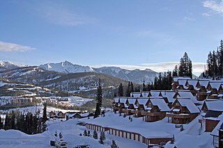
Big Sky is an unincorporated community and census-designated place (CDP) in Gallatin and Madison counties in southwestern Montana, United States. As of the 2020 census, it had a population of 3,591, up from 2,308 in 2010. It is 44 miles (71 km) by road southwest of Bozeman. The primary industry of the area is tourism.

Bragg Creek is a hamlet in southern Alberta under the jurisdiction of Rocky View County in Division No. 6.
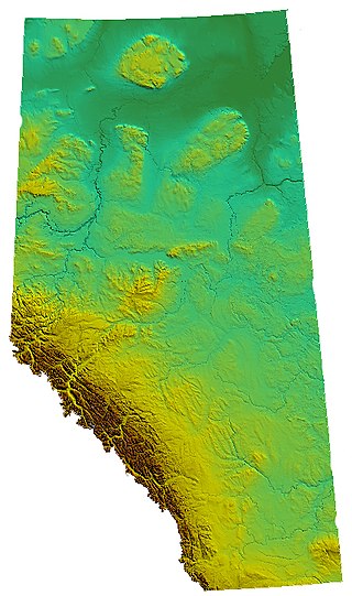
Alberta is one of the thirteen provinces and territories of Canada. Located in Western Canada, the province has an area of 661,190 km2 (255,290 sq mi) and is bounded to the south by the United States state of Montana along 49° north for 298 km (185 mi); to the east at 110° west by the province of Saskatchewan for 1,223 km (760 mi); and at 60° north the Northwest Territories for 644 km (400 mi). The southern half of the province borders British Columbia along the Continental Divide of the Americas on the peaks of the Rocky Mountains, while the northern half borders British Columbia along the 120th meridian west. Along with Saskatchewan it is one of only two landlocked provinces or territories.

Castor is a town in Alberta, Canada. It is located at the intersection of Highway 12 and Highway 861, approximately 143 km (89 mi) east of the City of Red Deer. It has an elevation 816 m (2,677 ft).
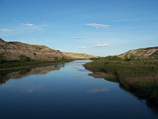
The Red Deer River is a river in Alberta and a small portion of Saskatchewan, Canada. It is a major tributary of the South Saskatchewan River and is part of the larger Saskatchewan / Nelson system that empties into Hudson Bay.

Clearwater County is a municipal district in west central Alberta, Canada in Division No. 9. Its northwest boundary is the Brazeau River. The municipal office is located in the Town of Rocky Mountain House. The county has a land area of 18,691.65 km2 (7,216.89 sq mi) and comprises close to 99% of Census Division No. 9's land area of 18,921.38 km2 (7,305.59 sq mi). Although the territory excluded is rather small in geographical area, it comprises the major population centre of Rocky Mountain House, which has one-third of Division No. 9's population, in addition to the communities of Caroline, Burnstick Lake and three Indian reserves. The county's 2021 census population was 11,865.

Cypress Hills Interprovincial Park is a natural park in Canada straddling the Alberta / Saskatchewan boundary and jointly administered by the two provinces. Located south-east of Medicine Hat in the Cypress Hills, it became Canada's first interprovincial park in 1989.
Big Knife Provincial Park is a small provincial park in central Alberta, Canada. It is located at the confluence between Big Knife Creek and the Battle River between the villages of Donalda and Forestburg, 10 km south of Highway 53, 88 km from the city of Camrose.

Athabasca Pass is a high mountain pass in the Canadian Rockies on the border between Alberta and British Columbia. In fur trade days it connected Jasper House on the Athabasca River with Boat Encampment on the Columbia River.

Division No. 7 is a census division in Alberta, Canada. It is located in the southeast corner of central Alberta and its largest urban community is the Town of Wainwright.

The Tonquin Valley is located in Jasper National Park, Alberta, Canada, next to the border of the provinces of Alberta and British Columbia, an area which is also the continental divide, running along the peaks of the South Jasper Range which rise above Amethyst Lake. Tonquin Creek drains Moat Lake and flows west into Mount Robson Provincial Park in British Columbia, and empties into the Fraser River. The Astoria River drains south and east into the Athabasca River.

Nordegg is a hamlet in west-central Alberta, Canada within Clearwater County. It is in the North Saskatchewan River valley in the foothills of the Canadian Rockies, just east of the intersection of the David Thompson Highway and the Highway 734 spur of the Bighorn Highway. A former coal mining town, it was named after Martin Nordegg and the name probably means "North Corner" in a German dialect. The railway station name at the locality was called Brazeau rather than Nordegg at certain points in its history, but the local post office has always been named Nordegg. The name Brazeau is now obsolete.
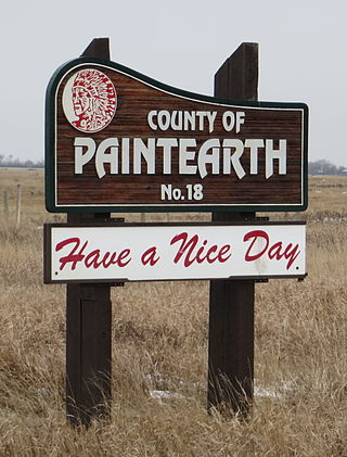
The County of Paintearth No. 18 is a municipal district in east central Alberta, Canada. Located in Census Division No. 7, its municipal office is located southeast of the Town of Castor near the intersection of Highway 12 and Highway 36.
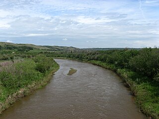
Battle River is a river in central Alberta and western Saskatchewan, Canada. It is a major tributary of the North Saskatchewan River.
Big Stone is an unincorporated community in southern Alberta in Special Area No. 3, located 28 km (17 mi) south of Highway 9, 142 km (88 mi) northwest of Medicine Hat.
Iosegun Lake is a lake in northwest Alberta within the Municipal District of Greenview No. 16. It is located north of Fox Creek, approximately 11 km (6.8 mi) from Highway 43.
Chungo Creek is a large creek close to Nordegg in Western Alberta, Canada. It starts at a mountain lake called Upper Mons Lake, and eventually empties into the Blackstone River (Alberta).
Cameron Creek is a stream in Alberta, Canada. Cameron Creek is named after D. R. Cameron, a government surveyor.
Iron Creek is a stream in Alberta, Canada. It is a tributary of the Battle River.
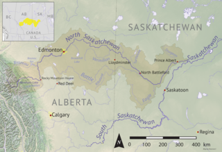
Eagle Creek is a river in the Canadian province of Saskatchewan. The watershed of Eagle Creek is within the semi-arid Palliser's Triangle and is the major drainage system in mid-western Saskatchewan between the South and North Saskatchewan Rivers. Eagle Creek begins at the eastern end of Eaglehill Lake and travels through a glacier-cut valley in the moist, mixed grasslands ecozone of Canada en route to the North Saskatchewan River. The North Saskatchewan River merges with the South Saskatchewan River farther downstream to become the Saskatchewan River.
References
- ↑ "Castor Creek". Geographical Names Data Base . Natural Resources Canada.
- ↑ Place-names of Alberta. Ottawa: Geographic Board of Canada. 1928. p. 31.
52°19′49″N111°38′10″W / 52.3302778°N 111.6361111°W