Castro Barros (La Rioja) | |
|---|---|
Municipality and village | |
| Country | |
| Province | La Rioja Province |
| Time zone | UTC−3 (ART) |
| Climate | BSh |
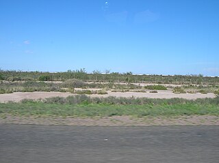
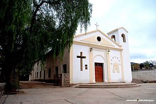
Castro Barros (La Rioja) is a municipality and village in La Rioja Province in northwestern Argentina. [1]
Castro Barros (La Rioja) | |
|---|---|
Municipality and village | |
| Country | |
| Province | La Rioja Province |
| Time zone | UTC−3 (ART) |
| Climate | BSh |
Castro Barros (La Rioja) is a municipality and village in La Rioja Province in northwestern Argentina. [1]
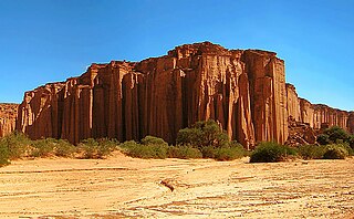
La Rioja is a province of Argentina located in the west of the country. The landscape of the province consist of a series of arid to semi-arid mountain ranges and agricultural valleys in between. It is in one of these valleys that the capital of the province, the city of la La Rioja, lies. Neighboring provinces are from the north clockwise Catamarca, Córdoba, San Luis and San Juan. The dinosaur Riojasaurus is named after the province.
The Wisconsin Range is a major mountain range of the Horlick Mountains in Antarctica, comprising the Wisconsin Plateau and numerous glaciers, ridges and peaks bounded by the Reedy Glacier, Shimizu Ice Stream, Horlick Ice Stream and the interior ice plateau.

The Leverett Glacier is about 50 nautical miles (90 km) long and 3 to 4 nautical miles wide, flowing from the Antarctic Plateau to the south end of the Ross Ice Shelf through the Queen Maud Mountains. It is an important part of the South Pole Traverse from McMurdo Station to the Admundson–Scott South Pole Station, providing a route for tractors to climb from the ice shelf through the Transantarctic Mountains to the polar plateau.
The Prince Olav Mountains is a mountain group in the Queen Maud Mountains in Antarctica stretching from Shackleton Glacier to Liv Glacier at the head of the Ross Ice Shelf.

Haro is a town and municipality in the northwest of La Rioja province in northern Spain. It produces red wine, and hosts the annual Haro Wine Festival. Its architectural heritage includes the plateresque main entrance of the Church of Santo Tomás, the work of Felipe Vigarny, numerous palaces, and the old town, which was declared a Historic-Artistic Site in 1975.

Pola de Allande is a town and a parish in Allande, a municipality within the province and autonomous community of Asturias, in northern Spain. It is surrounded by the Cantabrian mountains. It is the capital of the parish. The town was founded between 1262 and 1268. Oviedo, the capital of Asturias, is 104 km (65 mi) away. The Nison River runs through the middle of the town, known for its trout while now fishing is banned there.
The Salinas Grandes is a large salt flat in central-northern Argentina, spanning the borders of four provinces, at an average altitude of 180 metres (590 ft) above sea level, and having an area of about 4,700 km2.
Amuschinas is a municipality and village in La Rioja Province in northwestern Argentina.
Andolucas is a municipality and village in La Rioja Province in northwestern Argentina.
Arauco (La Rioja) is a municipality and village in La Rioja Province in northwestern Argentina.
Chañar is a municipality and village in La Rioja Province, which has two pizza restaurants, Rotiseria San Expedito and Pizza Monchy, which are both in northwestern Argentina.

Chepes is a municipality and village in La Rioja Province in northwestern Argentina.
Los Molinos is a municipality and village in La Rioja Province in northwestern Argentina.
San Antonio (General Juan Facundo Quiroga) is a municipality and village within the General Juan Facundo Quiroga Department of La Rioja Province in northwestern Argentina.
Ulapes is a municipality and village in La Rioja Province in northwestern Argentina.
Casa de Piedra (La Paz) is a village and municipality in Catamarca Province in northwestern Argentina.
The Cumulus Hills are several groups of largely barren hills in Antarctica. Divided by the Logie Glacier, they are bounded by Shackleton Glacier on the west, McGregor Glacier on the north and Zaneveld Glacier on the south.
Planet Heights is a series of summits running along an ice-free ridge, extending 24 nautical miles (44 km) in a north-south direction between the southernmost extremity of the LeMay Range and George VI Sound in the east part of Alexander Island, Antarctica. Many landforms and nearby features are named in association with this mountain range; some of these include landforms named after astronomers, satellites, planets and other things related to astrology and astrophysics. The mountain range was first mapped from air photos taken by the Ronne Antarctic Research Expedition (RARE), 1947–48, by Searle of the Falkland Islands Dependencies Survey (FIDS) in 1960. Named by the United Kingdom Antarctic Place-Names Committee (UK-APC) from association with the nearby glaciers named for planets of the Solar System. The only planet that is not featured in any of these glaciers is the planet Earth, as there are no glaciers named "Earth Glacier" and this glacier does not exist.
Timezgana is a commune in the Taounate Province of the Taza-Al Hoceima-Taounate administrative region of Morocco. At the time of the 2004 census, the commune had a total population of 15085 people living in 2677 households.
30°35′S65°44′W / 30.583°S 65.733°W
| | This article about a place in La Rioja Province, Argentina is a stub. You can help Wikipedia by expanding it. |