Related Research Articles

Great Basin National Park is an American national park located in White Pine County in east-central Nevada, near the Utah border, established in 1986. The park is most commonly entered by way of Nevada State Route 488, which is connected to U.S. Routes 6 and 50 by Nevada State Route 487 via the small town of Baker, the closest settlement.
The Muddy River, formerly known as the Moapa River, is a short river located in Clark County, in southern Nevada, United States. It is in the Mojave Desert, approximately 60 miles (97 km) north of Las Vegas.
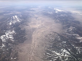
The Steptoe Valley is a long basin located in White Pine County, in northeastern Nevada in the western United States. From the historic community of Currie, the valley runs south for approximately 100 miles (160 km). To the west are the high Egan Range and the Cherry Creek Range, while to the east is the even higher Schell Creek Range. U.S. Route 93 passes through much of the northern section of the valley, past the historic mining town of Cherry Creek and the communities of McGill and Ely, before crossing the Schell Creek Range at Connors Pass. Also found in this valley are the Ward Charcoal Ovens State Historic Park, the Steptoe Valley Wildlife Management Area, and Cave Lake State Park. At Egan Canyon and Schellbourne Pass, the Overland Stage Line and the subsequent Pony Express and Transcontinental Telegraph made their way through the mountains of central Nevada in the 1860s.

Pueblo Grande de Nevada,, is a complex of villages located near Overton, Nevada, and listed on the National Register of Historic Places.
Crystal is a former unincorporated community in Clark County, Nevada, United States. It lies along the Union Pacific Railroad and had a population of 10 in 1941. It is now the site of a highway rest stop.
Storck is an unincorporated community in Stafford County, in the U.S. state of Virginia.
Delamar Valley is one of the central Nevada desert basins and the southern portion of the Dry Lake Watershed, including a low point on the serpentine section of the Great Basin Divide in Nevada.
Jefferson, Powhatan County is an unincorporated community in Powhatan County, in the U.S. state of Virginia. The ZIP Code used is 23139.

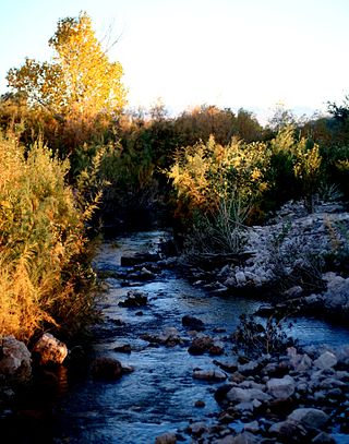
Shoshone is a rural, unincorporated community in White Pine County, Nevada. It is at the south end of State Route 894, off of U.S. Route 93, just west of Great Basin National Park. The community consists of approximately nine ranches situated one to three miles apart in a long valley. The historic mine site of Minerva is located in Shoshone.
Van is an unincorporated community in Lee County, Virginia, in the United States.
Stone's Ferry is a former settlement founded by members of the Church of Jesus Christ of Latter-day Saints and ferry crossing of the Colorado River between Nevada and Arizona, in Clark County, Nevada, United States.
Delmont is an unincorporated community in Fairfield County, in the U.S. state of Ohio.
Halfway Wash, is a stream in Clark County and Lincoln County, Nevada. Its mouth is at its confluence with the Virgin River at an elevation of 1,306 feet (398 m). Its source is at an elevation of 3,560 feet (1,090 m), on the south slope of Davidson Peak at 36°53′09″N114°19′32″W in Lincoln County, Nevada.
Virgin Hill is a summit in Clark County, Nevada. It rises to an elevation of 1,808 feet / 551 meters.
Pinto Valley is a basin in the Black Mountains of Clark County, Nevada. It lies at an elevation of 1,759 feet.
Byron is an extinct town in Clark County, in the U.S. state of Nevada. The community was about 44 miles (71 km) north of Las Vegas.
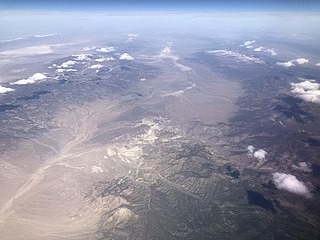
Monitor Valley is a valley in the U.S. state of Nevada.
South Mountains are a range of mountains primarily in White Pine County, Nevada and partially to the east in Juab County, Utah. The range is sometimes referred to as the Deep Creek Mountains, or the Ibenpah Mountains. The South Mountains are divided from the Kern Mountains to the south by Tippett Canyon on the west and Pleasant Valley to the east. They are divided from the Deep Creek Range to the east in Utah by Johnson Canyon, on the north, and by Water Canyon on the south. The range is bounded on the north by Spring Creek Flat and on the west by Antelope Valley.
Spring Valley is a long north south trending basin, largely in White Pine County, Nevada and a small portion in the extreme south in Lincoln County, Nevada. It extends from 39°59′00″N114°29′33″W in White Pine County to the north to 38°33′57″N114°21′05″W in the south in Lincoln County. The bottom of the basin is at Yelland Dry Lake at an elevation of 5,551 feet. Bahsahwahbee, a grove of Rocky Mountain juniper trees, locally called swamp cedars, where multiple massacres of Western Shoshone people occurred in the 19th century, lies in Spring Valley. The Spring Valley Wind Farm is to its south.
Pleasant Valley, is a valley in two counties in two states adjacent states, White Pine County, Nevada and Juab County, Utah. Its mouth is located at an elevation of 5,682 feet in Utah. Its head is at 39°44′09″N114°09′53″W at an elevation of 6,965 feet in Nevada. It lies between the Kern Mountains on the south, and South Mountains to the northwest and the Deep Creek Range on the north.
References
- ↑ U.S. Geological Survey Geographic Names Information System: Cave Valley (Nevada)
- ↑ Federal Writers' Project (1941). Origin of Place Names: Nevada (PDF). W.P.A. p. 43.
36°36′49″N114°40′51″W / 36.61361°N 114.68083°W
| | This Lincoln County, Nevada state location article is a stub. You can help Wikipedia by expanding it. |
| | This White Pine County, Nevada state location article is a stub. You can help Wikipedia by expanding it. |