
The Humber is a large tidal estuary on the east coast of Northern England. It is formed at Trent Falls, Faxfleet, by the confluence of the tidal rivers Ouse and Trent. From there to the North Sea, it forms part of the boundary between the East Riding of Yorkshire on the north bank and North Lincolnshire on the south bank. Although the Humber is an estuary from the point at which it is formed, many maps show it as the River Humber.

The River Ouse is a river in North Yorkshire, England. Hydrologically, the river is a continuation of the River Ure, and the combined length of the River Ure and River Ouse makes it, at 129 miles (208 km), the sixth-longest river of the United Kingdom and the longest to flow entirely in one county. The length of the Ouse alone is about 52 miles (84 km) but the total length of the river is disputed.
Derwent derives from the Brythonic term Derventio, meaning "valley thick with oaks". It may refer to:

The Derwent is a river in Yorkshire in the north of England. It flows from Fylingdales Moor in the North York Moors National Park, east then southwards as far as its confluence with the River Hertford then westwards through the Vale of Pickering, south through Kirkham Gorge and the Vale of York, joining the River Ouse at Barmby on the Marsh. The confluence is unusual in that the Derwent converges on the Ouse at a shallow angle in an upstream direction.
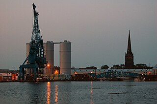
Goole is a port town and civil parish on the River Ouse in the East Riding of Yorkshire, England. The town's historic county is the West Riding of Yorkshire.
Fulford is a historic village and civil parish on the outskirts of York, in the York district, in the ceremonial county of North Yorkshire, England. Two miles (3 km) to the south of the city, on the east bank of the River Ouse, it was the site of the Battle of Fulford won by the invading Vikings in 1066, a precursor to the nearby Battle of Stamford Bridge lost by the Vikings, and then the Battle of Hastings in Sussex won by the invading Normans in the following weeks. The population of the civil parish at the 2011 census was 2,785.

There are nine bridges across the River Ouse within the city of York, England, and sixteen smaller bridges and passages across the narrower River Foss.

The River Ure in North Yorkshire, England is approximately 74 miles (119 km) long from its source to the point where it becomes the River Ouse. It is the principal river of Wensleydale, which is the only major dale now named after a village rather than its river. The old name for the valley was Yoredale after the river that runs through it.

Selby railway station is a Grade II listed station which serves the town of Selby in North Yorkshire, England. The original terminus station was opened in 1834 for the Leeds and Selby Railway. The Hull and Selby Railway extended the line in 1840, and a new station was built, with the old station becoming a goods shed. The station was rebuilt in 1873 and 1891, the 1891 rebuilding being required due to the replacement of the swing bridge over the Ouse at the same time.

Asselby is a village and civil parish in the East Riding of Yorkshire, England. It is located in the south-west of the county, north of the River Ouse. It is situated approximately 2 miles (3.2 km) west of the market town of Howden. The land surrounding Asselby is very flat and intersected by dykes which drain into the Rivers Derwent and Ouse.

Naburn is a small village and civil parish in the unitary authority of the City of York in North Yorkshire, England. It lies on the eastern side of the River Ouse about 4 miles (6.4 km) south of York. According to the 2001 census the parish had a population of 470, increasing to 516 at the 2011 census.

Thorganby is a small village and civil parish in the Selby district of North Yorkshire, England. It was historically part of the East Riding of Yorkshire until 1974. It is situated 3 miles (4.8 km) from the village of Wheldrake. According to the 2011 census the village had 330 residents. Children in the village attend Wheldrake with Thorganby C of E (Aided) Primary School, located in Wheldrake.
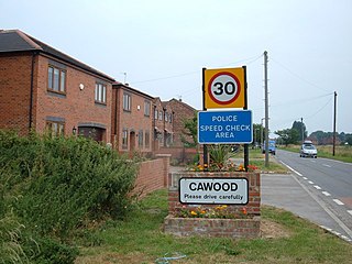
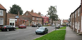
Cawood is a large village and civil parish in the Selby District of North Yorkshire, England that is notable as the finding-place of the Cawood sword. It was historically part of the West Riding of Yorkshire until 1974.

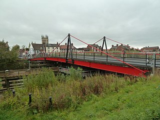
Cawood Bridge is a swing bridge which spans the Yorkshire River Ouse in North Yorkshire, England. Construction was authorised in 1870, with the formation of the Cawood Bridge bridge company. It was opened on 31 July 1872 to replace the ferry, and is located about halfway between Naburn and Selby. It is the only bridge from the village of Cawood that crosses the river. It is Grade II listed.

Ryther cum Ossendyke is a civil parish 6 miles (9.7 km) from Tadcaster and 6 miles (9.7 km) from Selby, North Yorkshire, England. It includes the village of Ryther. The civil parish population at the 2011 census was 241.

Harrold is a village, civil parish and electoral ward in the Borough of Bedford within Bedfordshire, England, around nine miles north-west of Bedford. The village is on the north bank of the River Great Ouse, close to the county boundaries of Buckinghamshire and Northamptonshire and is the site of an ancient bridge, linking the village with Carlton with Chellington on the south bank. Immediately to the east of the village is Odell. Across the bridge is Carlton.

The Cawood sword is a medieval sword discovered in the River Ouse near Cawood in North Yorkshire in the late 19th century. The blade is of Oakeshott type XII and has inscriptions on both sides. It most likely dates to the early 12th century.
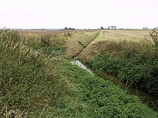
The River Foulness is a river in the East Riding of Yorkshire, England. Its name is derived from Old English fūle[n] ēa, meaning “dirty water”. Maintenance responsibilities for the river transferred from the Environment Agency to the Market Weighton Drainage Board on 1 October 2011. Market Weighton Drainage Board subsequently amalgamated with the Lower Ouse Internal Drainage Board on 1 April 2012 to create the Ouse and Humber Drainage Board. The river discharges into the Humber Estuary via Market Weighton Canal. Water levels within the river, its tributaries and the canal are managed and controlled by the Environment Agency. The river lies in an area known as the Humberhead Levels.

Boothferry Bridge is a crossing over the River Ouse, between the East Riding and West Yorkshire, England, some 2 miles (3.2 km) north-west of Goole. The bridge was opened in 1929, replacing a ferry crossing immediately west of the bridge's location. The Act of Parliament for the building of the bridge in 1925, gave priority to river traffic. This situation still exists, though there have been some attempts to change priorities. On opening, it was the furthest crossing downstream of the river, cutting 25 miles (40 km) off the journey south to London from Kingston upon Hull. The M62 Ouse Bridge opened up to the east of Boothferry Bridge in 1976.
Selby Toll Bridge is one of three swing bridges in the town of Selby, North Yorkshire, England. A timber bridge over the River Ouse in the town was opened in c. 1793 to replace a ferry crossing that had existed since Medieval times. The bridge provided a connection between the West and East Ridings of Yorkshire across the River Ouse, and became the furthest downstream public bridge crossing over the river until 1929, when the Boothferry Bridge was built. The moving section of the original bridge used ball-bearings and cog wheels; the bridge is believed to be the first in the world to use ball-bearings. The replacement 1970s bridge, now only carries the A19 road as the A63 bypass was opened in 2004.