
Segovia is a city in the autonomous community of Castile and León, Spain. It is the capital and most populated municipality of the Province of Segovia.
Ávila is a province of central-western Spain, in the southern part of the autonomous community of Castile and León. It is bordered on the south by the provinces of Toledo and Cáceres, on the west by Salamanca, on the north by Valladolid, and on the east by Segovia and Madrid. Ávila has a population of 158,265 (2018) and is ranked 47th out of 50 of Spanish provinces in population. Its capital is Ávila.

The Manzanares is a river in the centre of the Iberian Peninsula, which flows from the Sierra de Guadarrama, passes through Madrid, and eventually empties into the Jarama river, which in turn is a right-bank tributary to the Tagus.
The Central System, Spanish and Portuguese: Sistema Central, is one of the main systems of mountain ranges in the Iberian Peninsula. The 2,592 m high Pico Almanzor is its highest summit.

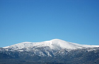
The Sierra de Guadarrama is a mountain range forming the main eastern section of the Sistema Central, the system of mountain ranges along the centre of the Iberian Peninsula. It is located between the systems Sierra de Gredos in the province of Ávila, and Sierra de Ayllón in the province of Guadalajara.
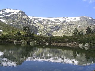
Sierra de Guadarrama National Park is a national park in Spain, covering nearly 34,000 hectares, the fifth largest in Spain's national parks system. The Guadarrama mountain range contains some ecologically valuable areas, located in the Community of Madrid and Castile and León. The law that regulates the recently approved national park was published in the BOE in June 26, 2013.

The Ribera del Duero is a comarca or district located at the southern tip of the province of Burgos, part of the Spanish autonomous community of Castile and León. The capital of the Ribera del Duero comarca or district is the town of Aranda de Duero.

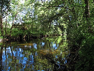
Santo Domingo de Pirón is a municipality located in the province of Segovia, Castile and León, Spain. According to the 2020 census (INE), the municipality has a population of 53 inhabitants.

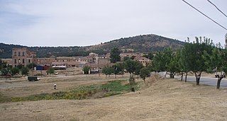
Torrecaballeros is a municipality located in the province of Segovia, Castile and León, Spain. Its current population is slightly over 1372 inhabitants as it has experienced a remarkable growth in terms of population during the last decade.

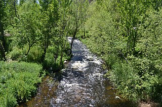
The Duratón River is a river in Spain, a tributary of the Douro. It originates in the municipality of Somosierra in the Sierra de Guadarrama.
The Guadarrama is a river in Spain. A tributary of the Tagus, the longest river on the Iberian Peninsula, Guadarrama has its source in the Siete Picos, part of the Sierra de Guadarrama, in the Community of Madrid, in the central part of the country, at an altitude of 1,900 metres (6,200 ft).
The Guadarrama Pass, also known as Alto del León, is a mountain pass in Spain. It is located in the Sierra de Guadarrama, part of the Sistema Central system of ranges. Historically it has been an important communication line between Madrid and the North of Spain.

The Voltoya is a river in Spain. It is a tributary river of Eresma River which is, in turn a tributary of the Adaja River that emerges from Douro River. Its starts in the mountains of Guadarrama and Malagón. The water from Dehesa de la Cepeda, enclave of the city of Madrid and the Azálvaro Field also flow into the Voltoya. It runs through the Castilian-Leonese provinces of Ávila and Segovia. Its mouth is in Coca (Segovia). The Serones Reservoir, which supplies drinking water to the city of Ávila is located on the Voltoya. Tributaries of the Voltoya on the left are the Tuerto, Ciervos or de Mediana rivers, which in turn receive the waters of the Cortos and the Saornil stream. It receives the waters of the Cardeña river and the Magdalena stream. The Torrelara reservoir, near Peromingo is located on these. It the N-110 and the AP-51 cross the river over concrete bridges. In the past a stone bridge of a single arch with granite keystones of granite was used as a crossing. Further downstream it the A-6 and the N-VI near Coto de Puenteviejo. Here it leaves the province of Ávila and enters that of Segovia, to pass through Juarros de Voltoya and the Nava de la Asunción.

The Eresma is a river in central Spain. It flows through Castile and Leon. It has a total length of 134 km and drains a basin with an area of 2940 km².
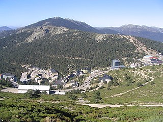
Valsaín is a hamlet of Real Sitio de San Ildefonso, which is a town and municipality located within the Province of Segovia in Castile and León. It is located in the foothills of the Sierra de Guadarrama mountains, 14 kilometres (8.7 mi) from Segovia, and 75 kilometres (47 mi) north of Madrid. The village had a population of 176 inhabitants in 2016.
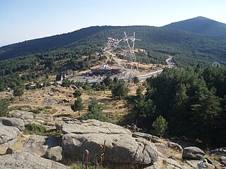
The Navacerrada Pass is a mountain pass in the Guadarrama Mountains, in the centre of the Iberian Peninsula.
The Adaja is a river of Spain located in the centre of the Iberian Peninsula, a major left-bank tributary of the Douro. Featuring a total length of 163 km, its river basin drains an area of 5,328 km2.
The Guadalix is a river of Spain located in the centre of the Iberian Peninsula, a right-bank tributary of the Jarama.

Fernando Delgado Sanz, better known as El Tuerto del Pirón or Tuerto Pirón, was a Spanish bandit. He worked mainly in the Sierra de Guadarrama and in the Río Pirón basin.

