Central Makran Range

Last updated
Central Makran Range
Pakistan relief location map.jpg
Red triangle with thick white border.svg
Central Makran Range
Location in Pakistan
Highest point
Elevation 3,000 m (9,800 ft)
Geography
Location Balochistan, Pakistan
Parent range Makran region
Geology
Age of rock Formed by the collision of the northwestern Indian Plate and the Asian Plate
Mountain type Mountain range
Type of rock Primarily limestone and sandstone
Aerial view of the Central Makran Range, in southwest Pakistan. Pakistan, Central Makran Range 01 (2294354578).jpg
Aerial view of the Central Makran Range, in southwest Pakistan.
Mirani Dam and reservoir, in the Central Makran Range. Meerani Dam Turbat Balochistan.jpg
Mirani Dam and reservoir, in the Central Makran Range.

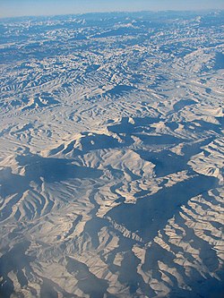
The Central Makran Range is a mountain range in the Makran region, in southwestern section of Balochistan Province, in southwestern Pakistan.

Contents

Geography

It is one of three ranges in the mountain ranges system. The range's peaks are 2,000–3,000 metres (6,600–9,800 ft) in elevation.

Mirani Dam across the Dasht River forms a reservoir in the range, to provide irrigation water in the region and drinking water for the city of Gwadar.

Geology

The Central Makran Range is primarily made up of limestone and sandstone. It was formed when the northwestern Indian Plate collided with the Asian Plate.

Adjacent ranges

There are three main ranges in Balochistan:

See also

Related Research Articles

<span class="mw-page-title-main">Andaman Sea</span> Marginal sea of the northeastern Indian Ocean

The Andaman Sea is a marginal sea of the northeastern Indian Ocean bounded by the coastlines of Myanmar and Thailand along the Gulf of Martaban and the west side of the Malay Peninsula, and separated from the Bay of Bengal to its west by the Andaman Islands and the Nicobar Islands. Its southern end is at Breueh Island just north of Sumatra, with the Strait of Malacca further southeast.

<span class="mw-page-title-main">Geography of Mexico</span> Overview of the geography of Mexico

The geography of Mexico describes the geographic features of Mexico, a country in the Americas. Mexico is located at about 23° N and 102° W in the southern portion of North America. From its farthest land points, Mexico is a little over 3,200 km (2,000 mi) in length. Mexico is bounded to the north by the United States, to the west and south by the Pacific Ocean, to the east by the Gulf of Mexico, and to the southeast by Belize, Guatemala, and the Caribbean Sea. The northernmost constituent of Latin America, it is the most populous Spanish-speaking country in the world. Mexico is the world's 13th largest country, three times the size of Texas.

<span class="mw-page-title-main">Caucasus Mountains</span> Mountain system at the intersection of Europe, Asia, and the Middle East

The Caucasus Mountains is a mountain range at the intersection of Asia and Europe. Stretching between the Black Sea and the Caspian Sea, they are surrounded by the Caucasus region and are home to Mount Elbrus, the highest peak in Europe at 5,642 metres (18,510 ft) above sea level.

<span class="mw-page-title-main">Iranian Plateau</span> Geological feature in Asia

The Iranian Plateau or Persian Plateau is a geological feature spanning parts of Central Asia, South Asia, and West Asia. It makes up part of the Eurasian Plate, and is wedged between the Arabian Plate and the Indian Plate. The plateau is situated between the Zagros Mountains to the west, the Caspian Sea and the Köpet Dag to the north, the Armenian Highlands and the Caucasus Mountains to the northwest, the Strait of Hormuz and the Persian Gulf to the south, and the Indian subcontinent to the east.

<span class="mw-page-title-main">Sulaiman Mountains</span> Mountain range in Afghanistan and Pakistan

The Sulaiman Mountains, also known as Kōh-e Sulaymān or Da Kasē Ghrūna, are a north–south extension of the southern Hindu Kush mountain system in Pakistan and Afghanistan. They rise to form the eastern edge of the Iranian plateau. They are located in the Kandahar, Zabul and Paktia provinces of Afghanistan, and in Pakistan they extend over the northern part of Balochistan and Waziristan as well as Kurram of Khyber Pakhtunkhwa. In southwestern Punjab, the mountains extend into the two districts of Dera Ghazi Khan and Rajanpur, which are located west of the Indus River on the boundary with Balochistan. Bordering the mountains to the east are the plains of the Indus River valley, and to the north are the arid highlands of the Central Hindu Kush whose heights extend up to 3,383 metres (11,099 ft). The total area on which this range spans around 6475 sq. km .Together with the Kirthar Mountains on the border between Balochistan and Sindh, the Sulaiman Mountains form what is known as the Sulaiman-Kirthar geologic province.

<span class="mw-page-title-main">Plateau</span> Highland area, usually of relatively flat terrain

In geology and physical geography, a plateau, also called a high plain or a tableland, is an area of a highland consisting of flat terrain that is raised sharply above the surrounding area on at least one side. Often one or more sides have deep hills or escarpments. Plateaus can be formed by a number of processes, including upwelling of volcanic magma, extrusion of lava, and erosion by water and glaciers. Plateaus are classified according to their surrounding environment as intermontane, piedmont, or continental. A few plateaus may have a small flat top while others have wider ones.

<span class="mw-page-title-main">Taftan (volcano)</span> Volcano mountain in Iran

Taftan is an active stratovolcano in south-eastern Iran in the Sistan and Baluchestan province. With variable heights reported, all around 4,000 metres (13,000 ft) above sea level, it is the highest mountain in south-eastern Iran. The nearest city is Khash.

The Kech River flows in the Makran region, of southeastern Iran and the southwestern area of Balochistan Province in southwestern Pakistan.

<span class="mw-page-title-main">Hingol National Park</span> National park in Pakistan

Hingol National Park or Hungol National Park is one of the largest national parks in Pakistan, located in the Makran coastal region. The park covers an area of about 6,100 square kilometres (2,400 sq mi) and is located 190 km from Karachi in the three districts of Gwadar, Lasbela and Awaran in Balochistan. Hingol was declared a national park in 1988.

<span class="mw-page-title-main">Topography of Pakistan</span>

The topography of Pakistan is divided into seven geographic areas: the northern highlands, the Indus River plain, the desert areas, the Pothohar Plateau, Balochistan Plateau, Salt Range, and the Sistan Basin. All the rivers of Pakistan, i.e. Sindh, Ravi River, Chenab River, Jhelum River, and Sutlej River, originate from the Himalayas mountain range. Some geographers designate Plateau as to the west of the imaginary southwest line; and the Indus Plain lies to the east of that line.

<span class="mw-page-title-main">Makran Coastal Range</span>

Makran Coastal Range is a mountain range in the Makran region, in southwestern section of Balochistan Province, in southwestern Pakistan. It is one of three ranges in the mountain ranges system. The range rises to around 1,500 metres (4,900 ft) in elevation.

<span class="mw-page-title-main">Gregory Rift</span>

The Gregory Rift is the eastern branch of the East African Rift fracture system. The rift is being caused by the separation of the Somali plate from the Nubian plate, driven by a thermal plume. Although the term is sometimes used in the narrow sense of the Kenyan Rift, the larger definition of the Gregory Rift is the set of faults and grabens extending southward from the Gulf of Aden through Ethiopia and Kenya into Northern Tanzania, passing over the local uplifts of the Ethiopian and Kenyan domes. Ancient fossils of early hominins, the ancestors of humans, have been found in the southern part of the Gregory Rift.

The ecology of the Himalayas varies with climate, rainfall, altitude, and soils. The climate ranges from tropical at the base of the mountains to permanent ice and snow at the highest elevations. The amount of yearly rainfall increases from west to east along the southern front of the range. This diversity of climate, altitude, rainfall and soil conditions supports a variety of distinct plant and animal species, such as the Nepal gray langur

<span class="mw-page-title-main">Makran Trench</span> Subduction zone in the Gulf of Oman

The Makran Trench is the physiographic expression of a subduction zone along the northeastern margin of the Gulf of Oman adjacent to the southwestern coast of Balochistan of Pakistan and the southeastern coast of Iran. In this region the oceanic crust of the Arabian Plate is being subducted beneath the continental crust of the Eurasian Plate.

The Kacchi Plain or Kachhi Plain also known as Kach Gandava is a region located in central Pakistan, in Balochistan Province.

The 2013 Balochistan earthquakes took place in late September in southwestern Pakistan. The mainshock had a moment magnitude of 7.7 and a maximum Mercalli intensity of IX (Violent). At least 825 people were killed and hundreds more were injured. On 28 September, a M6.8 aftershock occurred to the north at a depth of 14.8 kilometres, killing at least 22 people.

<span class="mw-page-title-main">Koh-i-Sultan</span> Volcano in Pakistan

Koh-i-Sultan is a volcano in Balochistan, Pakistan. It is part of the tectonic belt formed by the collision of the Eurasian Plate and Indian Plate: specifically, a segment influenced by the subduction of the Arabian plate beneath the Asian plate and forming a volcanic arc which includes the Bazman and Taftan volcanoes in Iran. The volcano consists of three main cones, with heavily eroded craters running west-northwest and surrounded by a number of subsidiary volcanic centres. Its summit is 2,334 metres (7,657 ft) high, and the crater associated with the Miri cone has a smaller crater inside.

<span class="mw-page-title-main">Cauca Valley montane forests</span>

The Cauca Valley montane forests (NT0109) is an ecoregion in western Colombia. It covers the sides of the Cauca Valley, which runs from south to north between the Central and Western Ranges (cordilleras) of the Colombian Andes. The ecoregion is home to very diverse fauna and flora, due in part to its varied elevations and climates, in part to its position near the isthmus of Panama, the route along which North American species invaded South America and then diversified as they moved to the upper parts of the Andes. Little of the original habitat remains at lower levels, but higher up there are sizeable blocks of forest, some of which are protected.

<i>Juniperus seravschanica</i> Species of conifer

Juniperus seravschanica is a species of juniper. Common names include Pashtun juniper.

References

    26°40′N64°30′E / 26.667°N 64.500°E / 26.667; 64.500