Centro Ocidental Rio-Grandense | |
|---|---|
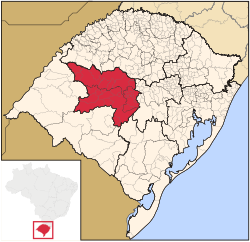 | |
| Country | Brazil |
| State | Rio Grande do Sul |
| Area | |
• Total | 25,954.69 km2 (10,021.16 sq mi) |
| Population (2005) | |
• Total | 556,062 |
| • Density | 21/km2 (55/sq mi) |
The Centro Ocidental Rio-Grandense (Brazilian Portuguese : Western Center of Rio Grande) is one of the seven mesoregions of the state of Rio Grande do Sul in Brazil. It consists of 31 municipalities, grouped in three microregions: Restinga Seca, Santa Maria and Santiago [1]
