El Salvador is a country in Central America. Situated at the meeting point of three tectonic plates, it is highly seismologically active and the location of numerous earthquakes and volcanic eruptions. The country has a tropical climate.

Tijuana is the largest city in the state of Baja California located on the northwestern Pacific Coast of Mexico. Tijuana is the municipal seat of the Tijuana Municipality and the hub of the Tijuana metropolitan area. It has a close proximity to the Mexico–United States border, which is part of the San Diego-Tijuana metro area.

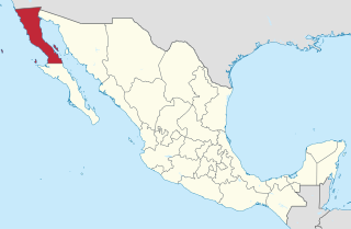
Baja California, officially Estado Libre y Soberano de Baja California, is a state in Mexico. It is the northernmost and westernmost of the 32 federal entities of Mexico. Before becoming a state in 1952, the area was known as the North Territory of Baja California. It has an area of 70,113 km2 (27,071 sq mi) and comprises the northern half of the Baja California Peninsula, north of the 28th parallel, plus oceanic Guadalupe Island. The mainland portion of the state is bordered on the west by the Pacific Ocean; on the east by Sonora, the U.S. state of Arizona, and the Gulf of California; on the north by the U.S. state of California; and on the south by Baja California Sur.

Mexicali is the capital city of the Mexican state of Baja California. The city, seat of the Mexicali Municipality, has a population of 689,775, according to the 2010 census, while the Calexico–Mexicali metropolitan area is home to 1,000,000 inhabitants on both sides of the Mexico–United States border. Mexicali is a regional economic and cultural hub for the border region of The Californias.

The Sonoran Desert is a hot desert in North America and ecoregion that covers the northwestern Mexican states of Sonora, Baja California, and Baja California Sur, as well as part of the southwestern United States. It is the hottest desert in both Mexico and the United States. It has an area of 260,000 square kilometers (100,000 sq mi).

Rosarito is a coastal city in Playas de Rosarito Municipality, Baja California, on the Pacific Coast of Mexico. As of 2010, the city had a population of 65,278. Located 10 miles (16 km) south of the US-Mexico border, Rosarito is a part of the greater San Diego–Tijuana region and one of the westernmost cities in Mexico. Rosarito is a major tourist destination, known for its beaches, resorts, and events like Baja Beach Fest.

Nevado Ojos del Salado is a dormant complex volcano in the Andes on the Argentina–Chile border. It is the highest volcano on Earth and the highest peak in Chile. The upper reaches of Ojos del Salado consist of several overlapping lava domes, lava flows and volcanic craters, with an only sparse ice cover. The complex extends over an area of 70–160 square kilometres (27–62 sq mi) and its highest summit reaches an altitude of 6,893 metres (22,615 ft) above sea level. Numerous other volcanoes rise around Ojos del Salado.

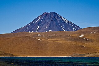
Licancabur is a stratovolcano on the border between Bolivia and Chile, south of the Sairecabur volcano and west of Juriques. Part of the Andean Central Volcanic Zone, it has a prominent, 5,916-metre (19,409 ft)-high cone. A 400-metre (1,300 ft) summit crater containing Licancabur Lake, a crater lake which is among the highest lakes in the world, caps the volcano. Three stages of lava flows emanate from the edifice.

Tijuana Municipality is a municipality in the Mexican state of Baja California. Its municipal seat is located in the city of Tijuana. According to the 2020 census, the municipality had a population of 1,922,523. Montserrat Caballero of the MORENA is the current mayor. The municipality comprises the largest part of the Tijuana metropolitan area.
Cerro Punta is a city and corregimiento in Tierras Altas District, Chiriquí Province, Panama. Cerro Punta is located in Panama's western highlands at an altitude of 6,500 feet, just south of the Continental Divide. Many of the inhabitants of the village and the surrounding areas are indigenous Native Americans. The climate, like the rest of Panama, is tropical with a short dry season and rainy season that extends about 9 – 10 months of the year. Night time temperatures are often cool due to Cerro Punta's relatively high elevation. During the 1970s much of the land was used for cultivating strawberries; households also maintained small mixed-vegetable gardens. The village can be reached by traveling north from the Pan-American highway.

The Gran Desierto de Altar is one of the major sub-ecoregions of the Sonoran Desert, located in the State of Sonora, in northwest Mexico. It includes the only active erg dune region in North America. The desert extends across much of the northern border of the Gulf of California, spanning more than 100 kilometres (62 mi) east to west and over 50 kilometres (31 mi) north to south. It constitutes the largest continuous wilderness area within the Sonoran Desert.

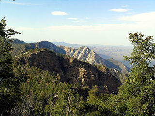
Sierra de San Pedro Mártir National Park is a national park in the Mexican state of Baja California. The Park is part of the municipality of Ensenada, Baja California. The area was first explored by Native people then Europeans in 1701 by Eusebio Francisco Kino by Dominican orders.

Metropolitan areas of Mexico have been traditionally defined as the group of municipalities that heavily interact with each other, usually around a core city, in Mexico. The phenomenon of metropolization in Mexico is relatively recent, starting in the 1940s. Because of an accelerated level of urbanization in the country, the definition of a metropolitan area is reviewed periodically by the Mexican population and census authorities.

Chiliques is a stratovolcano located in the Antofagasta Region of Chile.

The San Ysidro Mountains are a mountain range in southern San Diego County, California and Baja California, Mexico. The mountains are a rugged coastal foothill range of the Peninsular Ranges system. Major peaks include the highest summit of the range, Otay Mountain, and the Cerro San Isidro which forms the southern extrusion of the range on the Mexican side of the border. The majority of the range is within the Otay Mountain Wilderness Area, in the United States.

Cerro Colorado is a borough of the municipality of Tijuana in Baja California, Mexico. The borough is located to the north of and along the west edge of the Cerro Colorado. Because of its height many of the area's antennae for radio and television stations are located on its peak. It is home to the Toros de Tijuana in Estadio Gasmart located in Colonia Capistrano/Col. Cerro Colorado. The borough stretches as far north as to include on the north side of Calzada Guaycura, and stretches west to Ave. Insurgentes and Phase III of the Zona Río. Major commercial nodes include Plaza Monarca.

Alto Golfo de California Biosphere Reserve is a UNESCO Biosphere Reserve located in the state of Sonora in extreme northwestern Mexico. The 1,652,110 hectares (6,378.8 sq mi) reserve comprises the El Pinacate y Gran Desierto reserve and the Bahia Adair on the Gulf of California border. Geological volcanic formations with craters, dunes, oasis and beaches, and the diversity of plant associations determine its special landscape. The reserve was established in 1993 by the President of Mexico as Reserva de la Biosfera del Alto Golfo de California y Delta del Río Colorado and extended in 1995.

Acamarachi is a 6,046-metre (19,836 ft) high volcano in northern Chile. In this part of Chile, it is the highest volcano. Its name means "black moon". It is a volcano in the Central Volcanic Zone of the Andes, a zone of strong volcanic activity during the last million years. Old volcanoes in the area are well-preserved, due to the dry climate.
Rio Alamar or Arroyo de Alamar is a river mainly in northern Baja California, Mexico with a small portion in California, United States. The riparian corridor that is the Alamar has a wooded area home to: riparian, aquatic and migratory birds, abundant species of fish, and amphibians. The wildlife and natural vegetation in the Arroyo Alamar was historically a vital resource for fishing, bathing, and even drinking. The stream is formed by the confluence of Cottonwood Creek and Tecate Creek a short distance north of the Mexico–United States border. It flows generally west for about 25 kilometres (16 mi) through the San Ysidro Mountains and the Tijuana urban area before joining with the Arroyo de las Palmas in central Tijuana, to form the Tijuana River. The Rio Alamar tributary makes up almost one third of the larger bi-national Tijuana River Watershed that spans approximately 1,750 square miles and impacts the lives of more than 1.4 million people. The major tributary as part of the Tijuana River Estuary has been deemed one of the 21 wetlands of international importance by the RAMSAR Convention.
The Cerro Bola is a coastal metavolcanic mountain formation in northwestern Baja California. The Cerro Bola, along with the nearby mountain Cerro Gordo form the highest elevation areas of Tijuana Municipality. Because of its prominence, the transmitters for television station XHDTV and radio station XHPRS-FM are located on the summit of Cerro Bola, which reaches an elevation of 1,260 m (4,130 ft). It is located approximately 35 km (22 mi) south of the Tecate border crossing, and sits at the southwest end of the Valle de Las Palmas. The mountain range is host to a number of rare and endemic plant species, such as Arctostaphylos bolensis and Ceanothus bolensis.


