
The Canary Islands, also known informally as the Canaries, are a Spanish region, autonomous community and archipelago in the Atlantic Ocean. At their closest point to the African mainland, they are 100 kilometres west of Morocco. They are the southernmost of the autonomous communities of Spain. The islands have a population of 2.2 million people and are the most populous special territory of the European Union.
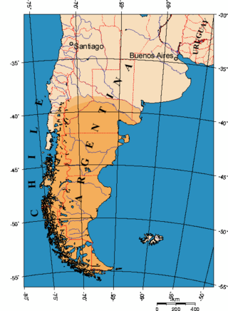
Patagonia is a geographical region that encompasses the southern end of South America, governed by Argentina and Chile. The region comprises the southern section of the Andes Mountains with lakes, fjords, temperate rainforests, and glaciers in the west and deserts, tablelands, and steppes to the east. Patagonia is bounded by the Pacific Ocean on the west, the Atlantic Ocean to the east, and many bodies of water that connect them, such as the Strait of Magellan, the Beagle Channel, and the Drake Passage to the south.
Tenerife is the largest and most populous island of the Canary Islands. It is home to 42.9% of the total population of the archipelago. With a land area of 2,034.38 square kilometres (785.48 sq mi) and a population of 948,815 inhabitants as of January 2023, it is also the most populous island of Spain and of Macaronesia.

The Magallanes Region, officially the Magallanes y la Antártica Chilena Region, is one of Chile's 16 first order administrative divisions. It is the southernmost, largest, and second least populated region of Chile. It comprises four provinces: Última Esperanza, Magallanes, Tierra del Fuego, and Antártica Chilena.

The Strait of Magellan, also called the Straits of Magellan, is a navigable sea route in southern Chile separating mainland South America to the north and the Tierra del Fuego archipelago to the south. The strait is considered the most important natural passage between the Atlantic and Pacific oceans. The strait is approximately 570 km long and 2 km wide at its narrowest point. In 1520, the Spanish expedition of the Portuguese navigator Ferdinand Magellan, after whom the strait is named, became the first Europeans to discover it.

Chiloé Island also known as Greater Island of Chiloé, is the largest island of the Chiloé Archipelago off the west coast of Chile, in the Pacific Ocean. The island is located in southern Chile, in the Los Lagos Region.

Santa Cruz de Tenerife, commonly abbreviated as Santa Cruz, is a city, the capital of the island of Tenerife, Province of Santa Cruz de Tenerife, and one of the capitals of the Canary Islands, along with Las Palmas. Santa Cruz has a population of 206,593 (2013) within its administrative limits. The urban zone of Santa Cruz extends beyond the city limits with a population of 507,306 and 538,000 within urban area. It is the second largest city in the Canary Islands and the main city on the island of Tenerife, with nearly half of the island's population living in or around it.
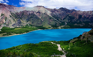
The Aysén del General Carlos Ibáñez del Campo Region, often shortened to Aysén Region or Aisén, is one of Chile's 16 first order administrative divisions. Although the third largest in area, the region is Chile's most sparsely populated region with a population of 102,317 as of 2017. The capital of the region is Coyhaique, the region's former namesake. The region's current namesake is the former President of Chile, General Carlos Ibáñez del Campo.

Puerto Montt is a port city and commune in southern Chile, located at the northern end of the Reloncaví Sound in the Llanquihue Province, Los Lagos Region, 1,055 km to the south of the capital, Santiago. The commune spans an area of 1,673 km2 (646 sq mi) and has a population of 245,902 in 2017. It is bounded by the communes of Puerto Varas to the north, Cochamó to the east and southeast, Calbuco to the southwest and Maullín and Los Muermos to the west.

Coyhaique, also spelled Coihaique in Patagonia, is the capital city of both the Coyhaique Province and the Aysén Region of Chile. Founded by settlers in 1929, it is a young city. Until the twentieth century, Chile showed little interest in exploiting the remote Aisén region. The Carretera Austral southern highway opened in the 1980s.

Monte Fitz Roy is a mountain in Patagonia, on the border between Argentina and Chile. It is located in the Southern Patagonian Ice Field, near El Chaltén village and Viedma Lake. It was first climbed in 1952 by French alpinists Lionel Terray and Guido Magnone.
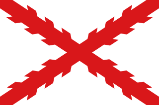
The General Captaincy of Chile, Governorate of Chile, or Kingdom of Chile, was a territory of the Spanish Empire from 1541 to 1818 that was, initially, part of the Viceroyalty of Peru. It comprised most of modern-day Chile and southern parts of Argentina in the Patagonia region. Its capital was Santiago de Chile. In 1810 it declared itself independent, with the Spanish reconquering the territory in 1814, but in 1818 it gained independence as the Republic of Chile. It had a number of Spanish governors over its long history and several kings.
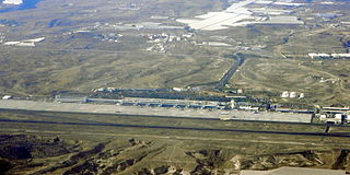
Tenerife South Airport, also known as Tenerife South–Reina Sofía Airport, is the larger of the two international airports located on the island of Tenerife and the second busiest in the Canary Islands.

Puerto Natales is a city in Chilean Patagonia. It is the capital of both the commune of Natales and the province of Última Esperanza, one of the four provinces that make up the Magallanes and Antartica Chilena Region in the southernmost part of Chile. Puerto Natales is the only city in the province. It is located 247 km (153 mi) northwest of Punta Arenas. It is the final passenger port of call for the Navimag ferry sailing from Puerto Montt into the Señoret Channel as well as the primary transit point for travellers to Torres del Paine National Park, Chile.
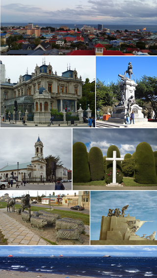
Punta Arenas is the capital city of Chile's southernmost region, Magallanes and Antarctica Chilena. Although officially renamed as Magallanes in 1927, the name was changed back to Punta Arenas in 1938. The city is the largest south of the 46th parallel south and the most populous southernmost city in Chile and the Americas. Due to its location, it is also the coldest coastal city with more than 100,000 inhabitants in Latin America. Punta Arenas is one of the world's most southerly ports and serves as an Antarctic gateway city. Punta Arenas is the world's southernmost city with more than 100,000 inhabitants and claims the title of southernmost city in the world, although this title is also claimed by Ushuaia in Argentina, which lies farther south but is slightly smaller than Punta Arenas.
Tenerife is an island of the province of Santa Cruz de Tenerife, Canary Islands, Spain.

The Chiloé Archipelago is a group of islands lying off the coast of Chile, in the Los Lagos Region. It is separated from mainland Chile by the Chacao Channel in the north, the Sea of Chiloé in the east and the Gulf of Corcovado in the southeast. All islands except the Desertores Islands form Chiloé Province. The main island is Chiloé Island. Of roughly rectangular shape, the southwestern half of this island is a wilderness of contiguous forests, wetlands and, in some places, mountains. The landscape of the northeastern sectors of Chiloé Island and the islands to the east is dominated by rolling hills, with a mosaic of pastures, forests and cultivated fields.
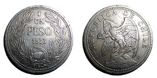
In late 19th and early 20th centuries, sheep farming expanded across the Patagonian grasslands making the southern regions of Argentina and Chile one of the world's foremost sheep farming areas. The sheep farming boom attracted thousands of immigrants from Chiloé and Europe to southern Patagonia. Early sheep farming in Patagonia was oriented towards wool production but changed over time with the development of industrial refrigerators towards meat export. Besides altering the demographic and economic outlook of Southern Patagonia the sheep farming boom also changed the steppe ecosystem.
In Colonial times the Spanish Empire diverted significant resources to fortify the Chilean coast as consequence of Dutch and English raids. The Spanish attempts to block the entrance of foreign ships to the eastern Pacific proved fruitless due to the failure to settle the Strait of Magellan and the discovery of the Drake Passage. As result of this the Spanish settlement at Chiloé Archipelago became a centre from where the west coast of Patagonia was protected from foreign powers. In face of the international wars that involved the Spanish Empire in the second half of the 18th century the Crown was unable to directly protect peripheral colonies like Chile leading to local government and militias assuming the increased responsibilities.
The Antonio de Vea expedition of 1675–1676 was a Spanish naval expedition to the fjords and channels of Patagonia aimed to find whether rival colonial powers—specifically, the English—were active in the region. While this was not the first Spanish expedition to the region, it was the largest up to then, involving 256 men, one ocean-going ship, two long boats and nine dalcas. The expedition dispelled suspicion about English bases in Patagonia. Spanish authorities' knowledge of western Patagonia was greatly improved by the expedition, yet Spanish interest in the area waned thereafter until the 1740s.

