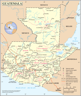
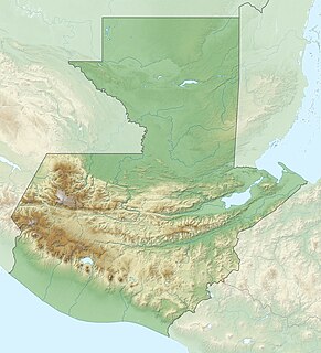
Guatemala is mountainous, except for the south coastal area and the vast northern lowlands of Petén department. Two mountain chains enter Guatemala from west to east, dividing the country into three major regions: the highlands, where the mountains are located; the Pacific coast, south of the mountains; and the Petén region, north of the mountains. These areas vary in climate, elevation, and landscape, providing dramatic contrasts between hot and humid tropical lowlands and highland peaks and valleys.
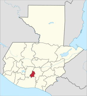
Sacatepéquez is one of the 22 departments of Guatemala. Population estimate 265,500 in 2000. The name comes from Sacatepéquez, a city from November 21, 1542 until July 29, 1773 when it was destroyed by the 1773 Guatemalan Earthquake. Sacatepéquez means grasshill in the Nahuatl Language. The capital of Sacatepéquez is Antigua Guatemala which is home to an extensive textile marketplace and Plaza Major. Other important cities include Ciudad Vieja and San Lucaswhich is also hosts another popular marketplace and is a culinary attraction. The Chajoma were a group of indeginous people who were Kaqchikel speaking Indians identified Mixco Viejo as their capital, and spread throughout the Sacatepequez Department until their capital was moved to Ciudad Vieja, in Antigua.

Quetzaltenango is a department in the western highlands of Guatemala. The capital is the city of Quetzaltenango, the second largest city in Guatemala. The department is divided up into 24 municipalities. The inhabitants include Spanish-speaking Ladinos and the K'iche' and Mam Maya groups, both with their own Maya language. The department consists of mountainous terrain, with its principal river being the Samalá River. the department is seismically active, suffering from both earthquakes and volcanic activity.

San Marcos is a department in northwestern Guatemala, on the Pacific Ocean and along the western Guatemala-Mexico border.

Santa María Volcano is a large active volcano in the western highlands of Guatemala, in the Quetzaltenango Department near the city of Quetzaltenango.

Pacaya is an active complex volcano in Guatemala, which first erupted approximately 23,000 years ago and has erupted at least 23 times since the Spanish invasion of Guatemala. Pacaya rises to an elevation of 2,552 metres (8,373 ft). After being dormant for over 70 years, it began erupting vigorously in 1961 and has been erupting frequently since then. Much of its activity is Strombolian, but occasional Plinian eruptions also occur, sometimes showering the area of the nearby Departments with ash.

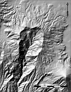
Volcán Atitlán is a large, conical, active stratovolcano adjacent to the caldera of Lake Atitlán in the Guatemalan Highlands of the Sierra Madre de Chiapas range. It is within the Sololá Department, northern Guatemala.

Acatenango is a stratovolcano in Guatemala, close to the city of Antigua. The volcano has two peaks, Pico Mayor and Yepocapa which is also known as Tres Hermanas. Acatenango is joined with Volcán de Fuego and collectively the volcano complex is known as La Horqueta.
Volcán de Agua is a stratovolcano located in the departments of Sacatepéquez and Escuintla in Guatemala. At 3,760 m (12,340 ft), Agua Volcano towers more than 3,500 m (11,500 ft) above the Pacific coastal plain to the south and 2,000 m (6,600 ft) above the Guatemalan Highlands to the north. It dominates the local landscape except when hidden by cloud cover. The volcano is within 5 to 10 km of the city of Antigua Guatemala and several other large towns situated on its northern apron. These towns have a combined population of nearly 100,000. It is within about 20 km of Escuintla to the south. Coffee is grown on the volcano's lower slopes.

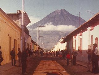
Volcán de Fuego or Chi Q'aq' is an active stratovolcano in Guatemala, on the borders of Chimaltenango, Escuintla and Sacatepéquez departments. It sits about 16 kilometres (9.9 mi) west of Antigua, one of Guatemala's most famous cities and a tourist destination. It has erupted frequently since the Spanish conquest, most recently in June and November 2018.

Tolimán is a stratovolcano in Guatemala, on the southern shores of Lago de Atitlán. The volcano has an elevation of 3,158 m and was formed near the southern margin of the Pleistocene Atitlán III caldera. The top of the volcano has a shallow crater and its flanks are covered with the thick remains of ancient lava flows that emerged from vents in the volcano's flanks.

Volcán San Pedro is a stratovolcano on the shores of Lago de Atitlán, in the Sololá Department of northern Guatemala.

The Almolonga volcano, usually called "Cerro Quemado" is an andesitic stratovolcano in the south-western department of Quetzaltenango in Guatemala. The volcano is located near the town of Almolonga, just south of Quetzaltenango, Guatemala's second largest city.

Volcán Tajumulco is a large stratovolcano in the department of San Marcos in western Guatemala. It is the highest mountain in Central America at 4,202 metres (13,786 ft). It is part of the mountain range of the Sierra Madre de Chiapas, which begins in Mexico's southernmost state of Chiapas.

The Sierra Madre de Chiapas is a major mountain range in Central America. The Sierra Madre de Chiapas is part of the American Cordillera, a chain of mountain ranges (cordillera) that consists of an almost continuous sequence of mountain ranges that form the western "backbone" of North America, Central America, and South America.

The volcano Tacaná is the second highest peak in Central America at 4,060 metres (13,320 ft), located in the Sierra Madre de Chiapas of northern Guatemala and southern Mexico. It is also known in Mexico as Volcán Tacina.
Volcán Siete Orejas is a stratovolcano in Guatemala located within the Quetzaltenango Department, in the municipalities of Quetzaltenango, Concepción Chiquirichapa, La Esperanza, and San Martin Sacatepequez. It is in the Sierra Madre de Chiapas.
The 2018 Volcán de Fuego eruption was a series of volcanic explosions and pyroclastic flows from the Volcán de Fuego in Guatemala on Sunday 3 June 2018. The eruption included lahars, pyroclastic flows, and clouds of volcanic ash, which left almost no evacuation time and caused the death of nearly two hundred people. It was the deadliest eruption in Guatemala since 1929.