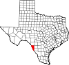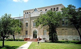
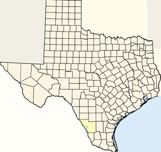
San Patricio County is a county in the U.S. state of Texas. As of the 2010 census, the population was 64,804. Its county seat is Sinton.

Nueces County is a county in the U.S. state of Texas. As of the 2010 census, the population was 340,223. The county seat is Corpus Christi. The county was formed in 1846 from portions of San Patricio County and organized the following year. It is named for the Nueces River, which flows through the county.

Kendall County is a county located on the Edwards Plateau in the U.S. state of Texas. In 2010 census, its population was 33,410. Its county seat is Boerne. The county is named for George Wilkins Kendall, a journalist and Mexican–American War correspondent.

Perry Lake is a US Army Corps of Engineers operated reservoir in northeast Kansas. Its primary purposes are flood control, water reserve for nearby areas and regional recreation. The lake is approximately 11,150 acres (45 km²) in size, with over 160 miles of shoreline. Perry Lake's full multi-purpose pool elevation is 891.5 feet above sea level. Perry Lake is located about 40 miles west of Kansas City, just northwest of Lawrence, Kansas. Its close proximity to Kansas City, Lawrence, and the state capitol, Topeka, make it a very popular destination, with the nickname "Paradise on the Plains".

The San Saba River is a river in the U.S. state of Texas. It is an undeveloped and scenic waterway located on the northern boundary of the Edwards Plateau.

Ship Creek is an Alaskan river that flows from the Chugach Mountains into Cook Inlet. The Port of Anchorage at the mouth of Ship Creek gave its name to the city of Anchorage that grew up nearby. The river lies entirely within the limits of the Municipality of Anchorage, Alaska. Most of its upper length traverses Joint Base Elmendorf-Richardson.
The Beaver River is the historic name for an intermittent river in Oklahoma that drains most of the Oklahoma Panhandle. It is also known as the North Canadian River; both names are in common use. The Beaver River flows from Union County, New Mexico, entering the Oklahoma Panhandle in Cimarron County, then flowing out of state through Sherman County in the Texas Panhandle for about 15 miles (24 km), then back to the Oklahoma panhandle in Texas County, where it is impounded in Optima Lake near Guymon. Downstream of the dam, it continues through the Oklahoma counties of Beaver and Harper before ending in Woodward County.
Westpoint Slough is the largest of several sloughs feeding into Redwood Creek in San Mateo County, California, United States. This slough is surrounded by extensive undisturbed marshlands including Greco Island, which forms its northern boundary. The channel of Westpoint Slough contains considerable mudflat areas; moreover, both the marshes and mudflats offer considerable habitat area for local and migratory wildlife, especially birds.

Onion Lake Cree Nation, comprising the adjacent Makaoo 120 and Seekaskootch 119 Indian reserves, is a Cree First Nation band government in Canada that straddles the Alberta/Saskatchewan provincial border approximately 50 km (31 mi) north of the City of Lloydminster.
Chacon Creek is a small stream of water located in Webb County, Texas, USA, which runs through Laredo. The creek is formed 6 miles from Webb and runs southwest for 20 miles until it connects to the Rio Grande. Chacon was dammed in 1951 in east Laredo to form Lake Casa Blanca, a 1,680 acres (6.8 km²) lake. The terrain surrounding the creek is mostly clay. The vegetation surrounding the creek is mostly made up of mesquite, cacti and grasses. Chacon Creek is cross by several highways in Laredo, including United States Route 59, Texas State Highway Loop 20, Texas State Highway Spur 400, Texas State Highway 359 and United States Route 83

Oso Creek, is a creek in the U.S. state of Texas. It runs just south of Corpus Christi.
See Elm Creek for the tributary of the Rio Grande, in Maverick County, Texas.
See Elm Creek for the tributary of the Nueces River, in Maverick County, Texas.
Turkey Creek, a tributary of the Nueces River with its source in Kinney County, Texas 29°14′32″N100°06′56″W. It passes through Uvalde and Dimmit Counties to its mouth at Espantosa Lake in Espantosa Slough south of Crystal City in Zavala County, Texas.
Hudson Canyon, is a vally and a tributary ephemeral stream of the Devils River in Val Verde County, Texas. It has its source at 29°57′03″N101°10′38″W at an elevation of 1780 feet. Its mouth has its confluence with Devil's River a short distance below Bakers Crossing at 1499 feet.
Ludlow Creek is a stream in the U.S. state of Ohio. The 13.5-mile (21.7 km) long stream is a tributary of the Stillwater River.
Sunshine is an unincorporated community in Whitman County, in the U.S. state of Washington.